
26.9
PDI
15.6 mi
DISTANCE
4,848 ft
GAINED
5.8 %
AVG. GRADE
FULL CLIMB STATS
INTRO
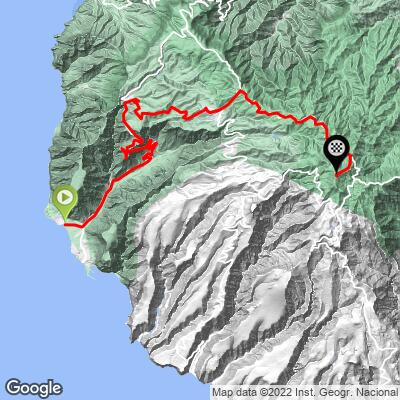
Alto de Garajonay is the highest point on La Gomera, a volcanic island in Spain's Canary Islands, and this route takes the most complete way up it - starting at the ocean's edge at Playa de la Calera in Valle Gran Rey and climbing 25.0 km (15.6 mi), gaining 1,478 m (4,848 ft) at a 5.8% average grade, before finishing in the cloud forest of Garajonay National Park.
The road climbs out of Valle Gran Rey's old fishing quarter and terraced banana plantations, through the village of Arure and two lit tunnels - Yorima and Arure - blasted through the cliffs in the 1990s to replace a narrow, rockfall-prone mountain road, then settles into the laurisilva, the ancient laurel cloud forest that gives Garajonay its UNESCO World Heritage status.
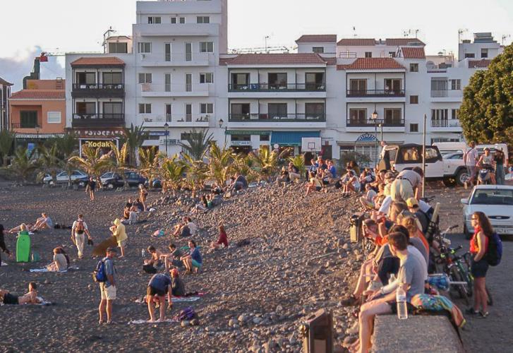
Valle Gran Rey is one of La Gomera's most popular bases, known for its relaxed, slightly bohemian feel, calm volcanic-sand beaches, and some of the clearest diving water in the Canary Islands - the coast is a recognized Whale Heritage Site.
At just over 25 km with almost no flat ground, this is one of the Canary Islands' longest continuous climbs, and a rare true sea-to-summit ride.
PLAN YOUR ROUTE
 We've partnered with Sherpa-Map.com to bring you the best route planning tool. With a PRO Membership you can use this climb as a reference when creating your route.
 From Playa de la Calera (12 m / 39 ft) on La Gomera's Atlantic coast, the climb to Alto de Garajonay runs 25.0 km (15.6 mi) and gains 1,478 m (4,848 ft) at a 5.8% average grade, finishing around 1,455 m (4,775 ft) in Garajonay National Park - a short walk from the island's true high point at 1,487 m (4,879 ft).
The grade is uneven rather than a steady grind. The road works up through Valle Gran Rey's terraced ravine, then hits its hardest stretch around Arure and the tunnels below it, where the steepest kilometer averages 10.5% and the steepest mile 10.1%. After Arure, the route eases into a long, steady grind through the laurel forest of Garajonay National Park to the finish; even so, the steepest 5 km segment on the whole route still averages 8.2%, so there's little real recovery anywhere on this climb.
At just over 25 km with almost no flat sections, this is one of the longest continuous climbs in the Canary Islands, and a rare true sea-to-summit ride.
Roadway: The GM-1 is paved the entire way from Playa de la Calera to Garajonay National Park, including through the two lit tunnels below Arure, Yorima and Arure, that replaced a narrow, rockfall-prone stretch of the old mountain road in the 1990s. As the only road connecting Valle Gran Rey to the rest of La Gomera, it is sometimes closed as a precaution during heavy rain - the Arure-to-Valle Gran Rey section had a preventive closure and reopening during a 2026 storm - so check the Cabildo de La Gomera's road-status announcements before you go.
Traffic: Light near the beach and through Valle Gran Rey's town center, picking up briefly with tourist traffic on the switchbacks above Arure. Above the tunnels, inside Garajonay National Park, traffic is generally light outside of midday sightseeing hours.
Parking: Playa de la Calera has beachside parking right at the start, in Valle Gran Rey's La Calera quarter - a maze of steep, car-free alleyways worth a walk before or after the ride. There's additional parking further up in Arure if you'd rather split the climb.
Start at sea level, so pack for real heat down at Playa de la Calera even when the upper mountain is wrapped in cool, damp cloud-forest mist near the top - a light packable layer is worth carrying for the finish and the descent. Valle Gran Rey has supermarkets and bike shops for last-minute supplies before you start. Arure, roughly two-thirds of the way up, has a couple of small bars and restaurants (Casa Conchita, El Jape) for a food or water stop - top off bottles there, since there's nothing dependable between Arure and the finish inside Garajonay National Park. A compact crank or wide-range gearing is worth having for the sharp switchbacks above Arure, where the steepest kilometer touches 10.5%.
Before heading out on any cycling adventure check out our Things to Bring on a Cycling Trip and use our interactive check list to ensure you don't forget anything.
Valle Gran Rey is La Gomera's most popular beach base, with a relaxed, slightly bohemian feel that's drawn long-term visitors for decades. La Calera, the old fishing quarter right at the start of the climb, is a maze of steep, car-free alleyways above the beach - worth a wander before you clip in. The beach itself, a kilometer of dark volcanic sand, is the calmest and most family-friendly on the island, and the surrounding waters are part of a recognized Whale Heritage Site, with regular dolphin and sperm whale sightings from boats just offshore - some of the clearest diving visibility in the Canary Islands (30+ m) is right here too.
Garajonay National Park's laurel cloud forest at the finish is the same UNESCO World Heritage forest reached from Hermigua and San Sebastián de La Gomera on the other two routes to this same summit - see our Routes in the Area tool if you're based on this side of the island for a few days and want to string together more than one way up.
ROUTE MAP
MEMBER RATING
CURRENT WEATHER
PJAMM TRIPS ADVENTURE STARTER BUNDLES
Check out PJAMM Adventure's prepackaged (self-guided) cycling trips. They will help you plan, document and conquer your next adventure.
NEARBY CLIMBS (0) RADIAL PROXIMITY
FROM No Climbs Found
MEMBER REVIEWS & COMMENTS
Let us know what you thought of this climb. Signup for our FREE membership to write a review or post a comment.
Already have an account?
LOG IN HERE
