
22.6
PDI
9.3 mi
DISTANCE
3,549 ft
GAINED
6.7 %
AVG. GRADE
FULL CLIMB STATS
INTRO
El Montnou is one of the toughest - and least-known - road climbs in the Solsonès: 15.0 km (9.3 mi) from the Riera de Canalda at 769 m (2,523 ft) to the top of the road at roughly 1760 m (5,774 ft), with 1082 m (3,549 ft) of gain. The 6.7% average hides how uneven it is - the first kilometer out of the valley is 12%, there's a real descent in the middle, and the final two kilometers are the steepest of the whole climb, at around 12%.
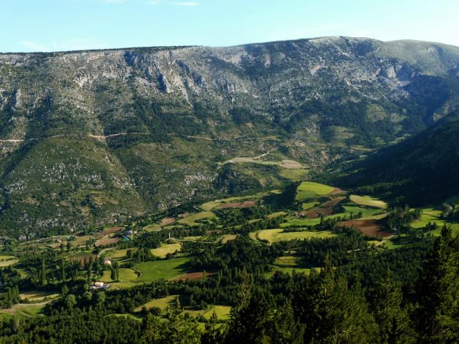
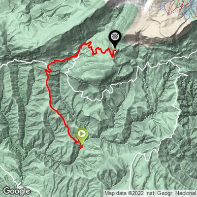
The route stitches together tiny rural roads in the municipality of Odèn - past the hamlet of Òrrit, through Odèn itself, and up the Camí del Montnou to the scattered farmhouses of El Montnou and beyond. Traffic is close to nonexistent, the views open up over the Solsonès hills as you gain height, and the finish feels a long way from anywhere.
This is a climb for riders who like their roads quiet and their gradients honest: there are no services on the way up, and the paved road ends at the top, so plan on descending the way you came unless you're riding a gravel bike.
PLAN YOUR ROUTE
 We've partnered with Sherpa-Map.com to bring you the best route planning tool. With a PRO Membership you can use this climb as a reference when creating your route.
 El Montnou is a climb in three acts. It opens hard: the first kilometer from the bridge averages 12.1%, with the steepest half-kilometer of the climb (14.7%) right at the start, and the fourth kilometer is back above 11%.
The middle is broken up - the road eases around Odèn, then drops for about 2 km (roughly 70 m of descent) between kilometers 7 and 9 before joining the Camí del Montnou. Use it to recover, because the final act is the hardest.
From the Montnou valley the road climbs steadily at 6-9% before kicking up for the finish: the steepest kilometer averages 13.3% and the steepest 2 km average 12.3%, both in the last stretch to the top.
Roadway: The climb is paved from the Pont d'Orrit bridge to the top, on narrow rural roads, including the Carretera d'Orrit, a short section of the L-401, and the Camí del Montnou. Riders rate the surface as fair rather than smooth, so don't expect perfect tarmac, and take care on the steep descent. Beyond the top, the way on toward Coll de Jou is an unpaved track, suitable for a gravel bike only.
Traffic: Very light. These are local roads serving the scattered farmhouses and hamlets of Odèn, a municipality with only around 250 residents spread over nine villages, and there is no through traffic. Expect little more than the occasional farm vehicle.
Parking: Pont d'Orrit is a rural bridge rather than a village, with no dedicated parking - if you drive in, pull well off the road without blocking any farm access. Most riders will find it easier to base in Solsona, the district capital to the south, and ride out to the start.
There are no shops, bars or reliable water sources anywhere on the climb, so leave Solsona with full bottles and enough food for a long, steep effort - the full out-and-back from town is a serious ride.
Gear low. With a 12% opening kilometer and a 13%+ finish, a compact crankset with a 32- or 34-tooth cog is a good idea for most riders. The top is at over 1700 m, so bring a layer for the descent, and in winter check for snow and ice on the upper road.
Before heading out on any cycling adventure check out our Things to Bring on a Cycling Trip and use our interactive check list to ensure you don't forget anything.
Solsona, the capital of the Solsonès district, is the natural base: a compact walled town with a cathedral and the Diocesan and County Museum, and restaurants and accommodation to match. Odèn itself is worth a detour off the bike too - the Salines de Cambrils, historic salt works in the village of Cambrils, lie within the same municipality.
To the east, Sant Llorenç de Morunys and the Vall de Lord are the gateway to the Port del Comte ski area.
The Cap del Pla climb starts from the same bridge, and there are dozens more climbs within a short ride - use our Routes in the Area tool to find them and link several into one day.
ROUTE MAP
MEMBER RATING
CURRENT WEATHER
PJAMM TRIPS ADVENTURE STARTER BUNDLES
Check out PJAMM Adventure's prepackaged (self-guided) cycling trips. They will help you plan, document and conquer your next adventure.
NEARBY CLIMBS (0) RADIAL PROXIMITY
FROM No Climbs Found
MEMBER REVIEWS & COMMENTS
Let us know what you thought of this climb. Signup for our FREE membership to write a review or post a comment.
Already have an account?
LOG IN HERE
