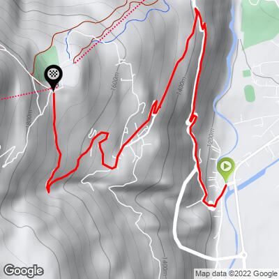
Forte di Oga Bike Climb - PJAMM Cycling

11.5
PDI
4.5 mi
DISTANCE
1,727 ft
GAINED
7.2 %
AVG. GRADE

FULL CLIMB STATS

Page Contributor(s): Craig Arcuri, Johnstown, PA

INTRO

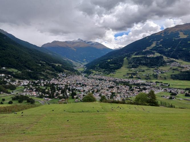
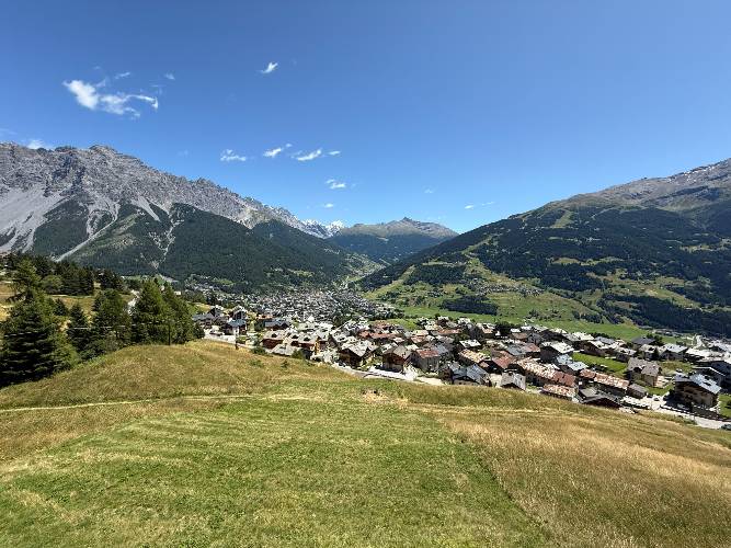
This 4.5 mile bike climb is located in Lombardia, Italy. The average gradient is 7.2% and there is a total elevation gain of 1,727 ft, finishing at 5,586 ft.

Use the profile tool, route map, and weather forecast to conquer this cycling climb.

See more details and tools regarding this climb's grade via our interactive Profile Tool.
Information Not Available

If you have any information regarding this climb, we'd like to hear from you. Click the CONTRIBUTE button to share your thoughts with us.

Information Not Available

If you have any information regarding this climb, we'd like to hear from you. Click the CONTRIBUTE button to share your thoughts with us.

Before heading out on any cycling adventure check out our Things to Bring on a Cycling Trip and use our interactive check list to ensure you don't forget anything.
Information Not Available

If you have any information regarding this climb, we'd like to hear from you. Click the CONTRIBUTE button to share your thoughts with us.

ROUTE MAP

MEMBER RATING

Not Yet Rated
-
Road
-
Traffic
-
Scenery

CURRENT WEATHER

PJAMM TRIPS ADVENTURE STARTER BUNDLES

Check out PJAMM Adventure's prepackaged (self-guided) cycling trips. They will help you plan, document and conquer your next adventure.
ALL TRIPS
Browse all of our prepackaged trips and find your next adventure!

NEARBY CLIMBS (0) RADIAL PROXIMITY

FROM
No Climbs Found

MEMBER REVIEWS & COMMENTS

Let us know what you thought of this climb. Signup for our FREE membership to write a review or post a comment.
Already have an account?
ROUTE MAP
PROFILE TOOL
Route Data
S.G. (%)
hide
Segment Data
hide

Climb Profile Not Found
CLIMB SUMMARY

Climb summary by Craig Arcuri, Johnstown, Pennsylvania.

A nice way to access this climb is to go to the Bormio Ice Arena. Just behind the Arena passes the Bormio Bike Path (nicely paved). Ride down the hill on the bike path, it’s a gentle grade, and the Adda River will be on the right (The river runs all the way down to Lake Como). But if you’re further down the hill in Bormio, just ride along via Milano to Santa Lucia. At Santa Lucia, exit the bike path and cross a little bridge and the climb quickly gets serious, starting at 8 to 10% through Santa Lucia. The climb gains over 1700 feet in roughly 4.5 miles.

The climb has some variation, alternating between going through little villages, dense pine forest, 4 sections of really nice, compact hairpins, and some majestic views of Bormio. It averages 7.6%, and although it kicks up to 13 or 14 % in a few places, they are short stretches and not too punishing. The road surface is very good for most of the climb. It gets relatively rougher near the top, but not bad at all (not littered with potholes).

Halfway up the climb is an isolated, tan colored church, which you will recognize if you’ve spent any time in Bormio. It’s just a lone church up on the mountainside.

Near the top is really dense pine forest and at the summit is a Ski Lodge-esque building which has what seems to be a thriving restaurant. Forte Di Oga is a World War I era fort. To get to the fort, continue past the lodge and the road turns gravel for a few hundred yards then continues into pine forest. Another ¼ mile or so, and 3 switchbacks on the gravel will get you to the fort, a monument, several plaques describing the fort, and a panoramic view of the neighboring mountains and Bormio. On the descent, past the village of Oga, follow the switchback to descend back to Santa Lucia, or go left at the switchback, on via alla Corva. Going down via alla Corva can provide an easy linkup with the Torri Di Fraele/Lago Cancano climb.

Note: coming down toward St. Lucia is a tunnel, but the road you ascended on is just left of the tunnel. Take the road. Bicycles are not allowed in the tunnel.