24.7
PDI
15.6 mi
DISTANCE
4,385 ft
GAINED
5.3 %
AVG. GRADE
FULL CLIMB STATS
INTRO
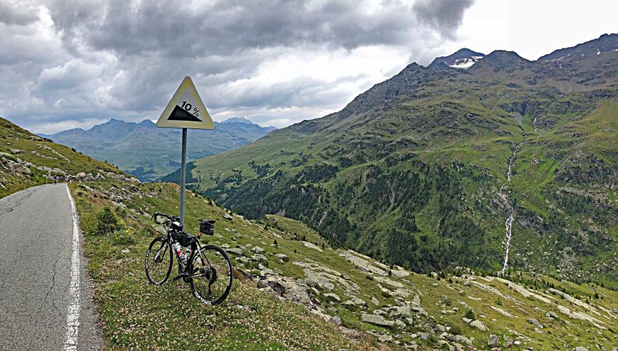
Passo Gavia from Bormio is the much easier route to the top of the pass. No tunnel and much milder grade - 5.26% versus 8% from Ponte di Legno. This route is scenic (not quite as breathtaking as the traditional side) and is a very nice out-and-back with both sides tacked on - 50 miles (80km) with 9,000’ (2,743).
PLAN YOUR ROUTE
7.1% average grade - 22 kilometers gaining 1,534 meters and 0 descent. 81% of this climb is at 5-10%. The steepest 500 meters is 10.8% and steepest kilometer 9.7%.
See more details and tools regarding this climb's grade via the “Profile Tool” button above.
Roadway: 2 lane road in good condition with solid center stripe and no shoulder.
Traffic: Moderate - no as heavy as the more famous route up to Passo Stelvio.
Parking: On our 3 trips to climb Stelvio, we have always started from our hotel. However, there are several places to park in Bormio - probably the best and closest location to the start of the climb is at the Bormio Tram parking lot 750 meters south of climb start and just ove the Adda River bridge - Map; Street View.
Provisions: 2 recommended locations: On the set of 14 hairpins (7th hairpin) at kilometer 12 and at the bottom of the waterfall is Bar Kiosk Nationalpark (Google Map + Reviews) and our favorite - Ernstl's Bratwurst at the summit - I have ridding this climb 3 times and have eaten 3 of their bratwurts with the works!! (Google Map + Reviews).
Before heading out on any cycling adventure check out our Things to Bring on a Cycling Trip and use our interactive check list to ensure you don't forget anything.
See our Bormio, Italy climb area page for the top bike climbs in this area (including Gavia and Mortirolo). Also consider this climb along with the world famous Passo dello Stelvio as an out and back which we did one time and thoroughly enjoyed - 94 kilometers gaining 3,415 meters (Map).
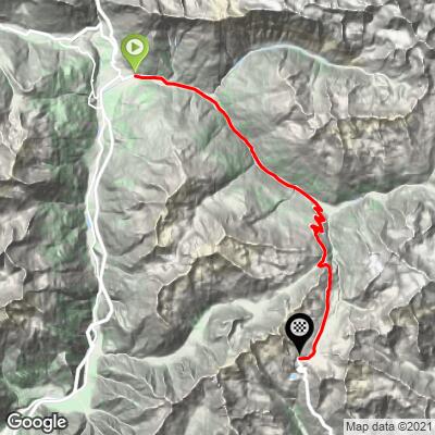
ROUTE MAP
MEMBER RATING
CURRENT WEATHER
PJAMM TRIPS ADVENTURE STARTER BUNDLES
Check out PJAMM Adventure's prepackaged (self-guided) cycling trips. They will help you plan, document and conquer your next adventure.
NEARBY CLIMBS (0) RADIAL PROXIMITY
FROM No Climbs Found
MEMBER REVIEWS & COMMENTS
Let us know what you thought of this climb. Signup for our FREE membership to write a review or post a comment.
Already have an account?
LOG IN HERE
Cyclopaat
The 'easier' end, but it's also more irregular and past Santa Caterina it's not easy at all. During all but one of my ascends, it was freezing cold - on a summer's day, with up to 30 degrees (C) in Bormio.