
8.4
PDI
3.1 mi
DISTANCE
1,192 ft
GAINED
7.3 %
AVG. GRADE
FULL CLIMB STATS
INTRO
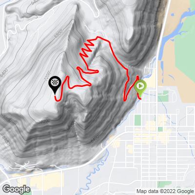
Saddle Butte - officially East Gros Ventre Butte, though everyone in Jackson calls it Saddle Butte- is a short, punchy climb up a paved residential road that switchbacks to the top of the butte overlooking downtown Jackson. In just over 3 miles you gain nearly 1,200 feet, averaging 7.3% with the steepest pitches near the bottom.
The road was carved out by hand starting in the late 1960s as the Saddle Butte subdivision developed, and picked up nearly a dozen sharp switchbacks when the upper section (Saddle Butte Heights) was built out in the early 2000s. It's fully paved today, though narrow and residential for its entire length - you're climbing through someone's neighborhood, not a wilderness road.
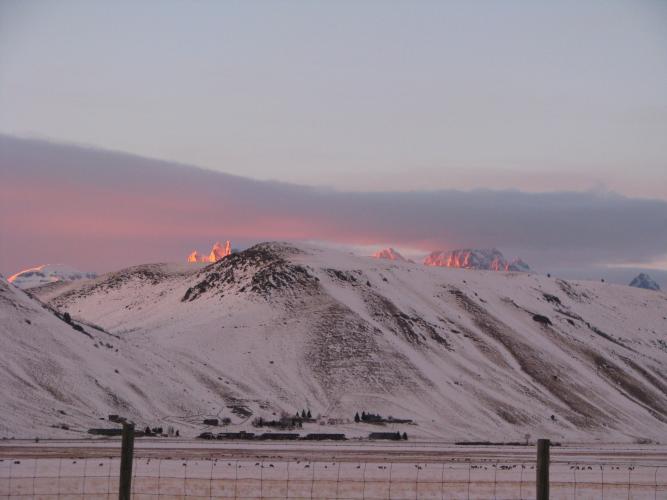
What you get for the effort: some of the best views in the valley. From the saddle and summit you can see the Tetons on one side and the town, National Elk Refuge, and Cache Creek on the other. It's a favorite quick add-on for locals looking to torch their legs without leaving town.
PLAN YOUR ROUTE
 We've partnered with Sherpa-Map.com to bring you the best route planning tool. With a PRO Membership you can use this climb as a reference when creating your route.
 Saddle Butte climbs in the high single digits for essentially its entire 3.1 miles - there's no flat section to recover on. The steepest quarter mile comes right out of the gate at 9.1%, and the grade holds in the 7-9% range through the switchbacks most of the way to the saddle, easing off slightly in the final approach to the summit. Treat it as one sustained effort from the first pedal stroke to the last.
Roadway: Fully paved the entire way, though narrow - this is a residential road serving the Saddle Butte and Saddle Butte Heights subdivisions, not a through-road, so expect tight switchbacks and no shoulder.
Traffic: Light - only residents and their guests use this road - but stay predictable through the switchbacks, since sightlines are short and several corners are blind.
Parking: Start at the corner of Mercill Avenue and North Millward Street, a few blocks from Town Square. Street parking is available nearby in downtown Jackson.
This is a short, in-town climb, so a normal road setup is all you need. There are no services, water, or facilities anywhere on the route itself - everything above the saddle is private residential driveways - so treat it as a hard, self-contained effort rather than a ride you can refuel on.
Fill your bottles before leaving downtown Jackson; you'll be back at your car in well under an hour.
Before heading out on any cycling adventure check out our Things to Bring on a Cycling Trip and use our interactive check list to ensure you don't forget anything.
Saddle Butte is essentially a neighborhood climb inside Jackson, so it pairs easily with everything else downtown has to offer - grab coffee or hit a bike shop on Town Square before or after.
Because it's short and steep, it's a popular add-on to a longer ride, or a quick lunchtime leg-burner for locals.
Jackson is also the gateway to Grand Teton National Park, minutes to the north, and Yellowstone beyond it. If you're visiting for this climb, budget extra days for the parks.
ROUTE MAP
MEMBER RATING
CURRENT WEATHER
PJAMM TRIPS ADVENTURE STARTER BUNDLES
Check out PJAMM Adventure's prepackaged (self-guided) cycling trips. They will help you plan, document and conquer your next adventure.
NEARBY CLIMBS (0) RADIAL PROXIMITY
FROM No Climbs Found
MEMBER REVIEWS & COMMENTS
Let us know what you thought of this climb. Signup for our FREE membership to write a review or post a comment.
Already have an account?
LOG IN HERE
