![]()
Cycling Fort Mountain West
Ride 6.1 miles gaining 1,863’ at 5.8% average grade.
Fort Mountain West is ranked the 5th hardest bike climb in Georgia. The climb is in Fort Mountain State Park, established in 1938. The name “Fort Mountain” derives from an ancient 885’ rock wall located at the peak of the mountain.
Climb summary by PJAMM ambassador Dan Razum, San Jose, CA:
We start climbing just outside the town of Chatsworth. From the town we can see Fort Mountain peak but the peak is inside Fort Mountain State Park, this climb doesn't take us to the peak itself, just to the entrance to the State Park. However, the elevation of the climb is only about 200 feet below the elevation of the peak and we do have the option of entering the park if we want to visit the peak.
![]()
The climb gradient is mostly uniform so it makes it easy to get into a climbing rhythm. The road is in good condition but without a shoulder. Traffic is light, though, so we didn't encounter any problems.
![]()
There is ample shade as we pass through the forest which covers the mountain.
![]()
Near the top there are two overlooks close together, just a couple hundred yards apart. There are nice scenic views from the overlooks but we can't quite see our starting point, Chatsworth is hidden by the mountain.
![]()
![]()
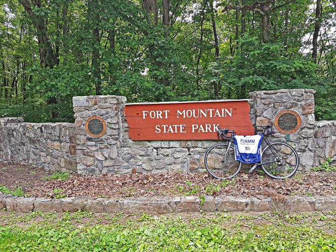
Shortly after the overlooks we reach the top of the climb, which is the entrance to Fort Mountain State Park. If you are interested in a more scenic view, you can enter the park and ride to Fort Mountain peak. There is a $5 parking fee in the park, but we aren't sure if cyclists must pay this fee or not (we brought a vehicle along with us so we paid).
![]()
To reach the peak requires about 2 miles additional riding and a short hike as well. The two miles extra riding are not flat, it is rolling terrain with a bit of climbing to reach a parking lot and then it's about a 15 minute hike to the peak. However, the view is well worth the effort if you have the time.
![]()
View from the peak after 15 minute hike.

 We've partnered with Sherpa-Map.com to bring you the best route planning tool. With a PRO Membership you can use this climb as a reference when creating your route.

