
25.6
PDI
3.6 mi
DISTANCE
2,475 ft
GAINED
13.1 %
AVG. GRADE
FULL CLIMB STATS
INTRO
At just 5.8 km (3.6 mi), Rifugio Talamini above Vodo di Cadore is short but genuinely brutal - it gains 754 m (2,475 ft) at a 13.1% average grade, making it one of the steepest sustained climbs in the Dolomites.
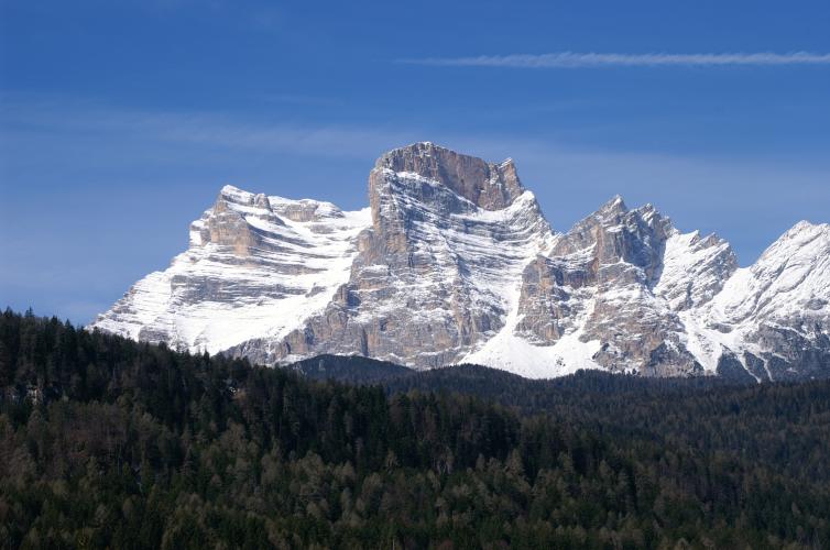
The lower kilometers out of the village are the steepest part of the whole climb, then the grade eases slightly through a wooded middle section where the pavement gives way to hard-packed gravel before the final push to the refuge. Traffic is close to nonexistent - this is a narrow forest road serving the rifugio, not a through route - and the reward at the top is a genuine mountain hut with open views to Monte Pelmo, Civetta, and Antelao.
Vodo di Cadore sits in the same valley system as some of the Dolomites' most famous passes - Passo Giau and Passo Falzarego are both a short drive away - but this climb is a quieter, lesser-known alternative aimed squarely at riders looking for a short, honest test of pure steepness rather than a long alpine haul.
PLAN YOUR ROUTE
 We've partnered with Sherpa-Map.com to bring you the best route planning tool. With a PRO Membership you can use this climb as a reference when creating your route.
 Rifugio Talamini packs its difficulty into a short distance - 5.8 km (3.6 mi) at a 13.1% average, front-loaded toward the bottom. The steepest 500 meters averages 19.8%, and the steepest full kilometer still averages 17.6%, both found in the opening kilometers straight out of Vodo di Cadore.
After that brutal start, the grade eases into a more manageable, rolling middle section through the woods before a final rise to the refuge at 1,599 m (5,247 ft) - hard, but never again quite as sharp as the opening ramps.
Roadway: The road out of Vodo di Cadore is paved through its steepest lower kilometers, then turns to well-packed gravel/forest-road surface for a stretch through the upper woods before reaching Rifugio Talamini - multiple regional route descriptions note this upper section is partially unpaved, so wider tires (28mm+) or a gravel bike are a safer bet than a pure race setup.
Traffic: Virtually none. This is a narrow, single-lane mountain road serving the refuge and a handful of forest tracks rather than a through route, so you'll likely have it to yourself outside of busy summer weekends.
Parking: Vodo di Cadore is a small village with informal roadside parking near the town center and church, close to where the climb begins - there's no dedicated lot, but space is easy to find outside the peak August weeks.
A compact or mountain-range crankset with a genuinely easy low gear is close to mandatory here - the opening kilometers out of Vodo di Cadore average well into the high teens, and there's little flat ground anywhere on the way up to recover.
Fill bottles in the village before you start; there's no store, cafe, or reliable water source on the climb itself until you reach Rifugio Talamini at the top, which serves food and drink in season (typically summer into early autumn - hours vary, so it's worth checking ahead in shoulder season).
Before heading out on any cycling adventure check out our Things to Bring on a Cycling Trip and use our interactive check list to ensure you don't forget anything.
Vodo di Cadore sits in the Cadore valley about 15 km south of Cortina d'Ampezzo, making it a quiet, low-key base for exploring the eastern Dolomites without Cortina's summer crowds or prices.
The refuge at the top, Rifugio Gianpietro Talamini, sits at 1,582 m in the Col Botei area with open views to Monte Pelmo, Civetta, and Antelao - a genuine payoff for a short, hard climb, and a natural turnaround point before heading back down.
This corner of the Dolomites has several other well-known passes nearby, including Passo Giau and Passo Falzarego - see the Routes in the Area tool for other climbs starting around the Cadore and Cortina area.
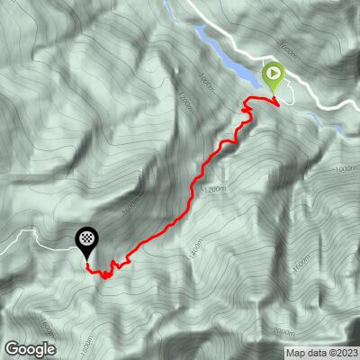
ROUTE MAP
MEMBER RATING
CURRENT WEATHER
PJAMM TRIPS ADVENTURE STARTER BUNDLES
Check out PJAMM Adventure's prepackaged (self-guided) cycling trips. They will help you plan, document and conquer your next adventure.
NEARBY CLIMBS (0) RADIAL PROXIMITY
FROM No Climbs Found
MEMBER REVIEWS & COMMENTS
Let us know what you thought of this climb. Signup for our FREE membership to write a review or post a comment.
Already have an account?
LOG IN HERE
