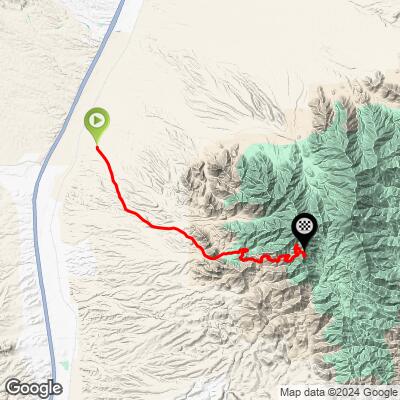
22.2
PDI
14.7 mi
DISTANCE
3,981 ft
GAINED
5.1 %
AVG. GRADE
FULL CLIMB STATS
Page Contributor(s): Doug Jansen, Durango, CO; Orion Child, Tucson, AZ;
INTRO
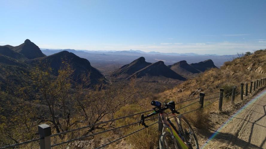
Orion Child -This climb goes about 6 miles of road, 6 miles of gravel (mostly smooth gravel for most of it) And then the last 5 miles is road. Very doable on even a road bike but just take the gravel slow and careful on the downhill :) Also it's best to only ride Hopkins on the weekends since the observatory workers only work week days.
PLAN YOUR ROUTE
See more details and tools regarding this climb's grade via our interactive Profile Tool.
Information Not Available
If you have any information regarding this climb, we'd like to hear from you. Click the CONTRIBUTE button to share your thoughts with us.
Information Not Available
If you have any information regarding this climb, we'd like to hear from you. Click the CONTRIBUTE button to share your thoughts with us.
Before heading out on any cycling adventure check out our Things to Bring on a Cycling Trip and use our interactive check list to ensure you don't forget anything.
Information Not Available
If you have any information regarding this climb, we'd like to hear from you. Click the CONTRIBUTE button to share your thoughts with us.
ROUTE MAP
MEMBER RATING
CURRENT WEATHER
PJAMM TRIPS ADVENTURE STARTER BUNDLES
Check out PJAMM Adventure's prepackaged (self-guided) cycling trips. They will help you plan, document and conquer your next adventure.
NEARBY CLIMBS (0) RADIAL PROXIMITY
FROM No Climbs Found
MEMBER REVIEWS & COMMENTS
Let us know what you thought of this climb. Signup for our FREE membership to write a review or post a comment.
Already have an account?
LOG IN HERE
whitworks

This is a gravel ride. There are no services and no cell coverage once you climb the first long draw into a canyon. I did it on a Salsa Cutthroat with 2.1 knobbies and still got my molars knocked around on the washboards coming downhill. the pavement sections aren't much better. On the plus side, I had this place completely to myself. 18 miles from the intersection of Mt. Hopkins road and elephant head road to the "Smithsonian gate." This is a real gate. You cannot get past it. 77 at bottom, 62 at top. 3 bottles was enough. It's a bummer that you can see the road swirl around the summit cone but you can't go up there.
aleangel
There is a gate about 4 miles from the top