
17.2
PDI
10.8 mi
DISTANCE
3,197 ft
GAINED
5.6 %
AVG. GRADE
FULL CLIMB STATS
INTRO
Serrada is a small ski village on the edge of the Folgaria plateau, and this is the long way up to it: out of Rovereto and along the Val di Terragnolo, a valley of about thirty scattered hamlets and farmsteads strung along the Leno stream. It's 17.4 km (10.8 mi) with 974 m (3197 ft) of climbing at 5.6%, from 279 m on the edge of Rovereto to 1251 m in Serrada.
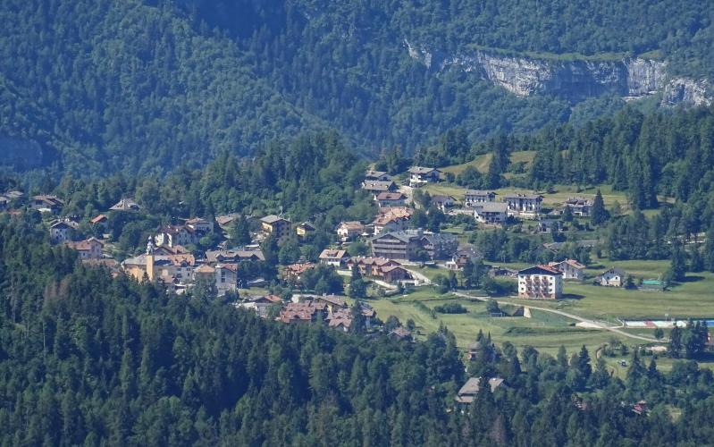
It starts with a proper climb. The first 4 km out of town run at 6 to 8%, and then the valley gives you a breather: from about km 5 to km 9 the road follows the stream upstream at 1 to 4%, past the hamlets of Terragnolo. After that it turns uphill for good. The last 8 km never drop much below 6% or go much above 7.5%, climbing back and forth up the valley side in long hairpins, with the limestone cliffs of the plateau above you and the Pasubio across the valley.
This valley was the front line in the First World War, and Serrada sat right on it. Above the village, the Austro-Hungarian Forte Dosso delle Somme (1670 m) watched the whole Terragnolo valley up to Passo della Borcola, and a trail from Serrada climbs through the trenches of the Forra del Lupo to its ruins. It's a walk, not a ride, but it's the thing to do at the top if you've brought shoes.
PLAN YOUR ROUTE
 We've partnered with Sherpa-Map.com to bring you the best route planning tool. With a PRO Membership you can use this climb as a reference when creating your route.
Rovereto to Serrada is 17.4 km (10.8 mi), rising from 279 m (916 ft) to 1251 m (4104 ft) - 974 m (3197 ft) of gain at an average of 5.6%. The steepest kilometer averages 9.0%, the steepest 2 km 7.9%, the steepest 5 km 7.2% and the steepest 10 km 6.1%.
Km 0-4: The climb out of Rovereto, 5.6 to 8.0% per kilometer.
Km 4-9: Gentle valley road, 4.1% easing to 1.2 to 1.5% around km 7-8 before picking up again to 4.4%.
Km 9-17.4: Steady hairpins at 6.1 to 7.6% per kilometer, easing to about 4% for the final few hundred meters into Serrada.
Roadway: Paved throughout on the SP2 Rovereto-Terragnolo-Serrada, a narrow-to-medium provincial road with Google Street View imagery from May 2026 along its whole length. The valley's slopes are prone to slides: a large landslide blocked the SP2 at the end of summer 2023 and closed it for about a month, and another hit the road in April 2024. After heavy rain, check the Provincia autonoma di Trento's road notices before you ride.
Traffic: Light. Most traffic between the Adige valley and Folgaria uses the main road from Calliano, so the Terragnolo road mainly carries locals from the valley's hamlets.
Parking: Park in Rovereto, where the station on the Verona-Brennero railway is an easy meeting point a few kilometers from the start. At the top, Serrada has a large car park just above the village used by hikers heading for Forte Dosso delle Somme, which works if someone is meeting you at the finish.
Provisions: Fill up in Rovereto. The Terragnolo hamlets are small and spread out, so don't count on an open shop or bar on the way. Serrada has restaurants and bars at the finish, and the Baita Tonda hut is on the walking loop to the fort.
Gear: Nothing here is very steep - the hardest kilometer is 9% - so whatever you normally climb on will do. The descent is long, about 17 km back to Rovereto, and Serrada is almost 1000 m above the valley floor, so pack a layer outside high summer.
Before heading out on any cycling adventure check out our Things to Bring on a Cycling Trip and use our interactive check list to ensure you don't forget anything.
Rovereto is the base, and our Monte Finonchio (Noriglio) page covers what to see in town, from the Mart to the Campana dei Caduti. That climb starts about 500 m from this one and heads to the other side of the same mountain.
In the valley, Terragnolo's restored Venetian sawmill is open to visitors and is a pleasant stop on the way down. At the top, the Folgaria plateau (Alpe Cimbra) is a good place to stay for a few days, with Folgaria itself a short ride on. Riding on through Folgaria and down to Calliano makes a loop back to Rovereto in the Adige valley.
ROUTE MAP

MEMBER RATING
CURRENT WEATHER
PJAMM TRIPS ADVENTURE STARTER BUNDLES
Check out PJAMM Adventure's prepackaged (self-guided) cycling trips. They will help you plan, document and conquer your next adventure.
NEARBY CLIMBS (0) RADIAL PROXIMITY
FROM No Climbs Found
MEMBER REVIEWS & COMMENTS
Let us know what you thought of this climb. Signup for our FREE membership to write a review or post a comment.
Already have an account?
LOG IN HERE
