11.4
PDI
4.4 mi
DISTANCE
1,740 ft
GAINED
7.6 %
AVG. GRADE
FULL CLIMB STATS
Page Contributor(s): Dan Razum, San Jose, CA
INTRO
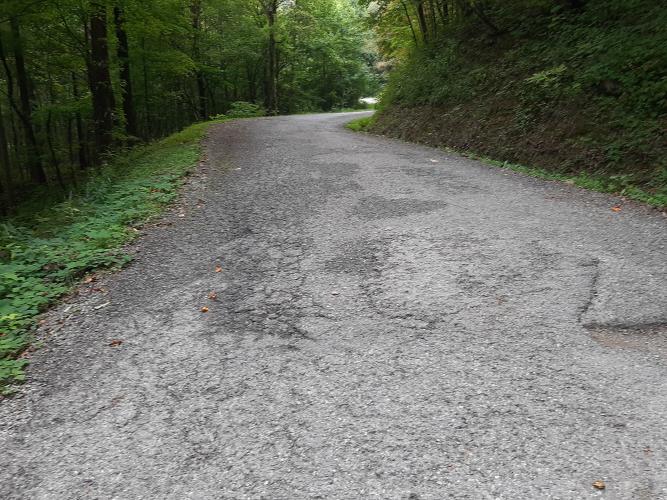
"This is an excellent and isolated climb from very near Interstate 75 north of Knoxville, Tennessee. The road is fairly steep right off the bat and through tight turns. Thick trees over much of the route result in a pleasant ride on hot days. Towards the top there is a series of tight switchbacks that get you up a big part of the mountain. At the summit the pavement turns to dirt. Mountain Road is a somewhat technical descent as well." (This quote is presented with the approval of John Summerson, from his book, The Complete Guide to Climbing (by Bike), 2nd Edition, pg. 116.)
PLAN YOUR ROUTE
See more details and tools regarding this climb's grade via our interactive Profile Tool.
Information Not Available
If you have any information regarding this climb, we'd like to hear from you. Click the CONTRIBUTE button to share your thoughts with us.
Information Not Available
If you have any information regarding this climb, we'd like to hear from you. Click the CONTRIBUTE button to share your thoughts with us.
Before heading out on any cycling adventure check out our Things to Bring on a Cycling Trip and use our interactive check list to ensure you don't forget anything.
Information Not Available
If you have any information regarding this climb, we'd like to hear from you. Click the CONTRIBUTE button to share your thoughts with us.
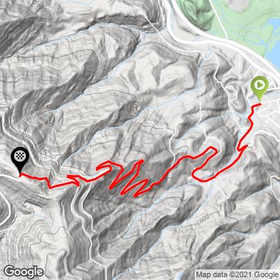
ROUTE MAP
MEMBER RATING
CURRENT WEATHER
PJAMM TRIPS ADVENTURE STARTER BUNDLES
Check out PJAMM Adventure's prepackaged (self-guided) cycling trips. They will help you plan, document and conquer your next adventure.
NEARBY CLIMBS (0) RADIAL PROXIMITY
FROM No Climbs Found
MEMBER REVIEWS & COMMENTS
Let us know what you thought of this climb. Signup for our FREE membership to write a review or post a comment.
Already have an account?
LOG IN HERE
KrisLJames262
Not much traffic but a very rough and deteriorating road. Did this one because it was not far off interstate on the way home. Cool switchbacks but the road was so rough I would not do it again.