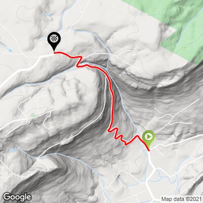
9.7
PDI
2 mi
DISTANCE
1,132 ft
GAINED
10.9 %
AVG. GRADE
FULL CLIMB STATS
Page Contributor(s): Eric Kuehl, Chicago, IL, USA; Todd Short, Scottsdale, AZ, USA
INTRO
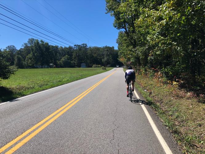
"The route up Roberts Mill Road is a short, difficult and classic climb up the southern Cumberland Plateau northwest of Chattanooga, Tennessee. Very twisty and within a dark tunnel of trees for much of its length, it contains multiple tight hairpin turns with fearsome grade and except for its very beginning and end is steep throughout. There is a bit of traffic on this road at times but the pain of the steep grade will hold your attention more than the vehicles on most days. There are also 2 short flats along the way which knock down its average grade. Toward the end the slope eases and the listed climb ends just beyond Mill Creek Road on the right..." (This quote provided with the approval of John Summerson from his book, The Complete Guide to Climbing (by Bike), 2nd Edition, pg. 117.)
PLAN YOUR ROUTE
See more details and tools regarding this climb's grade via our interactive Profile Tool.
Information Not Available
If you have any information regarding this climb, we'd like to hear from you. Click the CONTRIBUTE button to share your thoughts with us.
Information Not Available
If you have any information regarding this climb, we'd like to hear from you. Click the CONTRIBUTE button to share your thoughts with us.
Before heading out on any cycling adventure check out our Things to Bring on a Cycling Trip and use our interactive check list to ensure you don't forget anything.
Information Not Available
If you have any information regarding this climb, we'd like to hear from you. Click the CONTRIBUTE button to share your thoughts with us.
ROUTE MAP
MEMBER RATING
CURRENT WEATHER
PJAMM TRIPS ADVENTURE STARTER BUNDLES
Check out PJAMM Adventure's prepackaged (self-guided) cycling trips. They will help you plan, document and conquer your next adventure.
NEARBY CLIMBS (0) RADIAL PROXIMITY
FROM No Climbs Found
MEMBER REVIEWS & COMMENTS
Let us know what you thought of this climb. Signup for our FREE membership to write a review or post a comment.
Already have an account?
LOG IN HERE