
17.4
PDI
13 mi
DISTANCE
3,366 ft
GAINED
4.9 %
AVG. GRADE
FULL CLIMB STATS
INTRO
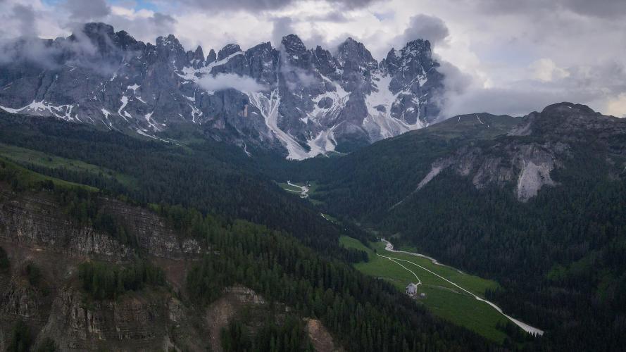
Legend says Antonio Stradivari came to these woods to choose the spruce for his violins, and Paneveggio is still called the Violin Forest. It's also the middle of this climb: a long, almost flat run through tall spruce on the Rolle road, past the lake of Forte Buso, between the ramps up from Predazzo and the real climbing on the Valles road.
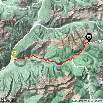
It's 21.0 km (13.0 mi) from Predazzo with 1026 m (3366 ft) of climbing, and the effort comes in two blocks. The first 6 km climb at 6 to 8% up to Bellamonte; then about 7 km barely rise at all through the forest. At the junction for Passo Rolle you turn left onto the Valles road, which starts mildly beside a stream, then runs up a long straight at about 10% - kilometers 18 and 19 average 10.1% and 9.8% - before a final set of hairpins lifts you onto the open saddle at 2033 m.
Up there the Capanna Passo Valles rifugio sits right on the pass, and the far side drops to Falcade and the San Pellegrino road. The Giro first crossed Valles in 1963; our Passo Valles (Agordino) page has the race history and the long climb up from the Biois valley.
PLAN YOUR ROUTE
 We've partnered with Sherpa-Map.com to bring you the best route planning tool. With a PRO Membership you can use this climb as a reference when creating your route.
From Predazzo to the pass the climb is 21.0 km (13.0 mi) long and gains 1026 m (3366 ft) at an average of 4.9%, from 1015 m (3329 ft) to 2033 m (6670 ft). There's only about 8 m (26 ft) of downhill in the whole route.
0-6 km (0-3.7 mi): 2.5% and 4.7% for the first two kilometers out of Predazzo, then a steady 6.7-7.7% up to Bellamonte.
6-13 km (3.7-8.1 mi): The Paneveggio plateau: mostly 0.4-2.5%, through the forest and past Lake Forte Buso.
13-15 km (8.1-9.3 mi): 4.6% and 7.2% as the Rolle road climbs to the Valles turn at about km 14.3.
15-17 km (9.3-10.6 mi): An easy start on the Valles road at 1.9-2.8%, beside the stream.
17-21 km (10.6-13.0 mi): The real climb: 10.1%, 9.8%, 7.0% and 8.4%, up the long straight and through the last hairpins to the pass.
The steepest 0.5 km averages 11.6%, the steepest kilometer 10.4%, the steepest 2 km 9.9% and the steepest 5 km 7.3%.
Roadway: Good asphalt from Predazzo to the pass. The first 14 km follow the SS50, the main road from the Val di Fiemme over Passo Rolle to San Martino di Castrozza, so the surface and width are what you'd expect of a state road. The SP81 to the pass is narrower but well paved, and riders rate its surface highly.
Traffic: The SS50 carries everyone heading for Passo Rolle and San Martino, so from Predazzo to the Valles turn expect a steady stream of cars and motorbikes in summer, busiest late morning and on weekends. Once you turn onto the Valles road it goes quiet.
Parking: Predazzo is the main town at the top of the Val di Fiemme; park in town and ride to the start on Via Marconi (Map). At the pass there's a small parking area by the rifugio for anyone coming up to meet you.
Gear: The first 17 km don't ask much of your gearing; the last 4 km, close to 10% on the straight, are where a 30 or 32 cog earns its place. At 2033 m the pass gets cold as soon as the cloud comes in, so pack a jacket for the long descent back through the forest.
Provisions: Stock up in Predazzo. Bellamonte, at about km 6, is a small resort village, and the Capanna Passo Valles at the top is a rifugio with food and drink in season. In between, the Paneveggio stretch is all forest.
Before heading out on any cycling adventure check out our Things to Bring on a Cycling Trip and use our interactive check list to ensure you don't forget anything.
Predazzo is a good base with everything a rider needs, and the ski jumps of the G. Dal Ben stadium, readied for the 2026 Milano Cortina Winter Olympics, stand at the edge of town. On the way up, the Paneveggio visitor center on the SS50 is worth a stop on a rest day: it has a deer enclosure, a nature trail and displays on the forest and the violin makers who prized its wood.
At the Valles junction you can also carry straight on to Passo Rolle, under the Pale di San Martino. Over the top of Valles, the road drops to Falcade, which sets up the classic loop back over San Pellegrino to Moena and down the Val di Fassa to Predazzo - see our Passo San Pellegrino (Falcade) page. Passo Lavazè from Cavalese is another good climb a few kilometers down the valley.
ROUTE MAP
MEMBER RATING
CURRENT WEATHER
PJAMM TRIPS ADVENTURE STARTER BUNDLES
Check out PJAMM Adventure's prepackaged (self-guided) cycling trips. They will help you plan, document and conquer your next adventure.
NEARBY CLIMBS (0) RADIAL PROXIMITY
FROM No Climbs Found
MEMBER REVIEWS & COMMENTS
Let us know what you thought of this climb. Signup for our FREE membership to write a review or post a comment.
Already have an account?
LOG IN HERE
