
35.9
PDI
7.2 mi
DISTANCE
4,052 ft
GAINED
10.7 %
AVG. GRADE
FULL CLIMB STATS
Page Contributor(s): Patrick Morris of Velo Asia and Indochina Travel
INTRO
The Zillertaler Hoehenstrasse is a toll road climbing out of the Zillertal valley in Austria's Tirol region, and the Ried im Zillertal side is its steepest, most direct approach. From the village at 1,808 feet, the road gains 4,052 feet over 7.2 miles at a demanding 10.7% average grade to the Zirmstadl viewpoint at 5,860 feet - one of the toughest climbs in the Austrian Alps.
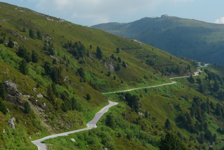
The road is a genuine alpine toll route, but cyclists ride the entire Zillertaler Hoehenstrasse free of charge - only motor vehicles pay at the booth partway up. The lower half climbs steadily through forest on a series of hairpin switchbacks, with a few tight spots where cars can crowd the shoulder; above the toll station the trees thin out and the road opens onto high alpine meadows with sweeping views across the Tux and Zillertal Alps.
This is one of several different approach roads onto the same mountain highway - other entrances climb from Kaltenbach, Aschau, Zellberg, and Hippach - but starting in Ried gives the shortest, steepest route to the top. The road typically opens for the season in mid-to-late May and closes by late October, weather permitting, so early- and late-season riders should check current status before heading out.
PLAN YOUR ROUTE
 We've partnered with Sherpa-Map.com to bring you the best route planning tool. With a PRO Membership you can use this climb as a reference when creating your route.
 This is a long, steady grind rather than a series of brutal spikes. The 7.2-mile climb averages 10.7%, and the gradient barely lets up throughout - the steepest quarter-mile touches 14.1%, the steepest half-mile holds 13.6%, and even the steepest 5-mile rolling average sits at 12.0%. In practice that means there's no easy section to recover on: expect a sustained double-digit effort essentially start to finish, eased only slightly by a handful of longer straights between the hairpin switchbacks.
Roadway: The Ried approach climbs through forest on a mix of older and newly repaved asphalt. Road quality is generally good on the lower slopes but gets noticeably rougher in the upper section beyond the toll booth. Expect numerous hairpin turns throughout, connected by longer straights.
Traffic: This is a functioning toll road used by cars, tour buses, and public buses as well as cyclists, so expect some vehicle traffic, especially in summer. Riders report most drivers passing safely, though some pass closer than a meter on the narrower upper sections - stay alert through blind corners. Cyclists ride the road completely free of charge; only motorized vehicles pay the toll (around 10 EUR per car as of 2026) at the booth partway up.
Parking: There's no dedicated cycling lot at the Ried entrance. Riders typically park in the village of Ried im Zillertal near the start of the toll road. A large public car park exists higher up at Melchboden, but that's well beyond this climb's endpoint.
There are no services once you leave Ried im Zillertal, so carry enough water and food for a 1.5-2 hour effort - there's nothing until the snack stop at Melchboden, above this climb's endpoint. Given the sustained double-digit grade, compact gearing (a 34-tooth chainring paired with a 30-32 tooth low cog) is worth having. The nearest full-service bike shops and rentals are in the larger Zillertal villages of Fuegen and Kaltenbach, a short drive down-valley.
Before heading out on any cycling adventure check out our Things to Bring on a Cycling Trip and use our interactive check list to ensure you don't forget anything.
Ried im Zillertal sits in the lower Zillertal, one of Tirol's best-known valleys for both winter skiing and summer cycling, with the Ziller river and the narrow-gauge Zillertalbahn running the length of the valley. The Zillertaler Hoehenstrasse is open seasonally, typically from mid-to-late May through late October depending on snowfall, so shoulder-season riders should check current conditions before heading up. The valley towns along the Ziller offer typical Tirolean food and lodging, and with several other approach roads onto this same mountain highway nearby, our Routes in the Area tool is a good way to see what else is close by before planning a trip.
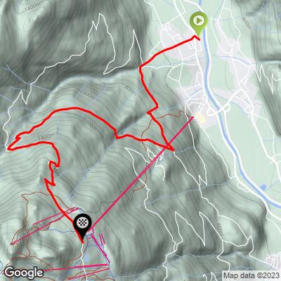
ROUTE MAP
MEMBER RATING
CURRENT WEATHER
PJAMM TRIPS ADVENTURE STARTER BUNDLES
Check out PJAMM Adventure's prepackaged (self-guided) cycling trips. They will help you plan, document and conquer your next adventure.
NEARBY CLIMBS (0) RADIAL PROXIMITY
FROM No Climbs Found
MEMBER REVIEWS & COMMENTS
Let us know what you thought of this climb. Signup for our FREE membership to write a review or post a comment.
Already have an account?
LOG IN HERE
