High Knob Climb Summary
![]()
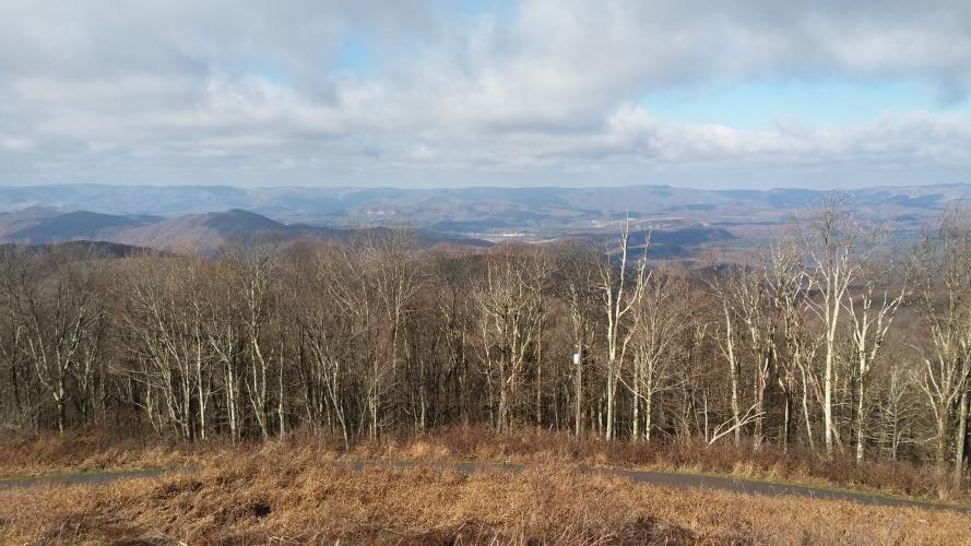
View from the top of High Knob
Thanks to our friend Dan Razum from Campbell, California for his contributions to the Climb Page and this write-up:
The climb starts at the intersection of Alt58 and 619 in Norton, VA.
![]()
Start of Climb.
The climb starts off immediately, so it's a good idea to ride around Norton a little to warm up first. Route 619 is narrow with no shoulder, mostly 2 lanes but with a few short stretches that are only 1 lane wide. The surface is good and quite smooth.
![]()
Generally two lanes, but narrow.
There are many sharp turns and switchbacks, which makes for a technical descent. There are also some pretty steep sections but luckily those sections aren't too long, you can power through them. Even though the road is narrow, steep and
twisty, it felt safe; the little traffic that was there was slow and courteous.
![]()
Some nice hairpins on the climb.
Halfway up the climb is the turnout to Flag Rock Overlook. A small road leads about a half a mile from 619
to the overlook. It is well worth riding to the overlook, there is a beautiful view of the city of Norton and
the surrounding area. There is a flag on a large rock (hence the name) but you can't actually reach it, the
closest you can get is an observation deck about 200 yards away. But the observation deck is higher than the flag,
so you have a better view than if you were at the flag itself. Due to the shapes of the mountains, you cannot see
the city of Norton from the High Knob tower, so you should definitely visit the Flag Rock overlook. If you want
to do the full climb non-stop, then you can always stop at Flag Rock on the way down.
![]()
View of Norton from Flag Rock Overlook.
Continuing up the mountain, you eventually reach the high point of 619. You then turn left and continue climbing
a little further along a smaller road before turning right for the final short little climb to the High Knob tower.
There is a small paved path from the parking lot up to the tower, for handicap (and cycling!) access, so you
can ride all the way to the tower. There are great 360 degree views from the tower but you can't see the starting
point in Norton, it is hidden by the mountain itself.
![]()
We made it! High Knob Tower.
All in all, this a beautiful twisty climb through thick forest with great views in all directions at the top.

 We've partnered with Sherpa-Map.com to bring you the best route planning tool. With a PRO Membership you can use this climb as a reference when creating your route.

