
24.3
PDI
7.6 mi
DISTANCE
3,387 ft
GAINED
8.3 %
AVG. GRADE
FULL CLIMB STATS
INTRO
Collepietra is a 12.2 km (7.6 mi) climb from Prato all'Isarco (Blumau), on the floor of South Tyrol's Isarco valley, up to the high plateau of Obergummer, gaining 1,032 m (3,387 ft) at a steep 8.3% average. It tops out at 1,349 m (4,425 ft), with the Sciliar (Schlern), Catinaccio (Rosengarten) and Latemar massifs filling the view for much of the upper half.
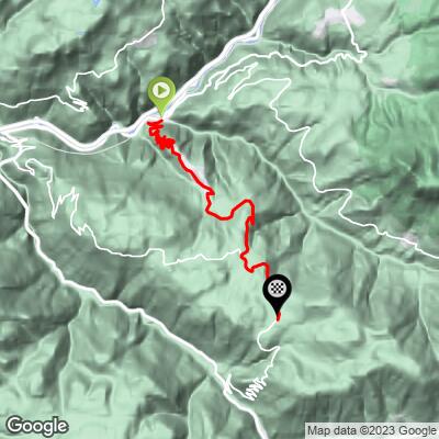
The first 5 km are the highlight: a stack of 15 hairpins that lifts you from the valley floor at about 330 m to the village of Collepietra (Steinegg) at roughly 820 m, with short pitches reaching the low teens. One German road-cycling guide describes the hairpin stack as a climb that would be a classic anywhere else, but tucked away in this quiet corner it's ridden mostly by locals - and that still fits: good pavement, very little traffic, and long views back down into the Isarco valley. Above the village the SP132 keeps climbing through meadows and forest at 6-11% all the way to Obergummer.
Collepietra and its neighboring villages in the municipality of Cornedo all'Isarco are known as Europe's first "star village," and the finish at Obergummer is a short, signposted detour from the Max Valier public observatory - a fitting reward for a climb this steep.
PLAN YOUR ROUTE
 We've partnered with Sherpa-Map.com to bring you the best route planning tool. With a PRO Membership you can use this climb as a reference when creating your route.
 Collepietra covers 12.2 km (7.6 mi) at an 8.3% average, gaining 1,032 m (3,387 ft) from 332 m (1,090 ft) in Prato all'Isarco to 1,349 m (4,425 ft) at Obergummer.
There's no easing in: the first kilometer already averages over 7%, and the second - right in the middle of the hairpins - is the steepest stretch of the whole climb. Kilometers 3 through 6 hold remarkably steady at about 9% as the road reaches and passes through Collepietra, followed by another hard kilometer above the village. The final third alternates between roughly 6% and 9% until the road levels off over the last few hundred meters into Obergummer.
The steepest half kilometer averages 14.1%, the steepest kilometer 11.4%, the steepest mile 10.6%, the steepest 2 km 10.4%, and the steepest 5 km 9.5%.
Roadway: The SP132 is paved the entire way from Prato all'Isarco through Collepietra to Obergummer, and cycling guides consistently describe it as a well-surfaced road. The lower 5 km are a tight sequence of 15 hairpins; above Collepietra the road climbs more directly across the plateau. It's a year-round local access road, but the upper section sits above 1,300 m and can see snow and ice in winter.
Traffic: Light. The SP132 mainly serves Collepietra and the hamlets above it, and it's a quiet road for most of the day. The SS12 state road at the bottom in Prato all'Isarco is a different story - it's very busy, so if you're riding in from Bolzano, use the paved Isarco valley cycle path instead.
Parking: Prato all'Isarco has limited on-street parking near the village center (see our San Cipriano/Passo Nigra page, which starts from the same village). The old Prato-Tires railway station has had no train service since 1999, so without a car the simplest option is to ride the Isarco valley cycle path from Bolzano, about 9 km, to the start - a natural warm-up for the hairpins.
Gear: A compact crankset with a 30- or 32-tooth low cog is a sensible choice - the 8.3% average hides half-kilometer pitches of up to 14% in the hairpins, and there's very little flat road to recover on until the top. Standard road tires are fine on the paved SP132.
Provisions: Stock up in Prato all'Isarco before you start. Collepietra, about 5 km up, is a small resort village with hotels and guesthouses and makes the natural mid-climb stop. Between the village and the top the road is sparsely settled, but at the finish the Gasthaus Untereggerhof, a traditional family-run inn a few steps from the Max Valier observatory, serves hearty South Tyrolean food daily from 8:00 to 20:00 except Wednesdays, its rest day.
Before heading out on any cycling adventure check out our Things to Bring on a Cycling Trip and use our interactive check list to ensure you don't forget anything.
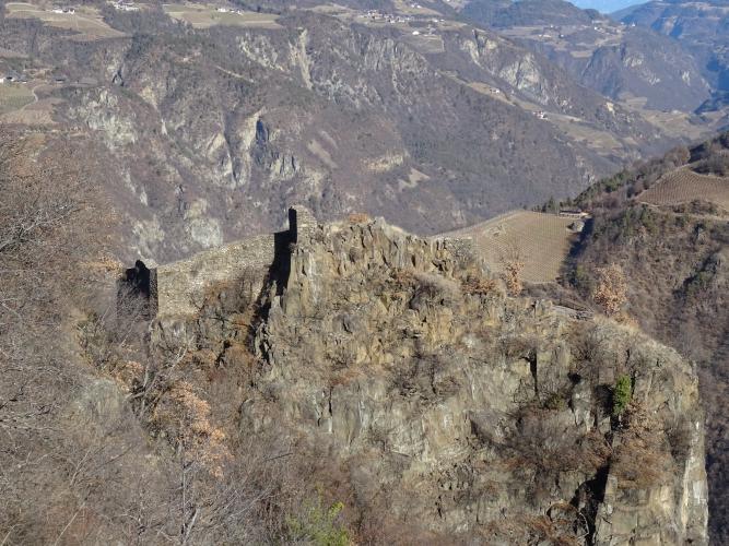
Collepietra's local history museum on the church square is one of South Tyrol's more unusual small museums - around 18,000 objects of rural Tyrolean life spread across 18 rooms, visitable by guided tour from Palm Sunday through October. The ruins of Castel Collepietra (Burg Steinegg), seat of the medieval lords of Steinegg, stand on a rocky spur just outside the village, and a short walk leads to the Steinegg earth pyramids, ice-age clay columns capped with boulders.
At the top, the Max Valier observatory near Obergummer, at about 1,350 m, is named for the Bolzano-born rocketry pioneer and is also home to South Tyrol's only solar observatory; it offers guided day and evening visits, and a "Path of the Stars" walking trail links it to the planetarium in Gummer. From the Untereggerhof inn, the Planet Path (Planetenweg) walks you through a scale model of the solar system on the way to the observatory - an easy post-ride stroll with the Catinaccio (Rosengarten) and Latemar towers as a backdrop. Obergummer's two listed chapels are the kind of detail you'd ride right past: the Holy Sepulchre chapel (Heilig-Grab-Kapelle) beside the Untersoler farm, and the Mount of Olives chapel (Ölbergkapelle) a little further along, both small white wayside chapels with shingled roofs set among the meadows within about a kilometer of the finish. Cornedo Castle and the lower Cardano approach to the same plateau are covered on our Cornedo page.
From Obergummer you can drop into the Val d'Ega toward Passo Costalunga or link across to Passo Nigra - see other climbs nearby, or build a custom route from here, with our Routes in the Area tool.
ROUTE MAP
MEMBER RATING
CURRENT WEATHER
PJAMM TRIPS ADVENTURE STARTER BUNDLES
Check out PJAMM Adventure's prepackaged (self-guided) cycling trips. They will help you plan, document and conquer your next adventure.
NEARBY CLIMBS (0) RADIAL PROXIMITY
FROM No Climbs Found
MEMBER REVIEWS & COMMENTS
Let us know what you thought of this climb. Signup for our FREE membership to write a review or post a comment.
Already have an account?
LOG IN HERE
