
17.1
PDI
3.9 mi
DISTANCE
2,013 ft
GAINED
9.8 %
AVG. GRADE
FULL CLIMB STATS
INTRO
The Giro d'Italia has finished up here twice. The 1976 stage to the Torri del Vajolet ended on this road, the day Felice Gimondi lost the pink jersey (he won the Giro anyway), and in 2011 Mikel Nieve won the stage from Conegliano, passing Stefano Garzelli on the climb, with Alberto Contador third.
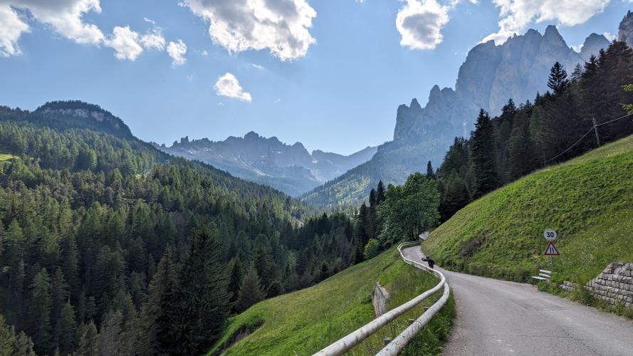
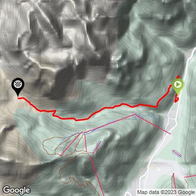
It's short and it hurts: 6.3 km (3.9 mi) from Pera di Fassa to the hut at 1948 m, climbing 614 m (2013 ft) at 9.8%. The first 1.2 km go straight up out of the valley at 11% through two hairpins, the hamlet of Muncion gives you a brief flat, and then the road narrows and follows the Rio Sojal into the side valley at around 6%. The last 3 km are where it gets serious - 11.7% on average through the forest, with the steepest kilometer at 14.1% - and the pale walls of the Catinaccio (Rosengarten) get closer the whole way.
Beyond Muncion the road is closed to private cars, so on a normal summer day the top half is shared with hikers and the odd supply vehicle. At the top, Rifugio Gardeccia and its neighbors serve food and drink, with the Vajolet Towers above, and there's an e-bike charging station by the hut. Snow can sit on the upper road into April.
PLAN YOUR ROUTE
 We've partnered with Sherpa-Map.com to bring you the best route planning tool. With a PRO Membership you can use this climb as a reference when creating your route.
From 1340 m (4398 ft) at the start to 1948 m (6392 ft) at Gardeccia, the climb gains 614 m (2013 ft) over 6.3 km (3.9 mi) at an average of 9.8%. The steepest kilometer averages 14.1%, the steepest half kilometer 15.1%, the steepest 2 km 12.2% and the steepest 5 km 9.4%. Kilometer posts count down the distance to the top.
Km 0-1.2: 11.1% and two hairpins out of the valley.
Km 1.2-3.2: 6.1%, the easiest stretch, through Muncion and along the Rio Sojal.
Km 3.2-6.2: 11.7%, steep and steady through the forest to the hut, with the steepest kilometer near the end.
Roadway: Narrow asphalt almost to the door, with the last 100 m or so to the hut unpaved. The surface is mostly good, but this is a mountain road that landslides and washouts have closed more than once. On 2 August 2026 a storm sent debris flows down from the Vajolet and eroded the road in several places; the comune closed it to all traffic, walkers included, under an ordinance set to run until the emergency ended and no later than 31 August. Before you ride, check with the Comune di San Giovanni di Fassa or Rifugio Gardeccia that the road is open and repaired.
Traffic: Normal local traffic as far as Muncion. Above it the road is closed to private cars, and the minibus and taxi shuttles that used to run up from Pera were stopped in 2019, so apart from hut supply and work vehicles it's bikes and hikers.
Parking: Park in Pera di Fassa or Pozza and ride to the roundabout at the start - there's no visitor parking on the upper road. Non-riders can meet you at the top by taking the Pera chairlift or the Vigo-Ciampedie cable car and walking the last stretch to Gardeccia.
Gear: Bring your lowest gear. With 3 km at nearly 12% and a 14% kilometer to finish, a 34 x 32 or 34 isn't overkill. Parts of the climb have little shade on a sunny afternoon, and you finish at almost 1950 m, so carry a layer for the descent - steep enough that you'll be on the brakes most of the way down.
Provisions: Fill bottles in Pera or Pozza before you start. At the top the huts serve food and drink in season; Rifugio Gardeccia also opens for parts of the winter, so check its opening days if you're riding in spring or late autumn.
Before heading out on any cycling adventure check out our Things to Bring on a Cycling Trip and use our interactive check list to ensure you don't forget anything.
Pera sits in what used to be Pozza di Fassa, which merged with Vigo di Fassa in 2018 to form San Giovanni di Fassa (Sèn Jan), and the villages make a good base, with plenty of hotels and the big Dolomite passes close by: Pordoi, Sella and Fedaia from Canazei, San Pellegrino from Moena, and the Costalunga over to the Karersee - our Passo Costalunga/Karerpass page covers the Bolzano side.
Gardeccia is also a trailhead. Path 546 carries on up to Rifugio Vajolet beneath the Vajolet Towers if you've packed walking shoes.
ROUTE MAP
MEMBER RATING
CURRENT WEATHER
PJAMM TRIPS ADVENTURE STARTER BUNDLES
Check out PJAMM Adventure's prepackaged (self-guided) cycling trips. They will help you plan, document and conquer your next adventure.
NEARBY CLIMBS (0) RADIAL PROXIMITY
FROM No Climbs Found
MEMBER REVIEWS & COMMENTS
Let us know what you thought of this climb. Signup for our FREE membership to write a review or post a comment.
Already have an account?
LOG IN HERE
