27.1
PDI
10.2 mi
DISTANCE
3,625 ft
GAINED
6.8 %
AVG. GRADE
FULL CLIMB STATS
Page Contributor(s): Jeremiah Bishop, Harrisonburg, VA
INTRO
This is an epic and still little-known gravel climb in the Highland Mountains of southwest Montana, south of Butte. It is remote, rugged and very scenic: 10.2 miles (16.4 km) and 3,625 ft (1,105 m) of climbing, from 6,077 ft (1,852 m) to 9,696 ft (2,955 m) at a 6.8% average grade.
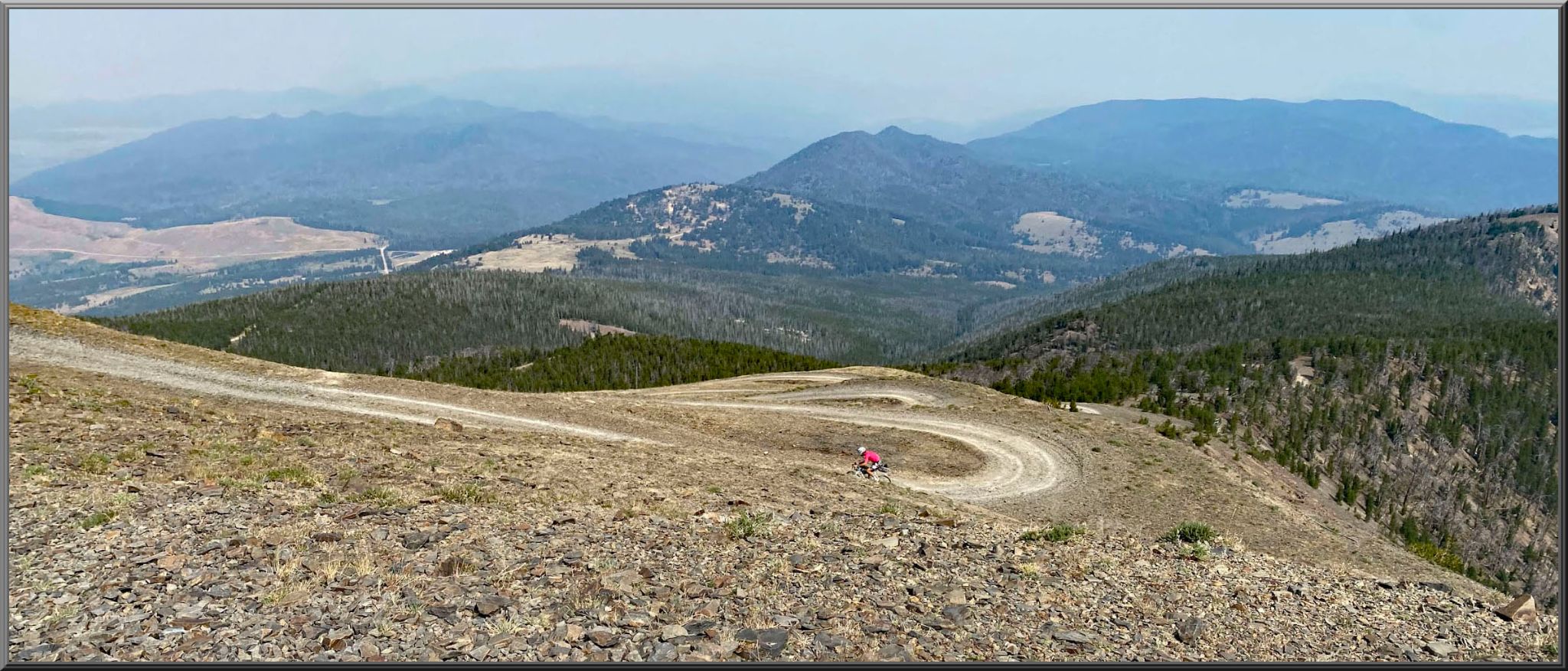
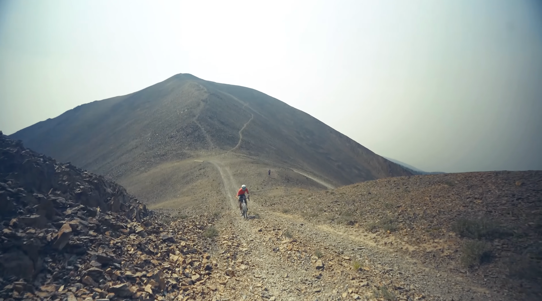
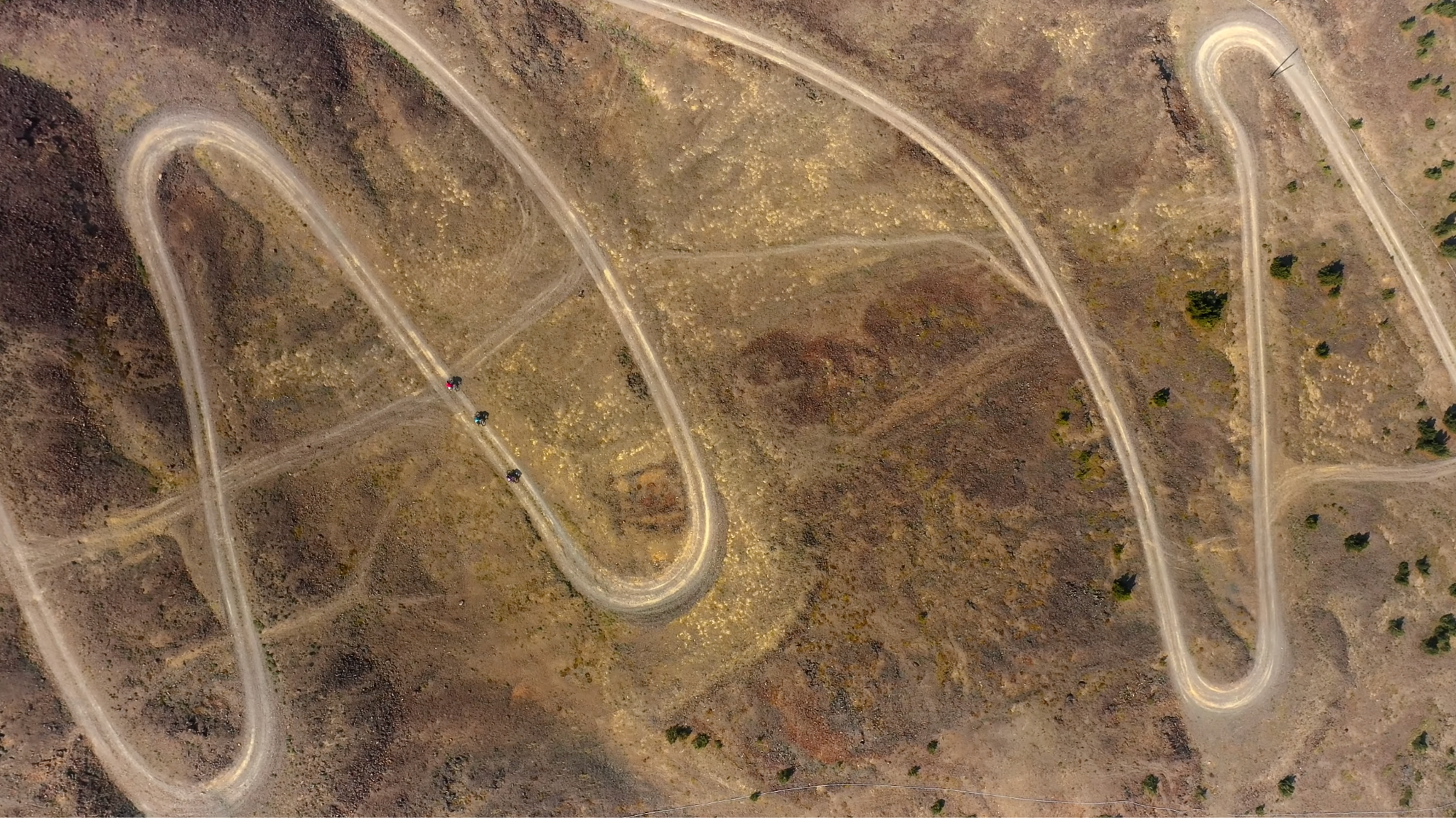
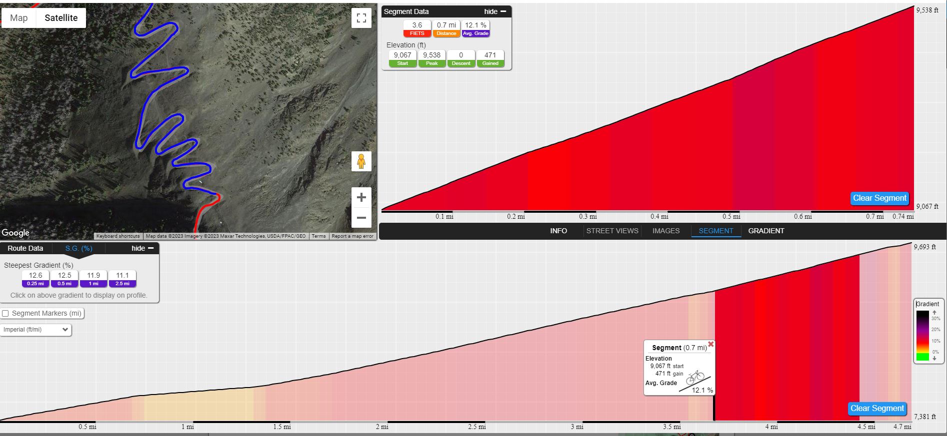
The long segment from the valley floor starts out as class 2/3 gravel, but the upper 2 miles (3 km) have some very rough class 4/5 stretches, and 50c tires are advised. The climb ends with 12 hairpins in about 0.7 mile averaging roughly 12%, all above treeline at over 9,000 ft, with the road laid out below you and the Rocky Mountains stretching away.
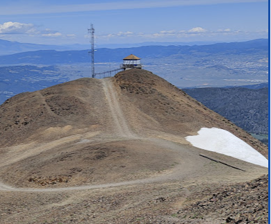
The finish is the Highland Lookout Tower, an L-4 cab built in 1954 to replace a 1933 groundhouse, with a monument beside it honoring Boy Scouts from Butte struck by lightning on the peak in 1922. The vista from the tower is worth it. The road is not plowed, so plan the ride for summer or early fall.
PLAN YOUR ROUTE
 We've partnered with Sherpa-Map.com to bring you the best route planning tool. With a PRO Membership you can use this climb as a reference when creating your route.
Red Mountain Lookout Tower averages 6.8% over 10.2 miles (16.4 km), gaining 3,625 ft (1,105 m).
The steepest 100 yards (91 m) reach 16.5%, the steepest quarter mile 14.3%, the steepest half mile 12.3% and the steepest mile 11.8%. The steepest 5 miles (8.0 km) still averages 8.9%.
The signature stretch is the string of 12 hairpins near the top, about 0.7 mile (1.1 km) at roughly 12%.
Roadway: Unpaved the entire way. It is a jeep road that starts as relatively smooth class 2/3 gravel and turns into rough, rocky 4x4 track in the upper 2 miles (3 km), with flat shale rock along the final stretch hugging the mountain's flank. A few short sections may require dismounting. The road is not plowed and is generally snowbound from about October to June, so confirm current conditions with the Beaverhead-Deerlodge National Forest before riding.
Traffic: Light. This is a remote, rough road that needs a high-clearance 4x4 to drive, so you will rarely share it with more than a handful of other users.
Parking: Parking is informal. Pull completely off the National Forest road near the start and keep gates and the track clear, since winter gates on the access road can close with snow.
Gear: Gravel bike with low gears and 45c+ tires, with 50c advised for the rough upper 2 miles (3 km). The finish is at 9,696 ft (2,955 m), well above treeline, where weather changes quickly, so carry layers.
Provisions: This is a self-supported ride with no services along the way. Carry all the water and food you need, plus a spare tube and pump.
Before heading out on any cycling adventure check out our Things to Bring on a Cycling Trip and use our interactive check list to ensure you don't forget anything.
Fly into Bozeman or Helena for a 1:40 drive to the start of this climb. Butte, the historic mining city to the north, is the nearest town for lodging and supplies.
For a look at your objective before you ride, the short Continental Divide Trail Viewpoint trail near Balance faces south toward the Highland Mountains, and Red Mountain is visible from it in good weather. Table Mountain, the high point of Silver Bow County, rises nearby. Check current conditions before you go with our Weather tool.
ROUTE MAP

MEMBER RATING
CURRENT WEATHER
PJAMM TRIPS ADVENTURE STARTER BUNDLES
Check out PJAMM Adventure's prepackaged (self-guided) cycling trips. They will help you plan, document and conquer your next adventure.
NEARBY CLIMBS (0) RADIAL PROXIMITY
FROM No Climbs Found
MEMBER REVIEWS & COMMENTS
Let us know what you thought of this climb. Signup for our FREE membership to write a review or post a comment.
Already have an account?
LOG IN HERE