
17.3
PDI
12.8 mi
DISTANCE
3,420 ft
GAINED
4.9 %
AVG. GRADE
FULL CLIMB STATS
INTRO
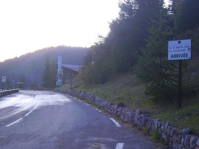
This is the long way to La Colmiane, and the way the 2024 Tour de France came. On the penultimate stage from Nice to the Col de la Couillole, the race dropped off the Col de Turini into the Vésubie, rode up this valley and climbed to the col from Saint-Martin-Vésubie, with Richard Carapaz first over the top on a day Tadej Pogačar won at the Couillole.
Our route runs 20.5 km (12.8 mi) from the Turini junction on the valley floor and gains 1042 m (3420 ft) at a 4.9% average, but the number blends two different rides. The first 13 km follow the Vésubie upstream at 2-6%, a long drag that wears your legs down more than it looks, past Roquebillière to Saint-Martin-Vésubie at around 960 m. The col itself, known on maps as the Col Saint-Martin, starts at the edge of town: about 7.5 km at 7%, steady and regular on a wide road, with the steepest kilometer at 10.2% and a couple of short tunnels near the top.
The Vésubie was one of the valleys worst hit by Storm Alex in October 2020, and the damage is still easy to see from the saddle, above all around Saint-Martin. The road is fully open again, and a coffee in the valley villages goes straight to the people who rebuilt them.
PLAN YOUR ROUTE
 We've partnered with Sherpa-Map.com to bring you the best route planning tool. With a PRO Membership you can use this climb as a reference when creating your route.
The first 13 km, up the valley to Saint-Martin-Vésubie, are mostly 2-4% with a few harder kilometers at 5-6% (km 5 and km 7 to 9). It's never steep, but it's relentless, and a headwind up the valley makes it feel like real climbing.
The col proper begins at Saint-Martin-Vésubie, around km 13. From there the road holds 7-9% for most of the way: 7.2% and 7.3% for the first two kilometers out of town, 9.0% and 7.9% next, then 6.3%, 8.3%, an easier 3.4% and a final 7.3% into La Colmiane.
Steepest sections on our profile: 1 km at 10.2%, 2 km at 9.3% and 5 km at 8.0%. Overall: 20.5 km (12.8 mi) at 4.9%, from about 507 m to roughly 1514 m on our profile.
Roadway: Paved throughout on the M2565, a wide two-lane road with a regular gradient. The valley road was badly damaged by Storm Alex in October 2020 and has been rebuilt, so expect long stretches of new surface and the odd repair site, especially around Saint-Martin-Vésubie. A couple of short tunnels near the top mark the end of the hard part. La Colmiane is a ski station, so snow and ice are possible from late autumn to spring.
Traffic: Busy by mountain standards, particularly in summer. This is the main road of the Vésubie and, above Saint-Martin, the link to the Tinée valley and a Route des Grandes Alpes cycling variant, so expect a steady flow of cars, motorcyclists and other riders on the climb itself. Early mornings are noticeably calmer.
Parking: For the full climb, look for roadside space near the M70 junction at the start, or park in Roquebillière, a few kilometers up the valley, and pick up the route there. To ride only the col, park in Saint-Martin-Vésubie, which has public parking around the village. There's also parking at the La Colmiane ski station at the top.
Gear: Gearing you'd use on a steady 7% climb is plenty here; nothing on the col asks for the bail-out gears. The bigger factor is the valley wind and heat on the long approach - in summer, start early.
Provisions: This is the best-supplied climb in the area. Roquebillière, early in the climb, and Saint-Martin-Vésubie, at the foot of the col, both have cafes and shops, so you can refill before the last 7.5 km. The ski station at La Colmiane has places to eat and public toilets in season.
Before heading out on any cycling adventure check out our Things to Bring on a Cycling Trip and use our interactive check list to ensure you don't forget anything.
Roquebillière is worth a stop on the way up. The village has been rebuilt more than six times after floods, earthquakes and landslides - the last move came after a deadly landslide in 1926 - and today sits on the right bank of the Vésubie. Down in the riverbed, the church of Saint-Michel-du-Gast is one of the few late-Gothic buildings in the Alpes-Maritimes, and an old arched bridge crosses the river nearby.
Saint-Martin-Vésubie, the old mountain town at the foot of the col, is covered on our Col Madone de Fenestre page, and the Boréon valley above it on our Col de Salèse page. For the far side of the col, the Valdeblore villages and La Colmiane's via ferrata and zipline, see our Col Saint-Martin (Rimplas) page. The 2024 Tour crossed the Turini from Sospel and came down to La Bollène before this climb. From here you can ride a shorter version: Col de Turini from La Bollène, which starts at the same junction, back down into the Vésubie, then up to La Colmiane - two big climbs back to back.
ROUTE MAP

MEMBER RATING
CURRENT WEATHER
PJAMM TRIPS ADVENTURE STARTER BUNDLES
Check out PJAMM Adventure's prepackaged (self-guided) cycling trips. They will help you plan, document and conquer your next adventure.
NEARBY CLIMBS (0) RADIAL PROXIMITY
FROM No Climbs Found
MEMBER REVIEWS & COMMENTS
Let us know what you thought of this climb. Signup for our FREE membership to write a review or post a comment.
Already have an account?
LOG IN HERE
