13.6
PDI
10 mi
DISTANCE
2,687 ft
GAINED
5.1 %
AVG. GRADE
FULL CLIMB STATS
Page Contributor(s): Bruce Hamilton and Stacy Topping, USA
INTRO
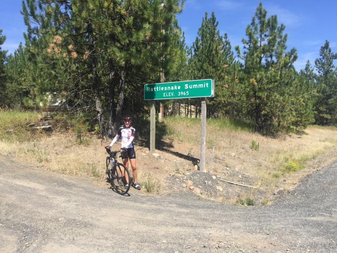
This is a remote but fun climb in southeastern Washington that begins at Boggan's Oasis at the bridge over the Grande Ronde River. This climb has many bends and turns and some valid hairpins (arguably 22) and is a very fun descent.
Input from our friend Bruce Hamilton: "We jumped in the river after the ride as it was really hot there in August. It’s a pretty ride with no traffic – very remote. No trees – just the prairie or the Palouse as it’s known in SE Washington. There is another climb up from the river on the Oregon side and we did them both in the same day."
PLAN YOUR ROUTE
 We've partnered with Sherpa-Map.com to bring you the best route planning tool. With a PRO Membership you can use this climb as a reference when creating your route.
 Average grade is 5.1%. 41% of the climb is at 0-5% average grade and 55% is at 5-10%. The steepest quarter-mile is 7.4%.
See more details and tools regarding this climb's grade via the “Profile Tool” button.
Roadway: This is a two lane state highway in good condition with no to narrow shoulder.
Traffic: Mild.
Parking: At Boggan's Oasis at the start of the climb (Map; Street View).
Provisions: Boggan's Oasis drive-in at the start of the climb has good ratings - Google Map + Reviews.
Before heading out on any cycling adventure check out our Things to Bring on a Cycling Trip and use our interactive check list to ensure you don't forget anything.
If you are coming this far for this climb, be sure to add Highway 129 & 3 South as an out and back with Rattlesnake Summit - 50 miles with 6,000' of climbing (Map).
ROUTE MAP

MEMBER RATING
CURRENT WEATHER
PJAMM TRIPS ADVENTURE STARTER BUNDLES
Check out PJAMM Adventure's prepackaged (self-guided) cycling trips. They will help you plan, document and conquer your next adventure.
NEARBY CLIMBS (0) RADIAL PROXIMITY
FROM No Climbs Found
MEMBER REVIEWS & COMMENTS
Let us know what you thought of this climb. Signup for our FREE membership to write a review or post a comment.
Already have an account?
LOG IN HERE

