18.3
PDI
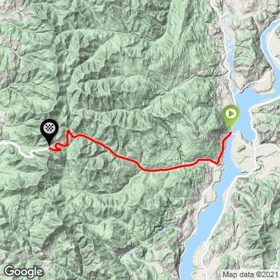
22.5 mi
DISTANCE
4,363 ft
GAINED
3.5 %
AVG. GRADE
FULL CLIMB STATS
INTRO
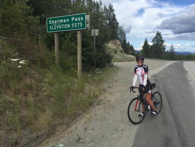
"Sherman Pass is a big climb in central Washington to altitude. The highest year round pass in the state, the climb of its east side is a long one but there is a shoulder on the road for riding. never steep, the first 9 miles are over quite shallow grade and through thick woods. Beyond that section the grade increases a bit and the hill takes on a more alpine feel. Soon the trees indicate altitude and the climb ends at the signed summit between big rock walls created when the road grade was blasted from the mountain. The west side of Sherman is also a solid climb (13.9 miles at 4.3% grade)." (This quote is presented with the approval of John Summerson, from his book, The Complete Guide to Climbing (by Bike), 2nd Edition, pg. 228.)
PLAN YOUR ROUTE
Eliminating descent from the gradient equation raises the average grade from 3.6% to 4.2%. 59% (13.3 miles) is at 5-10%, and 29% (6.6 miles) is at 5-10%. The steepest quarter-mile is 8% and the steepest mile is 6.9%.
Consult the PJAMM "Full Forecast" feature for the time you expect to arrive at the finish to assess what clothing to bring on your ride.
Roadway: This is a two lane highway in good condition with modest to descent shoulder throughout.
Traffic: Mild.
Parking: On the side of the road at climb start or at the fast food parking lot just beyond (Map; Street View).
Provisions: None on the route, but there is a restaurant at Barney's Junction at the start of the climb.
Before heading out on any cycling adventure check out our Things to Bring on a Cycling Trip and use our interactive check list to ensure you don't forget anything.
Consider doing this climb as an out and back with Sherman Pass WA West - (Map).
ROUTE MAP
MEMBER RATING
CURRENT WEATHER
PJAMM TRIPS ADVENTURE STARTER BUNDLES
Check out PJAMM Adventure's prepackaged (self-guided) cycling trips. They will help you plan, document and conquer your next adventure.
NEARBY CLIMBS (0) RADIAL PROXIMITY
FROM No Climbs Found
MEMBER REVIEWS & COMMENTS
Let us know what you thought of this climb. Signup for our FREE membership to write a review or post a comment.
Already have an account?
LOG IN HERE