Cycling Mt. St. Helena
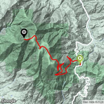
Ride 5.4 miles gaining 2,130’ at 7.3% average grade.
![]()
![]()
Turn left onto the firetrail at mile
The climb begins at the yellow gate just down hill (north) from the parking lot at Robert Louis Stevenson State Park Trailhead which is at the very peak of Hwy 29 between Calistoga and Middletown.
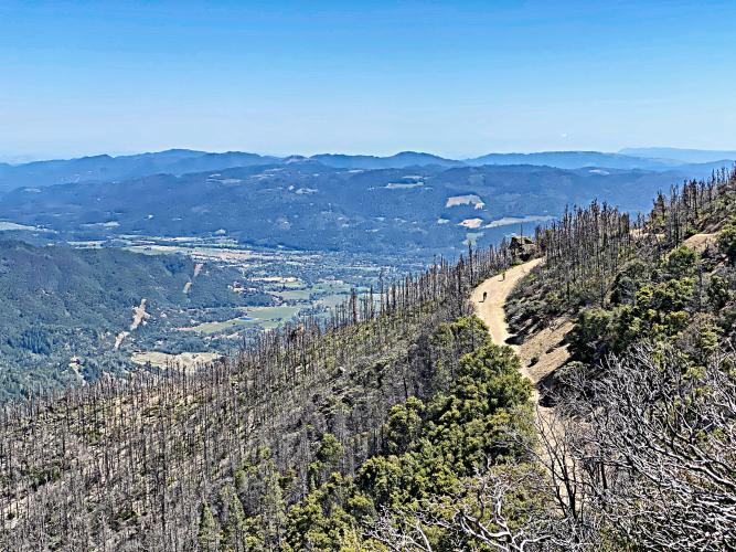
The entire climb is on a moderately maintained fire road consisting of dirt and gravel, which is easily manageable for the first couple of miles on a gravel (or even road bike, for that matter) but becomes steeper and softer/looser as you climb, being particularly difficult over a 0.2 mile 13.9% stretch just before the summit. We have used anywhere from 28mm tires, 30t cassette with compact crankset (at a fit and youthful age 55), to 33mm knobbies with 34t chainring and 42t cassette (at an aged 62). The final 50 meters of the climb is so steep it is nearly impossible to ride.

Climbing wall at Mile 1.7, 3.5 miles from the top.

Hairpins three miles from the summit.
![]()
![]()

A very tiny cyclist on his way up the final stretch . . . 👍😅

Better done on 45mm than the 33mm used on this day.
![]()
At the top.

The tiny guy made it!
View from drone looking north from the summit towards Lake County.

Aerial Drone Sphere photo of Mt. St. Helena -- easterly view.
![]()
Aerial drone panorama -- view south towards Mt. Tamalpais and San Francisco from Mt. St. Helena Summit.
A Bit About the Mountain:
Mt. St. Helena was formerly known as Mount Mayacamas, as it is part of Sonoma/Napa/Lake Counties’ Mayacamas mountain range. The mountain became known as Mt. St. Helena in 1841 after Russian surveyors left a copper plate on its summit, inscribed with the date of their visit and the name of Princess Helena de Gagarin (wife of Alexander G. Rotchev, officer of Fort Ross). The mountain has flanks in each of Sonoma, Napa, and Lake counties. On a clear day, Mt. Tamalpais, Mt. Diablo, and even Mt. Lassen can be seen from Mt. St. Helena’s summit (Summit Post). Of its five peaks, the North peak is the highest, and is also highest point in Sonoma County. Read more about Mt. St. Helena here.
![]()
PJAMM’s New Year’s Day Challenge . . .
Mounts St. Helena, Tamalpais and Diablo in a day . . .
Sunrise Mt. St. Helena - snow on the mountain that a.m.
Of historic note, author Robert Lewis Stevenson honeymooned with his wife Fanny Vandegrift on Mt. St. Helena in 1880. Staying in the remains of the three-story bunkhouse at what had been the Silverado mine (a site for mining gold and silver), they spent the summer along the mountainside. From this experience, Stevenson wrote his book The Silverado Squatters, published in 1883. Covering the area where Stevenson and Vandegrift stayed during this summer, the Robert Lewis Stevenson State Park is a popular site for locals and tourists alike.

Geodetic Survey Marker at the very top.
As early as 1878, surveyors were able to see light from Mt. Shasta’s Geodetic Monument 192 miles away at this point (Article).
MT. ST. HELENA FROM A DISTANCE
![]()
As seen from Photos from Coleman Valley Road, Occidental (top left); Diamond Road, Calistoga (top center);
Chileno Valley Road, Petaluma (top right); Alexander Valley, Healdsburg (bottom right)
Bald Mountain, Kenwood (center); Lichau Road, Rohnert Park (bottom center);
Eastside Road, Healsburgh (bottom left).
![]()
Kortum Canyon, Calistoga (top right); Hwy 29, Calistoga (top center);
Hwy 29, Oakville (top right); Pine Flat Rd, Healdsburg (center);
Ida Clayton Rd (bottom center); Mt. Vision, Inverness (bottom left);
![]()
Photos clockwise from top left:
Sonoma Mountain Rd West; Skaggs Road, Healdsburg; River Road, Santa Rosa;
Hwy 29, Rutherford; Sky Farm, Santa Rosa; Ridgecrest Dr., Marin Co.;
Sonoma Mountain Rd. East, Glen Ellen; Spring Mountain Rd, St. Helena;

This is a special place.