![]()
Cycling Emigrant Pass West
Ride 15.8 miles gaining 4,141’ to elevation 5,413, at 4.9% average grade.
Photo: Aerial view of miles 5-9, the road curves from middle left to bottom middle of photo.
![]()
Climb begins on Wildrose Road (closed to autos).
This climb overlaps the first 9.7 miles of the Wildrose Road/Charcoal Kiln climb. At mile 9.7 turn left onto Emigrant Canyon Road, then travel roughly another six miles to the high point of the climb, then another mile to the pass sign. This is a very remote climb without any provisions, so plan accordingly. The Wildrose Road stretch of the climb is along a road in general disrepair while the last six miles on Emigrant Pass are along a roadway that is in very good shape.
![Cycling Wildrose Road - Death Valley]()
Cycling Death Valley’s Emigrant Pass West, one of the most remote US Top 100 Bike Climb.
![]()
![IMG_1556.JPG]()
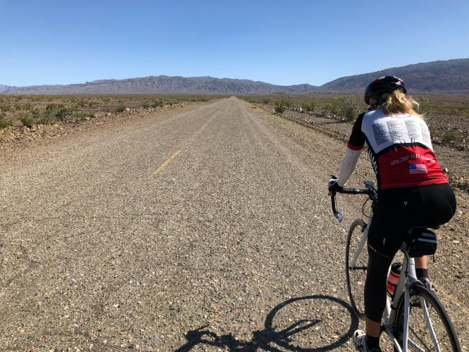
There are not many view obstructions in Death Valley.
View on the beginning leg of the climb.
![]()
First segment (Wildrose Road to junction with Emigrant Canyon Road).
9.4 miles at 5.4%.
![]()
![Emigrant Pass, Death Valley National Park]()
Segment two of two (junction to the top) is six miles at 4.5% average grade.
![Emigrant Pass, Death Valley National Park]()
Narrow canyon for nearly a mile after turning onto Emigrant Canyon Road.
![]()
Steep and narrow canyon for close to a mile after the junction.
![]()
A half mile of 1-4% after coming out of the canyon.
![Emigrant Pass, Death Valley National Park]()
1.5 miles to the pass from the left loop middle bottom third of photo.
![Emigrant Pass, Death Valley National Park Cycling Emigrant Pass, Death Valley National Park - 2 cyclists with bikes next to summit sign]()
Thank you Bruce and Stacy.
![Emigrant Pass, Death Valley National Park]()
Pass sign gone as of October 2019.
DEATH VALLEY WEATHER
![]()
National Park Service Death Valley Weather Chart.
As you may expect, Death Valley is dangerously hot during the day from June through September with average monthly highs during that time ranging from 106° to 116.5°. Cycling is not recommended during the summer and certainly never without good SAG support. The heat can be stifling (if not truly dangerous) and supplies are few and far between.
The hottest temperature ever recorded on earth was in Furnace Creek on July 10, 1913 (134℉/56.7℃) and, while that record has been challenged, the “alternate” record is also held by Death Valley (2013 in a tie with Mitribah, Kuwait in 2016 at 129.2℉/54.0℃).
![]()
July 2017 -- Badwater to Mt. Whitney Summit.
![Cycling Death Valley - Cycling Death Valley - pjamm cycling ride bikes through death valley]()
OK! I didn’t take my own advice in July, 2017. 😨

 We've partnered with Sherpa-Map.com to bring you the best route planning tool. With a PRO Membership you can use this climb as a reference when creating your route.

