
32.6
PDI
16.3 mi
DISTANCE
5,024 ft
GAINED
5.6 %
AVG. GRADE
FULL CLIMB STATS
Page Contributor(s): Alan Adams, Bozeman, MT;
INTRO
Mt. Lemmon (gravel) climbs the historic Control Road (Forest Road 38) up the northeast shoulder of the Santa Catalina Mountains north of Tucson, AZ - the original 1920 route to the summit, decades before the paved Catalina Highway existed. From a start near Oracle at about 4,371 feet, the climb runs 15.13 miles and gains over 5k feet to roughly 9,107 feet near Summerhaven, averaging 5.94%.
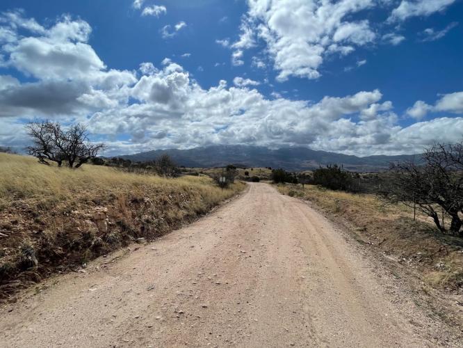
The paved highway climbs the range's southwest face in a run of switchbacks; Control Road takes the quieter northeast side instead - a wide, mostly smooth dirt-and-gravel road through old mining and ranching country, with views east across grassy, oak-studded foothills toward the San Pedro Valley. Riders pass through several ecosystems on the way up, from desert scrub near the start to juniper woodland and ponderosa pine forest near the top.
The name dates to when this was the only way up the mountain: the narrow upper section was so tight that opposing traffic couldn't pass, so travel direction was controlled and alternated - hence "Control Road." It's still unpaved and rougher than the highway, but remains popular with cyclists and sightseers trading pavement for solitude.
The Forest Service gates the road to cars seasonally each year from December 15 through February 28, and a late-2025 project began hardening about 6.5 miles of the upper road near the Mt. Lemmon Fire Station - worth checking current conditions before a ride.
PLAN YOUR ROUTE
 We've partnered with Sherpa-Map.com to bring you the best route planning tool. With a PRO Membership you can use this climb as a reference when creating your route.
 Mt. Lemmon (gravel) averages 5.94% over its 15.13 miles, climbing steadily from about 4,371 feet to a peak near 9,107 feet - a gain of over 5,000ft, one of the larger elevation gains of any PJAMM-ranked gravel climb. The grade doesn't have the long, sustained steady pitches found on the paved side of the mountain; instead it's a long, grinding, unpredictable dirt ascent, with effort shaped as much by the unpaved surface as by the gradient itself - conditions vary from smooth hardpack to loose, rutted, and rocky sections as you climb.
The steepest quarter-mile comes in at 12.49%, and the single steepest 100-yard stretch hits 14.06%, so there are still a few punchy pitches mixed into the otherwise steady grade. Because it's gravel, effort and speed depend as much on surface condition after recent rain or grading work as on the numbers alone - budget more time and energy than the grade would suggest for a paved climb of similar length and elevation gain.
Roadway: The climb follows Forest Road 38, the historic Control Road - a wide, mostly maintained dirt-and-gravel road for much of its length, though sections get narrower, rockier, and rutted higher up. Surface condition can change noticeably after rain or forest service grading, so check current conditions before heading out; the Santa Catalina Ranger District (520-749-8700) is the best source for up-to-date road status.
Traffic: Traffic is light. Control Road is mostly used by forest visitors, high-clearance/4WD sightseers, and the occasional cyclist rather than through-commuters, since the paved Catalina Highway carries the bulk of traffic to the summit. Expect the occasional slow-moving vehicle rather than steady car traffic.
Parking: Roadside pullouts are available near the Coronado National Forest boundary south of Oracle, and there's small trailhead parking near American Flag Ranch a few miles up Mount Lemmon Road from town. The Forest Service closes Control Road with a seasonal gate each year from December 15 to February 28 (36 CFR § 261.13), so it isn't accessible from the north end during that window.
There is no water, food, or services anywhere along Control Road itself - carry everything you'll need for the full climb, plus extra if you're riding an out-and-back. A gravel or adventure bike with at least 35-40mm tires is recommended; a road bike isn't well suited to the loose and rutted sections higher up.
The USDA Forest Service confirms no potable water or restrooms are available at this site. Once you reach the top near Summerhaven, the Cookie Cabin and a handful of small shops offer food and drinks if you continue into the village - a welcome reward after a long dirt climb. Cell service is unreliable to nonexistent for long stretches of the road, so carry a paper map or offline GPS track and let someone know your plan.
Before heading out on any cycling adventure check out our Things to Bring on a Cycling Trip and use our interactive check list to ensure you don't forget anything.
Control Road is best ridden in cooler months - spring and fall offer the most comfortable temperatures, since the lower elevations near Oracle get brutally hot in summer and the upper road can hold snow and ice in winter. The Forest Service gates the road seasonally from December 15 through February 28 each year, so confirm it's open before planning a trip in that window.
Oracle, AZ is the closest town for gas, food, and basic supplies before starting the climb; Tucson, about 40 minutes south, has full services and is the nearest airport. If you'd rather ride point-to-point, Control Road tops out near Summerhaven, from which the paved Catalina Highway offers a smooth, fast way back down to Tucson - a popular way to turn this into a one-way gravel adventure. For current road status, call the Santa Catalina Ranger District at (520) 749-8700.
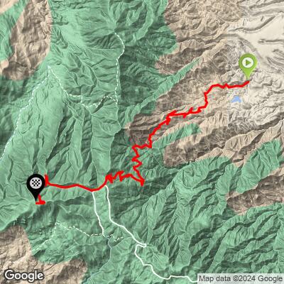
ROUTE MAP
MEMBER RATING
CURRENT WEATHER
PJAMM TRIPS ADVENTURE STARTER BUNDLES
Check out PJAMM Adventure's prepackaged (self-guided) cycling trips. They will help you plan, document and conquer your next adventure.
NEARBY CLIMBS (0) RADIAL PROXIMITY
FROM No Climbs Found
MEMBER REVIEWS & COMMENTS
Let us know what you thought of this climb. Signup for our FREE membership to write a review or post a comment.
Already have an account?
LOG IN HERE
