![]()
Cycling Tumala Mountain
Ride 15.8 miles gaining 4,431’ at 4.8% average grade (6.7% climb only)
Tumala Mountain is a Top 100 US gravel climb located in Mt. Hood National Forest in northeastern Oregon.
![]()
Climb summary by PJAMM’s Brad Butterfield -
The climb route begins perpendicular to highway 224 and is less than an hour's drive from Portland. A series of paved switchbacks start the climb off with a bang. Once the pavement ends, the climb enters a dense forest and direct light is tough to come by. Temperatures dropped into the 40’s -still 3k feet of climbing from the summit- when PJAMM rode the climb in mid-June, 2024. About 5 miles in, there is a large staging area for OHV’s. OHV’s completely dominate this area. I was passed by at least 15 trucks towing OHV’s in the first few miles alone. In total, I was passed by over 30 OHV’s during the 16 mile climb. The road is hard packed dirt/gravel with the occasional crater sized pothole to watch out for. The last mile, the road narrows and it is extremely rocky, but doable on a gravel bike. At the summit, there is a cell tower. A short trail (.1 mile) can be hiked for an awesome viewpoint of the surrounding mountains.
![]()
Climb begins at the intersection of Hwy 224 and NF Road 4610 (North Fork Road)
The start of the climb is just across Hwy 224 from the Clackamas River and Promontory Marina which has a small door and picnic grounds and grills.
![]()
The first ½ mile of the climb is paved.
![]()
Surface conditions along the first half of the climb.
![]()
Surface conditions along the second half of the climb.
![]()
The ride quickly turns to gravel.
![]()
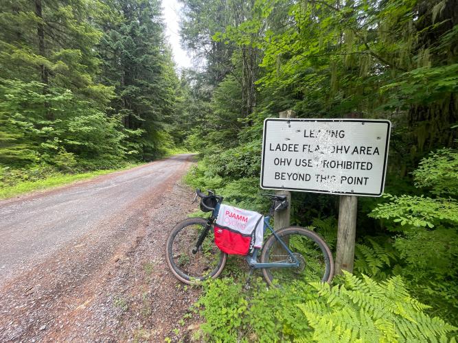
Enter the Off Highway Vehicle (OHV) area at mile 2.7 and leave at mile 10.8
Mount Hood National Forest was first established as Bull Run Forest Reserve in 1892 and later merged with Cascade National Forest in 1908 to become Mt. Hood National Forest. The forest consists of 1,071,466 acres and has over 4,000,000 visitor per year. La Dee OHV area includes 35 miles of designated off-road trails, including roughly 8 along our climb route.
![]()
Pass over the bridge at Boyer Creek at mile 7.9 at the bottom of a .8 mile 5.5% descent.
![]()
The climb finishes after a punishing final mile at what appears to be a repurposed military structure that my be a radio repeater station. Hike a short distance for some great views of the surrounding dense forests of the Clackamas Foothills of the Cascade Range.

 We've partnered with Sherpa-Map.com to bring you the best route planning tool. With a PRO Membership you can use this climb as a reference when creating your route.

