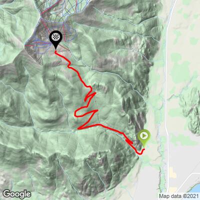
13.8
PDI
8.6 mi
DISTANCE
2,544 ft
GAINED
5.6 %
AVG. GRADE
FULL CLIMB STATS
Page Contributor(s): Bruce Hamilton, La Quinta, CA, USA; Stacy Topping, Tacoma, WA, USA; Ken Read, CAN.
INTRO
"A magnificent hill climb, Schweitzer Mountain Rd begins within the trees and ends at altitude with views in places. Solid grade from the start, the road contains several big switchbacks over its bottom portion. You will climb along a mostly steady grade and through thick trees over the lower portion...find decreased grade across a ridgeline. Soon the grade increases again as the road eventually bears left to approach mountain homes and excellent views down into the valley. At mile 8.0 turn left on Mogul Hill Road to continue to climb over double digit grade...Shortly the grade becomes more moderate but a right hand switchback changes that although not for long. A left hander follows and then you bear right into "The Spires'..." (Quote presented with John Summerson's approval from The Complete Guide to Climbing (by Bike), 2nd Ed, p 184.)
PLAN YOUR ROUTE
5.5% average grade. 38% of the climb is at 0-5% average grade and 58% is at 5-10%. The steepest quarter-mile is 9%.
See more details and tools regarding this climb's grade via the “Profile Tool” button.
Roadway: Two lane road in good condition with no center striping and no shoulder.
Traffic: Mild.
Parking: Park in the chain up area on the left on Schweitzer Mountain Road just before the climb starts (Map; Street View).
Provisions: There are plenty of spots to get food and beverages within a few miles of the climb in Sand Point.
Before heading out on any cycling adventure check out our Things to Bring on a Cycling Trip and use our interactive check list to ensure you don't forget anything.
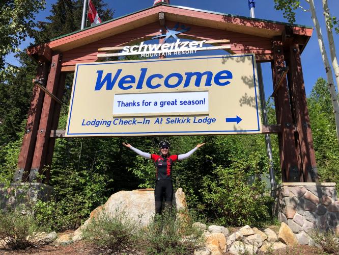
The climb ends at Schweitzer Mountain Resort which is open during the summer for mountain biking (Schweitzer Mountain Resort Summer). The Sandpoint area is fun in the summer - Lake Pend Oreille is the largest lake in Idaho (#38 US) and is quite beautiful. Sandpoint is an artsy town with a rural feel that is well worth visiting and staying in - as you drive around town it will feel as if you passed through another dimension into the 1960s.
ROUTE MAP
MEMBER RATING
CURRENT WEATHER
PJAMM TRIPS ADVENTURE STARTER BUNDLES
Check out PJAMM Adventure's prepackaged (self-guided) cycling trips. They will help you plan, document and conquer your next adventure.
NEARBY CLIMBS (0) RADIAL PROXIMITY
FROM No Climbs Found
MEMBER REVIEWS & COMMENTS
Let us know what you thought of this climb. Signup for our FREE membership to write a review or post a comment.
Already have an account?
LOG IN HERE
mikekeating
I used to live in Sandpoint. I had been a lifelong runner, college oarsman, and casual mountain biker. This is the climb that made me fall in love with both road cycling & climbing. I ascended this road 161 times from '09 to '18. I know every switchback, every crack in the asphalt, and where the moose and bear can typically be seen (between switchback 6 & 7). I wonder if anyone has climbed this road more than me. The cars are aware that this is a popular cycling climb, the views of the of the lake & town are stunning, and the road is climbable/snow-free for about six months of the year. PJamm only takes you to the ski village, but you can lengthen it out to about 10 miles on the road ... and that extra 1.5 miles gets steeper. I may be biased, but this is my favorite climb. It has all that you could want from a climb; long continuous steady grind, safe roads, breathtaking views most of the way & at the top, and a few places to refuel at the top!