O'Leary Mountain Bike Climb - PJAMM Cycling

32.2
PDI
6.8 mi
DISTANCE
3,704 ft
GAINED
10.4 %
AVG. GRADE

FULL CLIMB STATS

Page Contributor(s): Don Baty, Corvallis, OR

INTRO

This 6.8 mile bike climb is located in OR, USA. The average gradient is 10.4% and there is a total elevation gain of 3,704 ft, finishing at 5,015 ft.

Use the profile tool, route map, and weather forecast to conquer this cycling climb.

PLAN YOUR ROUTE

We've partnered with Sherpa-Map.com to bring you the best route planning tool. With a PRO Membership you can use this climb as a reference when creating your route.

See more details and tools regarding this climb's grade via our interactive Profile Tool.
Information Not Available

If you have any information regarding this climb, we'd like to hear from you. Click the CONTRIBUTE button to share your thoughts with us.

Information Not Available

If you have any information regarding this climb, we'd like to hear from you. Click the CONTRIBUTE button to share your thoughts with us.

Before heading out on any cycling adventure check out our Things to Bring on a Cycling Trip and use our interactive check list to ensure you don't forget anything.
Information Not Available

If you have any information regarding this climb, we'd like to hear from you. Click the CONTRIBUTE button to share your thoughts with us.

ROUTE MAP

MEMBER RATING

Not Yet Rated
-
Road
-
Traffic
-
Scenery

CURRENT WEATHER

PJAMM TRIPS ADVENTURE STARTER BUNDLES

Check out PJAMM Adventure's prepackaged (self-guided) cycling trips. They will help you plan, document and conquer your next adventure.
ALL TRIPS
Browse all of our prepackaged trips and find your next adventure!

NEARBY CLIMBS (0) RADIAL PROXIMITY

FROM
No Climbs Found

MEMBER REVIEWS & COMMENTS

Let us know what you thought of this climb. Signup for our FREE membership to write a review or post a comment.
Already have an account?
ROUTE MAP
PROFILE TOOL
Route Data
S.G. (%)
hide
Segment Data
hide
CLIMB SUMMARY

Cycling O’Leary Mountain

Ride 6.8 miles gaining 3,704’ at 104% average grade.

This is one of the steeper forest roads you will encounter.

This is a very challenging climb in Willamette National Forest on NF Road 1900-411 ending near O’Leary Mountain Trail.

The climb begins at Cougar Dam and Reservoir.

Turn left at the 519’ high, 1,600’ rockfill Cougar Dam to begin this very steep and challenging Top 100 US Gravel Climb.

View of the Dam looking back down the road .4 miles from the start.

Climb summary by PJAMM’s Brad Butterfield -

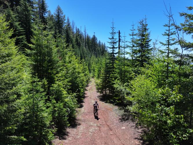
This climb begins at the foot of the massive Cougar Powerhouse and Fish Facility. There are a number of pull outs along the river, perpendicular to the start point of the climb, which serve as great parking areas if driving to the climb. The opening miles are marked by mellow gradients and dense forest. Then, with a little over three miles to go, the gradient pitches up - straight up. Gradients in this section of the climb ranged from 10% all the way up to 23% - according to my garmin. The gravel here is loose in some sections, making it extremely difficult to keep traction and keep pedaling - arrive at this climb with a low climbing gear, or you’ll be walking! About a half mile from the summit, the dirt road narrows and the forest looks to be taking back the former road. It is quite overgrown and doesn’t look to have been driven for some time, but it is all rideable with a gravel bike. Ride with care and enjoy!

Various surface conditions on the climb.

The road is in very good condition although a bit rough at the end.

The climb finishes on more a single track than road, but rideable on a gravel bike.