
39.8
PDI
20.1 mi
DISTANCE
6,347 ft
GAINED
6 %
AVG. GRADE
FULL CLIMB STATS
Page Contributor(s): Don Baty, Corvallis, OR; Sean, Lewiston, Idaho
INTRO
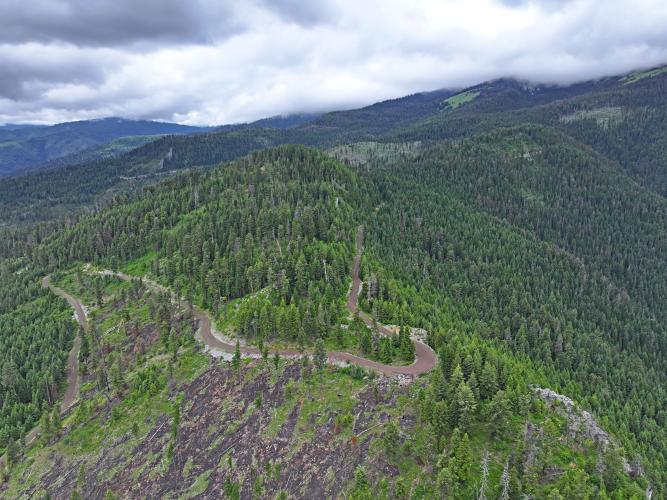
At 20.05 miles and 6,347 feet of gain, this is the longer of two PJAMM routes up to the Heavens Gate Overlook above Hells Canyon - PJAMM's separate "Heavens Gate" climb covers similar elevation gain in about 3 fewer miles via Seven Devils Road. PJAMM currently ranks this route the 12th-hardest gravel climb in the world.
PJAMM contributor Sean, who's ridden it, describes the surface as changing throughout the climb and "predominantly dirt and not as much gravel." Because the descent back down is long and technical, he recommends at least a 2-inch front tire if your bike doesn't have suspension.
Both routes finish at the same 8,429-foot overlook, the highest viewpoint on the Idaho side of Hells Canyon, with views into four states - Idaho, Oregon, Washington, and Montana - from the fire lookout tower at the top.
Like the standard Heavens Gate route, this climb sits at high elevation and holds snow late into the season. Sean advises not attempting it until toward the end of June, or you'll run into snow before reaching the top.
PLAN YOUR ROUTE
 We've partnered with Sherpa-Map.com to bring you the best route planning tool. With a PRO Membership you can use this climb as a reference when creating your route.
 This route averages a gentler grade - around 6% - than PJAMM's shorter Heavens Gate climb, despite gaining similar total elevation, because it's spread over roughly 3 additional miles. That makes it a steadier, more gradual grind overall on paper, though PJAMM contributor Sean notes the surface itself "changes throughout" and is predominantly dirt rather than gravel, which can make sections feel harder than the average grade alone would suggest - especially on the long final descent. PJAMM does not yet have a full mile-by-mile gradient breakdown for this specific route.
Roadway: Predominantly dirt rather than gravel for much of its length, according to PJAMM contributor Sean, with conditions that change throughout the climb. The long final descent toward Heavens Gate is rough enough that he recommends at least a 2-inch front tire if you're not running suspension.
Traffic: This is a remote forest road with light, seasonal traffic - mostly other recreational users headed to the Heavens Gate Overlook, Windy Saddle trailhead, or the Seven Devils backcountry.
Parking: There's a parking lot at the Heavens Gate summit for the short trail to the lookout tower. Lower down, park along the shoulder wherever the road is wide enough, since there's no dedicated trailhead lot partway up this particular route.
A gravel or adventure bike with wide tires - 2 inches or more up front is a good call, per contributor feedback - handles the mixed dirt-and-gravel surface and long descent better than a narrow-tire setup. Bring all your own food and water, since there are no services anywhere on the mountain, and don't attempt this climb before late June, when snow typically clears from the upper route.
Before heading out on any cycling adventure check out our Things to Bring on a Cycling Trip and use our interactive check list to ensure you don't forget anything.
Riggins, Idaho is the closest town with services - gas, food, and lodging - about 100 miles south of Lewiston on US-95. Combine this climb with a stop at Windy Saddle or the Seven Devils trail system while you're up there. Check current Nez Perce-Clearwater National Forest road conditions before heading out, since this route, like the standard Heavens Gate climb, is only reliably open from late June through October.
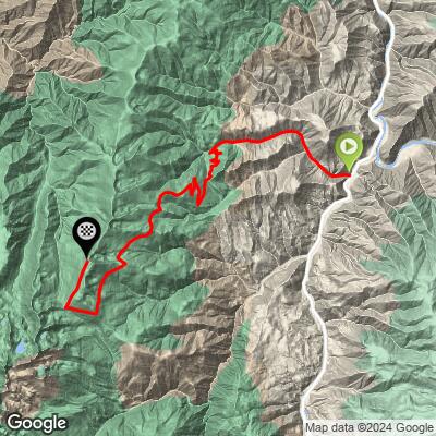
ROUTE MAP
MEMBER RATING
CURRENT WEATHER
PJAMM TRIPS ADVENTURE STARTER BUNDLES
Check out PJAMM Adventure's prepackaged (self-guided) cycling trips. They will help you plan, document and conquer your next adventure.
NEARBY CLIMBS (0) RADIAL PROXIMITY
FROM No Climbs Found
MEMBER REVIEWS & COMMENTS
Let us know what you thought of this climb. Signup for our FREE membership to write a review or post a comment.
Already have an account?
LOG IN HERE
