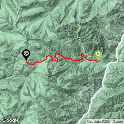
22.7
PDI
13.5 mi
DISTANCE
4,100 ft
GAINED
5.5 %
AVG. GRADE
FULL CLIMB STATS
INTRO
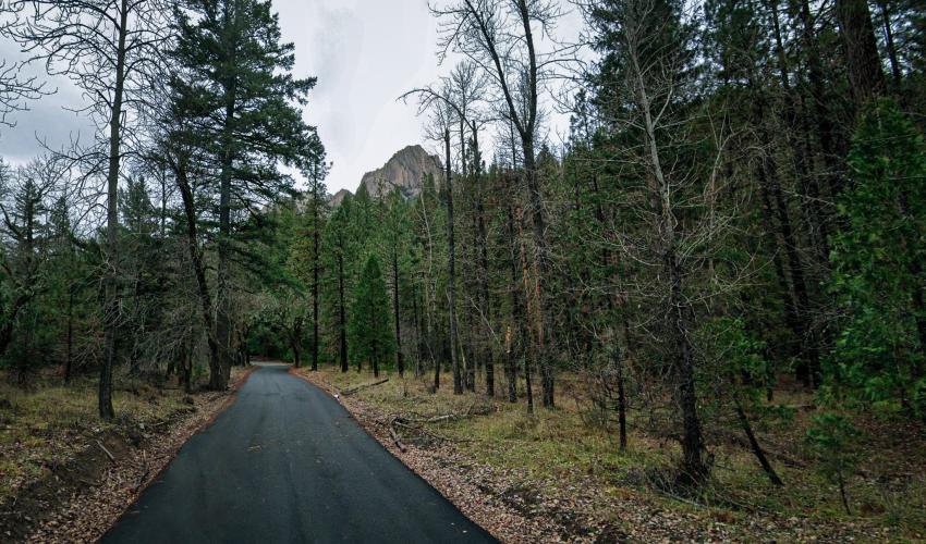
A peaceful but challenging climb out of Castle Crags State Park.
PLAN YOUR ROUTE
See more details and tools regarding this climb's grade via our interactive Profile Tool.
Information Not Available
If you have any information regarding this climb, we'd like to hear from you. Click the CONTRIBUTE button to share your thoughts with us.
Information Not Available
If you have any information regarding this climb, we'd like to hear from you. Click the CONTRIBUTE button to share your thoughts with us.
Before heading out on any cycling adventure check out our Things to Bring on a Cycling Trip and use our interactive check list to ensure you don't forget anything.
Information Not Available
If you have any information regarding this climb, we'd like to hear from you. Click the CONTRIBUTE button to share your thoughts with us.
ROUTE MAP
MEMBER RATING
CURRENT WEATHER
PJAMM TRIPS ADVENTURE STARTER BUNDLES
Check out PJAMM Adventure's prepackaged (self-guided) cycling trips. They will help you plan, document and conquer your next adventure.
NEARBY CLIMBS (0) RADIAL PROXIMITY
FROM No Climbs Found
MEMBER REVIEWS & COMMENTS
Let us know what you thought of this climb. Signup for our FREE membership to write a review or post a comment.
Already have an account?
LOG IN HERE
Skotscott
July 11, 2024
Parked inside the SP and started the ride. Road up is good and bad. Some very large potholes - clearly marked with white paint - rough pavement, and some short perfect areas. No issues climbing with slow speed but limiting on the descent. No traffic so no issues maneuvering all over the road for the best route. A sign at the bottom states "pavement ends 2.4 miles". This is not correct. The road is paved all the way. It does end at about mile 12 but pavement continues with a right turn, meandering for a bit, then up again to the "summit" - no signage - at mile 15.5, 4209ft gain
The climb is an easy spin at mostly less than 8%. 1 short steep section at 20% followed by a longer 1 mile section at 12 to 17%. There is a 1 mile dh just after the burn scar area, then you turn right to continue on the paved road.
A slow descent back to the SP.
There is a nice, stout, 1 mile climb 12 to 17% in the park up to Vista Viewpoint on a perfect road - hors d' oeuvre or dessert !