
23.1
PDI
6.2 mi
DISTANCE
2,947 ft
GAINED
8.9 %
AVG. GRADE
FULL CLIMB STATS
Page Contributor(s): Rashid Kohan, Pacifica, CA; Maya Wolf, Berkley, CA
INTRO
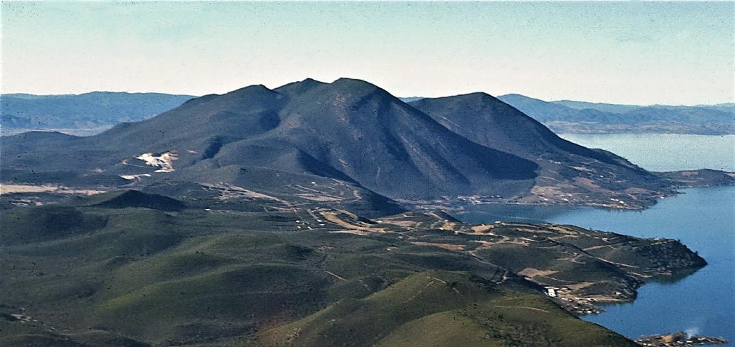
Konocti Road climbs 2,947 feet in 6.2 miles up Mount Konocti, a dormant volcanic complex that rises abruptly above the south shore of Clear Lake in Lake County, California. The gravel route starts in Kelseyville and runs the entire way up through Mount Konocti County Park to Wright Peak (4,299 feet), the mountain's highest summit, averaging close to 9% - one of the steeper sustained gravel climbs in the region.
Mount Konocti has been sacred ground to the Pomo people, who have lived around Clear Lake for more than 11,000 years - in the Pomo language, Konocti roughly translates to "Mountain Lady." The road itself is a wide fire road for its whole length, built to service a 1977 Cal Fire lookout tower that once was staffed year-round and today runs on a lighter, seasonal schedule. The views from the top - across Clear Lake, California's largest natural freshwater lake, and out over the surrounding wine country - are the payoff for the effort.
Mount Konocti County Park is open daily from dusk to dawn with no entrance fee or permit required. Vehicles are stopped by a gate at the park's main parking area a few miles up; from there, the road continues as a pedestrian route to the summit, though it remains a popular way for gravel riders to finish the climb - ride it with that in mind and be ready to yield to hikers.
PLAN YOUR ROUTE
 We've partnered with Sherpa-Map.com to bring you the best route planning tool. With a PRO Membership you can use this climb as a reference when creating your route.
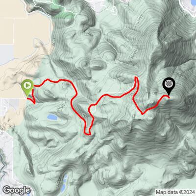
 Konocti Road gains about 2,950 feet over 6.2 miles for an average gradient close to 9%, making it noticeably steeper than most gravel climbs of similar length. The lower miles out of Kelseyville climb gradually on pavement before the surface turns to gravel and the grade steepens; riders have reported sustained pitches on the loose upper sections steep and loose enough to require walking on a loaded gravel bike. There's a brief, less-steep detour just past mile 3.3, near the Mt. Konocti hiking trails parking lot, before the final push to the Wright Peak lookout.
Roadway: Konocti Road is paved for its first short stretch out of Kelseyville, then turns to a wide fire road of loose gravel and hard-packed dirt for the remainder of the climb, aside from one brief paved bypass near a ranch. The surface is rideable on a gravel bike, but 40mm-plus tires are recommended - riders have reported steep, loose pitches on the upper mountain that are hard to keep traction on, and the long gravel descent isn't one to attempt on slicks.
Traffic: Traffic is minimal - the road serves the county park and a scattering of rural properties, and a gate near the main parking area (about 3 miles up) stops private vehicle traffic altogether, leaving the upper road to hikers, cyclists, and park staff.
Parking: Free parking is available at the Mount Konocti County Park lot roughly 3 miles up Konocti Road, or riders can start from the base in Kelseyville near the high school for the full climb. The park is open dusk to dawn daily with no fee or permit required.
A gravel bike with wide, knobby tires (40mm or wider) is the right setup here - the loose, steep sections on the upper mountain reward traction and low gearing over speed. Bring plenty of water; there's no reliable water source on the mountain itself, though restrooms are available at the county park parking area partway up. Kelseyville, at the base, has grocery stores, restaurants, and gas stations - the last services before you start climbing. Cell coverage becomes unreliable higher on the mountain.
Before heading out on any cycling adventure check out our Things to Bring on a Cycling Trip and use our interactive check list to ensure you don't forget anything.
Kelseyville and nearby Lakeport, on the shores of Clear Lake, make an easy base for a visit - Lake County wine country surrounds the area, and Clear Lake itself is popular for boating and fishing after a hot ride. The gate near the county park parking lot is marked for pedestrians only beyond that point, so treat the upper mountain accordingly and be ready to yield to hikers on what is a shared-use route, not a bike-specific one.
For riders looking to string together more climbs in the area, our Routes in the Area tool is a good way to see what else is nearby in Lake County.
ROUTE MAP
MEMBER RATING
CURRENT WEATHER
PJAMM TRIPS ADVENTURE STARTER BUNDLES
Check out PJAMM Adventure's prepackaged (self-guided) cycling trips. They will help you plan, document and conquer your next adventure.
NEARBY CLIMBS (0) RADIAL PROXIMITY
FROM No Climbs Found
MEMBER REVIEWS & COMMENTS
Let us know what you thought of this climb. Signup for our FREE membership to write a review or post a comment.
Already have an account?
LOG IN HERE
