![]()
Cycling Mt. Ashland via Wagner Creek Road
Ride 22.7 miles gaining 6,238’ at 4.7% average grade (6% climb only) to 7,532’
This is one of three gravel routes to Mt. Ashland Summit, the longest gravel climb in Oregon and one of the hardest gravel bike climbs in the US.
![]()
Climb summary by PJAMM’s Brad Butterfield -
The climb begins on a road lined with ranches/farms/and very nice houses. There are a few miles of pavement, then the road turns to gravel for the rest of the long climb. The toughest sections are in the first two thirds, with long stretches of double digit gradient. Additionally, the lower two thirds, unlike the 2080/Loop routes up Ashland, is loose gravel mixed with washboard surface. This makes it difficult, if not impossible, to stand up and climb without losing traction - making the climb that much more strenuous. When I rode the climb on June 4, 2024 it was 90 degrees at the bottom and in the mid 40’s at the summit. Plan for everything - there are no places to stop for water or refuel along the route. There is a significant downhill before the final summit push. Notably, there was snow and fallen trees covering many miles of the route between 6k and 7k feet on my ascent. The best time for doing this climb is July-October.
![]()
Climb begins by riding south on Wagner Creek Road just south of Anderson Creek Road.
This very difficult gravel bike climb begins about 7 miles northwest of Ashland on paved Wagner Creek Road.
![]()
The first 3.4 miles of the climb are paved.
![]()
The gravel begins at mile 3.4
![]()
Surface conditions along the climb.
The road surface is generally good throughout the gravel portion of the climb.
![]()
![]()
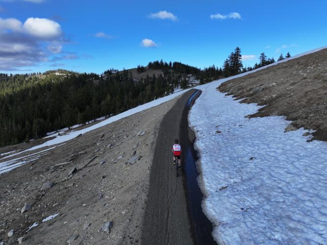
We encountered snow blocking portions of the roadway in early June, 2024.
![]()
Mile 15.6
![]()
View at mile 18.3 at Meridian Overlook
There is a clear and breathtaking view of Mt. Shasta (CA; 14,179’) 50 miles south and Grayback Mountain (OR; 7,048’) from Meridian Overlook
![]()
Unlike the other Mt. Ashland Summit gravel climbs, the Wagner Creek route does not go through the Mt. Ashland Ski Resort. However, all three routes overlap the final mile at a very challenging 10.3% average grade.
![Cycling Mt. Ashland, Oregon via Loop Road: aerial drone views of white National Weather Service weather dome sitting atop Mt. Ashland from climb's summit, green pine forestation and white snow patches on mountaintop]()
Most bike climbs do not make it all the way to the summit of the mountain being climbed by bike, but this amazing climb does. We finish at the summit of Mt. Ashland and the NWS weather dome which first became operational in 1996, and tracks weather patterns for Southern Oregon and Northern California.
![Cycling Mt. Ashland, Oregon via Loop Road: photo collage shows aerial drone views of deep volcanic ash, large white, round, National Weather Service dome, and bike parked in snow patch on mountain's top]()
The deep volcanic ash and spectacular views at the summit.

 We've partnered with Sherpa-Map.com to bring you the best route planning tool. With a PRO Membership you can use this climb as a reference when creating your route.

