24.4
PDI
8.2 mi
DISTANCE
3,457 ft
GAINED
7.6 %
AVG. GRADE
FULL CLIMB STATS
Page Contributor(s): Damo, Mehama, OR; Eric Weninger
INTRO
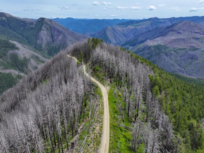
A scenic climb high in the Oregon Cascades, with panoramic views of Mt. Jefferson at the top.
PJAMM note: The last mile cannot be ridden on a gravel bike, but you can leave your bike and hike to the top where dramatic views await.
PLAN YOUR ROUTE
See more details and tools regarding this climb's grade via our interactive Profile Tool.
Damo - It is very rough going past the Natural Arch Trailhead at mile 6.4. Note, the Natural Arch is accessible via walking trail at the hairpin at mile 6.4 of the climb - it is roughly at the 4 o'clock position looking north from the hairpin - generally southwest.
Eric Weininger - there could be some pushing through soft sand on Sand Flats.
View the Images tab in our Profile Tool for more detailed information on the road surface.
Information Not Available
If you have any information regarding this climb, we'd like to hear from you. Click the CONTRIBUTE button to share your thoughts with us.
Before heading out on any cycling adventure check out our Things to Bring on a Cycling Trip and use our interactive check list to ensure you don't forget anything.
Information Not Available
If you have any information regarding this climb, we'd like to hear from you. Click the CONTRIBUTE button to share your thoughts with us.
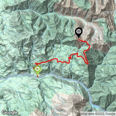
ROUTE MAP
MEMBER RATING
CURRENT WEATHER
PJAMM TRIPS ADVENTURE STARTER BUNDLES
Check out PJAMM Adventure's prepackaged (self-guided) cycling trips. They will help you plan, document and conquer your next adventure.
NEARBY CLIMBS (0) RADIAL PROXIMITY
FROM No Climbs Found
MEMBER REVIEWS & COMMENTS
Let us know what you thought of this climb. Signup for our FREE membership to write a review or post a comment.
Already have an account?
LOG IN HERE