
22.9
PDI
17.8 mi
DISTANCE
4,312 ft
GAINED
4.2 %
AVG. GRADE
FULL CLIMB STATS
Page Contributor(s): Tony McGettigan, Golden, CO
INTRO
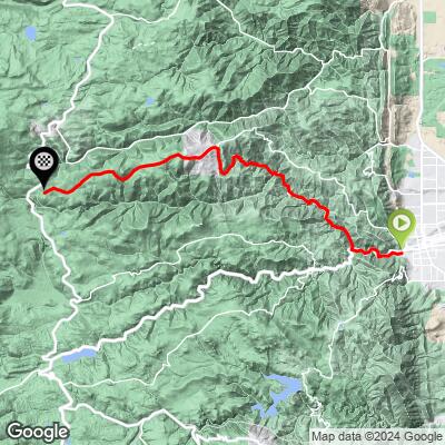
Gold Hill Road climbs from Boulder, Colorado (5,412') to about 9,332' where it meets the Peak-to-Peak Highway (CO-72) south of Ward, gaining 4,312 feet of climbing over 17.8 miles at an average grade of 4.2%. It's one of Boulder's signature gravel climbs and currently ranks #100 in the world for climb difficulty.
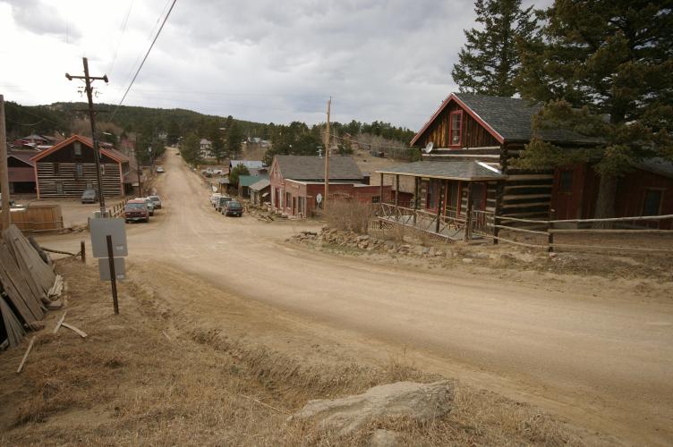
The first 5.7 miles up Mapleton Avenue and Sunshine Canyon Drive are paved and fairly steep in stretches, gaining about 1,800 feet before the pavement ends. From there, roughly 4 miles of hard-packed dirt and gravel - often with washboard - lead through forest to Gold Hill, a former 1859 gold-mining camp now a tiny residential community anchored by the Gold Hill General Store, still serving out of its original 1873 building. Past town, the road mixes gravel and pavement up to the Peak-to-Peak Highway, with sweeping views over the Boulder Valley and Indian Peaks Wilderness.
The road is popular with local gravel riders and generally well maintained, though washboard can make for a rough descent even though the climb itself is non-technical. Boulder County's foothills are wildfire-prone in dry years - Sunshine Canyon itself was briefly threatened by a wildfire in December 2022 - so check current conditions before riding during high fire-danger periods.
PLAN YOUR ROUTE
 We've partnered with Sherpa-Map.com to bring you the best route planning tool. With a PRO Membership you can use this climb as a reference when creating your route.
 Gold Hill Road averages 4.2% over its full 17.8 miles, but the grade is uneven - long, gentler stretches are broken up by steeper pitches, especially on the paved lower half through Sunshine Canyon. The steepest 100 yards reaches 12.3%, the steepest quarter mile averages 11.8%, the steepest half mile 10.8%, and the steepest continuous mile still holds 9.9%.
Zoomed out, the steepest 5-mile stretch averages 7.8%, showing that the real work is concentrated in the lower and middle sections rather than spread evenly across the whole climb. Expect a mix of paved rollers and gravel grades that can feel steeper than the numbers suggest once washboard and loose surface are factored in.
Roadway: The first 5.7 miles - Mapleton Avenue into Sunshine Canyon Drive - are paved and in good condition. The pavement ends at roughly 1,800 feet of gain, giving way to about 4 miles of hard-packed dirt and gravel through Gold Hill; this stretch is generally well maintained but often has washboard, which can make for a jarring, technical descent even though it's a straightforward, non-technical climb. Beyond Gold Hill the surface alternates between pavement and gravel on the way up to the Peak-to-Peak Highway. As of 2026 there are no reported long-term closures on this route, but Boulder County's foothills - including Sunshine Canyon itself, briefly threatened by a wildfire in December 2022 - see real wildfire risk in dry years, so check current conditions before riding during high fire-danger periods.
Traffic: The paved lower section carries moderate local and residential traffic, including some vehicles headed up to Gold Hill and Ward. Once the gravel starts, traffic drops off significantly - mostly other cyclists, hikers, and the occasional resident.
Parking: The climb starts at 4th Street and Mapleton Avenue in Boulder. There's a small parking area on the south side of Sunshine Canyon Drive near the start; if it's full, street parking is available nearby on Mapleton Avenue.
Provisions: The Gold Hill General Store sits right in the middle of the route in the town of Gold Hill and is the only real stop for food and drinks along the way - it operates out of its original 1873 building after reopening in the 1960s following a decades-long closure. There's nothing else - no gas stations, cafes, or water fountains - between Boulder and the Peak-to-Peak Highway, so plan around the store's hours if you're counting on it.
Gear: This climb tops out above 9,300', so temperatures and wind at the top can be noticeably harsher than in Boulder - pack a light jacket or vest even on a warm day. A gravel or mountain bike with tires wide enough to handle washboard and loose gravel is strongly preferred over a standard road bike for the upper sections.
Before heading out on any cycling adventure check out our Things to Bring on a Cycling Trip and use our interactive check list to ensure you don't forget anything.
Boulder makes an easy home base for this climb - it's just a few minutes from downtown to the start at 4th and Mapleton, with plenty of lodging, food, and bike shops in town. If you don't want to ride Gold Hill Road as an out-and-back, a popular option is looping back to Boulder via the Peak-to-Peak Highway and Left Hand Canyon, or via Fourmile Canyon through Salina.
Gold Hill itself is worth a slow-down stop, not just a water break - the General Store doubles as the town's library and has been a fixture since the gold-rush era that gave the town its name in 1859. If you're building out a longer ride in the area, our Routes in the Area tool is a good way to see other nearby Boulder County climbs - Sunshine Canyon, Fourmile Canyon, and Flagstaff Mountain are all close by - and to string together a custom route from here.
ROUTE MAP
MEMBER RATING
CURRENT WEATHER
PJAMM TRIPS ADVENTURE STARTER BUNDLES
Check out PJAMM Adventure's prepackaged (self-guided) cycling trips. They will help you plan, document and conquer your next adventure.
NEARBY CLIMBS (0) RADIAL PROXIMITY
FROM No Climbs Found
MEMBER REVIEWS & COMMENTS
Let us know what you thought of this climb. Signup for our FREE membership to write a review or post a comment.
Already have an account?
LOG IN HERE
thall1
Enjoyability: 75/100
