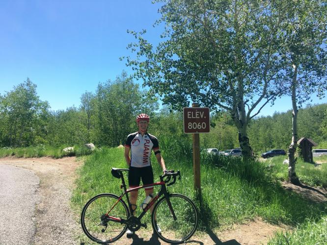
16.9
PDI
10.9 mi
DISTANCE
3,013 ft
GAINED
5.2 %
AVG. GRADE
FULL CLIMB STATS
Page Contributor(s): Ron Hawks, Las Vegas, NV, USA; Bruce Hamilton, La Quinta, CA, USA.
INTRO
"The west side of Alpine Summit (Route 39) is a bit longer and more shallow than its east side but is still a solid ascent and is among the most scenic in Utah. The initial section is within a canyon and passes through Timpanogos Cave National Monument along the way. Soon the road turns right and up the mountain, getting more twisty as you climb. The climb ends at an unmarked but obvious pass within a huge grove of aspen trees (closed in winter - Uinta National Forest - 801-785-3563). AlpineSummit is used at times in the annual Tour of Utah, one of the most difficult stage races in the U.S." (This quote is presented with the approval of John Summerson, from his book, 50 Climbs (by Bike) in Utah, pg. 100.)
PLAN YOUR ROUTE
See more details and tools regarding this climb's grade via our interactive Profile Tool.
Information Not Available
If you have any information regarding this climb, we'd like to hear from you. Click the CONTRIBUTE button to share your thoughts with us.
Information Not Available
If you have any information regarding this climb, we'd like to hear from you. Click the CONTRIBUTE button to share your thoughts with us.
Before heading out on any cycling adventure check out our Things to Bring on a Cycling Trip and use our interactive check list to ensure you don't forget anything.
Information Not Available
If you have any information regarding this climb, we'd like to hear from you. Click the CONTRIBUTE button to share your thoughts with us.
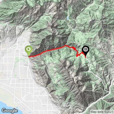
ROUTE MAP
MEMBER RATING
CURRENT WEATHER
PJAMM TRIPS ADVENTURE STARTER BUNDLES
Check out PJAMM Adventure's prepackaged (self-guided) cycling trips. They will help you plan, document and conquer your next adventure.
NEARBY CLIMBS (0) RADIAL PROXIMITY
FROM No Climbs Found
MEMBER REVIEWS & COMMENTS
Let us know what you thought of this climb. Signup for our FREE membership to write a review or post a comment.
Already have an account?
LOG IN HERE
HakenBaconator


Road quality at the start is amazing, but as the road steepens up, it gets a bit crappier; not terrible, just pretty bumpy. Not a ton of traffic and quite a few cyclists. There are some great views of Mt. Timpanogas along the way. I've done it twice and would definitely recommend.