
91.9
PDI
67.3 mi
DISTANCE
16,014 ft
GAINED
3.9 %
AVG. GRADE
FULL CLIMB STATS
Page Contributor(s): Jeremiah Bishop, VA; Tyler Pearce, CA
INTRO
The Impossible Route is widely considered the hardest one-day road ride in cycling: 67 miles from sea level on Hawaii's Big Island to 13,780 feet atop Mauna Kea, gaining over 16,000 feet along the way - more vertical than any other single climb on this site.
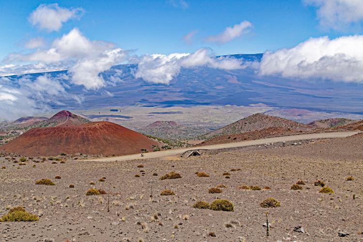
The road stays paved until the Mauna Kea Visitor Information Station at roughly 9,200 feet, then turns to loose, steep gravel for the final push to the summit, where the air holds only about 60% of the oxygen found at sea level.
This isn't a casual ride - it combines extreme distance, altitude, and a genuinely difficult gravel surface at the exact point riders are most exhausted. Only a small number of cyclists have completed the full route, and it's earned its reputation as one of the toughest single-day climbs anywhere in the world.
PLAN YOUR ROUTE
 We've partnered with Sherpa-Map.com to bring you the best route planning tool. With a PRO Membership you can use this climb as a reference when creating your route.
 See more details and tools regarding this climb's grade via our interactive Profile Tool.
Roadway: Paved smoothly from near sea level up to the Mauna Kea Visitor Information Station around 9,200 feet; beyond that the surface turns to loose, rutted gravel for the final stretch to the summit.
Traffic: Light on the lower paved sections away from town, picking up somewhat near the Visitor Center where tourists drive up for stargazing; the gravel summit road sees very little traffic beyond maintenance vehicles for the observatories.
Parking: No formal parking at the true start near sea level - most riders begin from a hotel or a spot near the coast in Hilo or Kona. The Mauna Kea Visitor Information Station has a parking lot and is the natural staging point for the gravel section.
This is an all-day effort spanning sea level to nearly 14,000 feet, so pack layers - it can be 85F at the coast and near freezing with high wind at the summit. A gravel-capable bike, or at minimum wide, sturdy tires, is required for the final section.
Carry more water and food than feels necessary - there are no services above the Visitor Center, and altitude sickness is a real risk gaining this much elevation this fast.
Before heading out on any cycling adventure check out our Things to Bring on a Cycling Trip and use our interactive check list to ensure you don't forget anything.
Most riders base themselves in Hilo or Kona the night before and start at first light to leave enough daylight for the full 67-mile effort. The Mauna Kea Visitor Information Station (about 9,200 ft) is a natural stop for acclimatization and marks the split between the paved and gravel sections.
Given the altitude and remoteness above the Visitor Center, riding with at least one partner is strongly recommended.
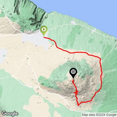
ROUTE MAP
MEMBER RATING
CURRENT WEATHER
PJAMM TRIPS ADVENTURE STARTER BUNDLES
Check out PJAMM Adventure's prepackaged (self-guided) cycling trips. They will help you plan, document and conquer your next adventure.
NEARBY CLIMBS (0) RADIAL PROXIMITY
FROM No Climbs Found
MEMBER REVIEWS & COMMENTS
Let us know what you thought of this climb. Signup for our FREE membership to write a review or post a comment.
Already have an account?
LOG IN HERE
