
25.7
PDI
7.2 mi
DISTANCE
3,023 ft
GAINED
8 %
AVG. GRADE
FULL CLIMB STATS
Page Contributor(s): Doug Jansen, Durango, CO; Howard Grotts, Durango, CO
INTRO
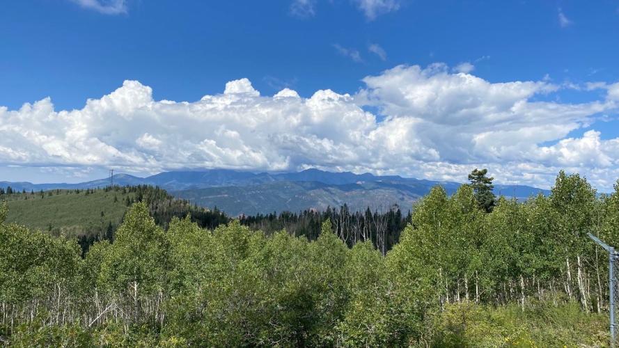
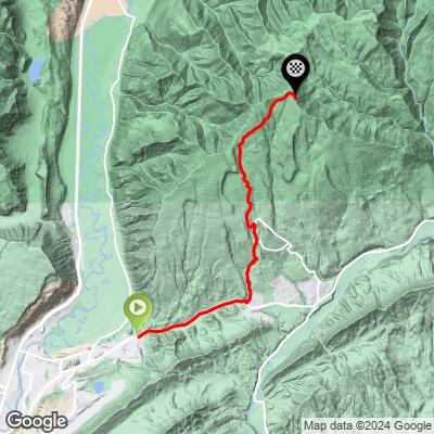
Baldy Mountain is a 7.2-mile, 3,023 ft climb above Durango, CO, topping out at 9,831 ft near the radio and cell towers on Baldy's 9,874-ft summit in San Juan National Forest. The first 2 miles run on pavement through the Edgemont Highlands neighborhoods off Florida Road (CR 240); above a Forest Service gate around 8,700 ft, it turns to unpaved National Forest road for the rest of the way up. Average grade is about 8% - pretty brutal.
Local riders who've done it on gravel bikes describe the lower gravel as steep through the neighborhoods but not too rough, then rougher and chunkier past the gate:
"You can do an out-and-back on a gravel bike. The road is steep up through the neighborhoods but not too rough, then the closed road past the gate gets rougher - like 3/5, but all rideable on a gravel bike for sure." - Skinjacket
"The Nashbaum/Silver Mesa part (first 1,400 ft from Florida Rd) is great gravel bike material. Above the FS gate at 8,700 ft, it gets chunky - rutted, rocky, muddy, or sandy depending on recent weather and communication-tower traffic. If you're comfortable riding rough 4WD road at 10-15% grades, it's rideable." - Doug Jansen, Durango, CO
"Yes, doable on a gravel bike. The road surface is a 2 for most of it, with a few sections up to 4 on a 1-smooth-to-5-extremely-rough scale." - Howard Grotts, Durango, CO
PLAN YOUR ROUTE
 We've partnered with Sherpa-Map.com to bring you the best route planning tool. With a PRO Membership you can use this climb as a reference when creating your route.
 Baldy Mountain averages 7.97% over 7.2 miles but ramps up well past that near the top. PJAMM's GPX data shows 13.6% over the steepest 100 yards, 12.5% over the steepest quarter-mile, 11.5% over the steepest half-mile, and 11.1% over the steepest full mile - all above the Forest Service gate at 8,700 ft, where local riders describe sustained 10-15% pitches on rough 4WD road. The paved first 2 miles through the Edgemont Highlands neighborhoods is comparatively gentle by comparison. Preview every pitch, kilometer by kilometer, with our free Profile tool before you go.
Roadway: The first 2 miles are paved, climbing through Durango's Edgemont Highlands neighborhoods via Florida Road (CR 240) and local streets. At a Forest Service gate around 8,700 ft, the road becomes unpaved National Forest road up to the communication towers near the 9,874 ft summit - rougher and more technical, with sections that can be rutted, rocky, muddy, or sandy depending on recent weather. Local riders rate the surface around 2/5 for most of it, with a few chunkier sections up to 4/5.
Traffic: Light. The paved section carries local residential traffic; past the Forest Service gate the road is closed to public motor vehicles, so cyclists mostly share it only with occasional maintenance traffic servicing the communication towers.
Parking: There's no formal trailhead lot - riders typically park along Florida Road (CR 240) or a neighborhood street near where the pavement ends, being mindful of posted residential parking restrictions.
Last services (gas, food, water) are in Durango before you turn onto Florida Road - nothing beyond that. Local riders who've climbed it confirm it's doable on a gravel bike but recommend low gearing for the sustained 10-15% pitches above the Forest Service gate, and wider tires (40mm+) help on the rutted, rocky sections higher up. It rides better going up than coming back down - the rough upper section makes for a tedious, technical descent.
Before heading out on any cycling adventure check out our Things to Bring on a Cycling Trip and use our interactive check list to ensure you don't forget anything.
Durango is the obvious base - Florida Road (CR 240) runs east out of town to the Baldy Mountain turnoff in the Edgemont Highlands. If you're driving in from out of town, Durango also has several other well-known gravel climbs nearby, including Missionary Ridge Road - use our Sherpa Map tool to string together a custom multi-climb route starting from Baldy Mountain.
Upper-elevation San Juan National Forest roads are typically open roughly June through October; check current conditions with the San Juan National Forest Columbine Ranger District before heading up early or late season.
ROUTE MAP
MEMBER RATING
CURRENT WEATHER
PJAMM TRIPS ADVENTURE STARTER BUNDLES
Check out PJAMM Adventure's prepackaged (self-guided) cycling trips. They will help you plan, document and conquer your next adventure.
NEARBY CLIMBS (0) RADIAL PROXIMITY
FROM No Climbs Found
MEMBER REVIEWS & COMMENTS
Let us know what you thought of this climb. Signup for our FREE membership to write a review or post a comment.
Already have an account?
LOG IN HERE
