
36.5
PDI
10.2 mi
DISTANCE
4,243 ft
GAINED
7.8 %
AVG. GRADE
FULL CLIMB STATS
INTRO
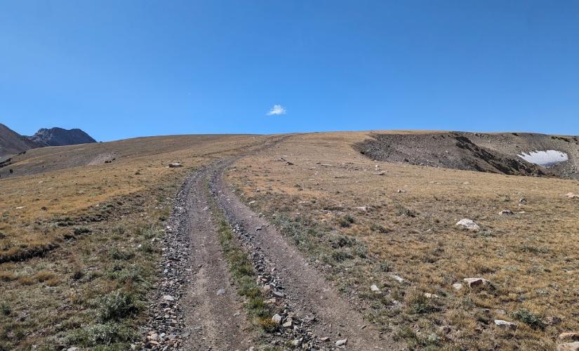
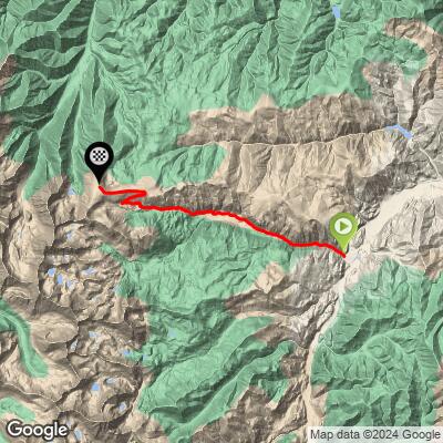
Railroad Ridge is the highest road in Idaho, a remote gravel and dirt climb into the White Cloud Mountains above Clayton in Custer County. In just 10.2 miles it gains 4,243 feet at an average grade of 7.8%, starting near the East Fork Salmon River at 6,154 feet and topping out above 10,340 feet near the old Livingston Mine.
This isn't a groomed gravel road - it's a rough Forest Service track (FR 669, also called Jim Creek Road) built originally for mining access, and it climbs like one. The steepest full mile averages nearly 15%, and short pitches spike above 20%. Loose rock, narrow tread, and almost no shoulder or pullouts make it as much a technical challenge as a fitness one.
The payoff is the setting: Railroad Ridge sits in the heart of the White Clouds, an area known for rare alpine plant life and sweeping views over the Boulder and Sawtooth ranges once you clear treeline. It's remote - there's little to no cell signal once you're past the East Fork Road - so this is a climb to do prepared and, ideally, not alone.
PLAN YOUR ROUTE
 We've partnered with Sherpa-Map.com to bring you the best route planning tool. With a PRO Membership you can use this climb as a reference when creating your route.
 Railroad Ridge's 7.8% average hides just how punchy this climb actually gets. The steepest 100 yards spikes to nearly 24%, and the steepest quarter-mile still averages over 18% - numbers that put short sections of this road among the steepest found on any climb in PJAMM's database.
It doesn't let up much as the window widens either: the steepest full mile averages close to 15%, the steepest 2.5 miles hold above 13%, and even the steepest 5-mile stretch (essentially the whole back half of the climb) still averages nearly 11%. There's no real flat or downhill recovery section anywhere on the route.
In practice, that means Railroad Ridge rides harder than its overall average suggests. Riders should be prepared for extended stretches in the 12-18% range on loose, rocky surface, not a steady grind - this is a climb where gearing low and staying patient matters more than raw power.
Roadway: Jim Creek Road (FR 669) is a rough, narrow Forest Service road, not a maintained gravel road - expect loose rock, ruts, and washboard, especially in the upper miles near the old Livingston Mine. It was built for mining access and 4WD travel, and it shows; a mountain bike or a gravel bike with wide, high-volume tires and low gearing is the right choice, not a road or all-road setup.
Traffic: Very light. This is a remote backcountry road with occasional high-clearance 4x4 and ATV traffic, particularly in late summer, but no through-traffic to speak of. Cell coverage is unreliable to nonexistent once you're off the East Fork Road, so treat this as self-supported.
Parking: Riders typically start from the trailhead area near Livingston Mill off East Fork Salmon River Road, where there's informal roadside parking used by hikers and 4x4 drivers accessing the same route.
This climb rewards a mountain bike or a rugged gravel bike over anything narrower - wide, high-volume tires (40mm+) and a wide-range low gear are worth prioritizing over aerodynamics or weight. The surface is loose and rocky enough in places that traction, not just fitness, becomes the limiter.
Carry more water and food than the short distance suggests. There's no store, water source, or cell signal along the route, and the effort at altitude (finishing above 10,300 feet) will drain riders faster than a 10-mile climb normally would. A basic repair kit is worth the extra weight too - this is not a road where a mechanical means a quick rescue.
Weather changes fast at this elevation. Even on a clear morning in Clayton, pack a windproof layer for the ridge - afternoon storms are common in the White Clouds through summer, and there's no cover once you're above treeline.
Before heading out on any cycling adventure check out our Things to Bring on a Cycling Trip and use our interactive check list to ensure you don't forget anything.
Clayton and Stanley, Idaho are the nearest towns with gas, food, and lodging - both are small, so plan ahead rather than counting on services being open. The climb sits well above 6,000 feet throughout and finishes above 10,300, so riders coming from lower elevations should budget a day or two to acclimate.
Late July through September is the realistic window - the road holds snow into early summer at this elevation and access can be cut off by drifts well into June. Afternoon thunderstorms are common in the White Clouds during summer, so an early start is the safer play, both for weather and for cooler temperatures on the exposed upper ridge.
ROUTE MAP
MEMBER RATING
CURRENT WEATHER
PJAMM TRIPS ADVENTURE STARTER BUNDLES
Check out PJAMM Adventure's prepackaged (self-guided) cycling trips. They will help you plan, document and conquer your next adventure.
NEARBY CLIMBS (0) RADIAL PROXIMITY
FROM No Climbs Found
MEMBER REVIEWS & COMMENTS
Let us know what you thought of this climb. Signup for our FREE membership to write a review or post a comment.
Already have an account?
LOG IN HERE
