
24.2
PDI
5.9 mi
DISTANCE
2,846 ft
GAINED
8.8 %
AVG. GRADE
FULL CLIMB STATS
Page Contributor(s): Oliver Welch, Bend, Bellingham; Brad Metzler, Powell, WY; Caiden Hartrich, Bend, SLO
INTRO
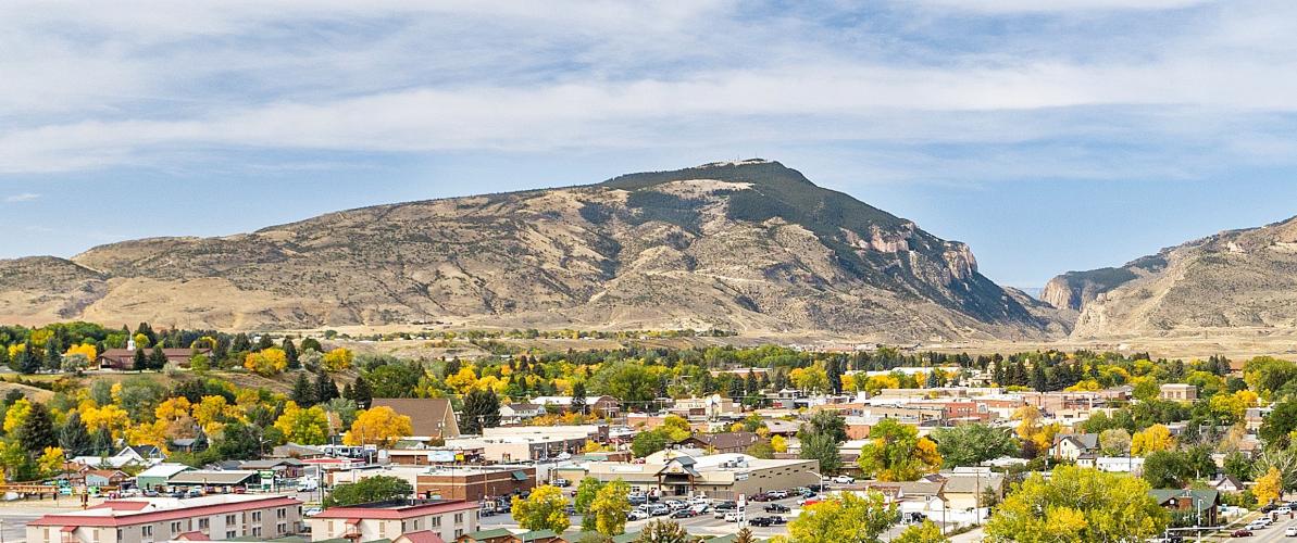
Cedar Mountain (sometimes called Spirit Mountain) rises directly above Cody, Wyoming, and this gravel route climbs 5.9 miles up its eastern flank to the communications towers near its 7,857-foot summit, gaining 2,846 feet at an 8.8% average grade.
What makes this one unusual is access: the lower couple of miles cross Bureau of Land Management ground, but the upper mountain is private property split between two ranches, with a locked gate and a posted phone number where you're expected to call ahead for permission before continuing. Past the gate, the surface gets progressively chunkier and rockier - contributors who've ridden it report it's all rideable on a gravel bike, but it isn't smooth double-track throughout.
The payoff at the top is the view: Cedar Mountain looks out over the Shoshone River canyon, Buffalo Bill Reservoir, and Rattlesnake Mountain across the valley - though the summit itself is fenced and posted "no trespassing" around the roughly 20 companies' and agencies' radio and TV towers up there, including infrastructure used by local law enforcement and search and rescue.
PLAN YOUR ROUTE
 We've partnered with Sherpa-Map.com to bring you the best route planning tool. With a PRO Membership you can use this climb as a reference when creating your route.
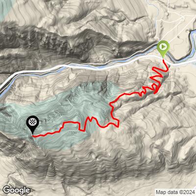
 The climb gains 2,846 feet over 5.92 miles at an average grade of 8.8% - a sustained gravel effort to a summit elevation of 7,857 feet, starting from about 5,120 feet on the outskirts of Cody.
The grade builds gradually rather than hitting hard right away, with the steepest sections coming in the upper third as the road leaves the lower BLM section for the private ranch roads and the surface turns rockier. There's little flat ground anywhere on the route to recover on once the climb gets going.
Roadway: This is a true gravel/dirt climb, not a paved road with a gravel section. The lower couple of miles on BLM land are a maintained dirt road; past the first locked gate the surface becomes noticeably rougher and rockier, especially in the final mile below the radio towers. Riders report it's doable on a standard gravel bike the whole way, but expect some technical, chunky sections near the top rather than smooth double-track.
Traffic: Traffic is very light - this is a private ranch/utility access road, not a through road, so the only vehicles you'll likely see are ranch trucks or crews servicing the towers. The road is gated in at least two places: a lower gate about 2.5 miles up marks the start of private property, and a second gate roughly 1.5 miles beyond that leads onto the section with the radio and TV towers. A phone number is posted at the gate for requesting permission to pass - call ahead rather than assume you can just ride through, since this is private land and the summit tower site is posted no trespassing.
Parking: There's no dedicated trailhead parking - riders typically start from within Cody itself and ride out to the base of the climb on local streets.
There's no water, food, or bike shop support anywhere on the route once you leave Cody, so treat this as fully self-supported from the base gate onward. The exposed, high-desert terrain and rocky upper sections make a gravel bike with reasonably sturdy tires the right tool here - riders have done it on standard gravel setups, but wider, more durable tires make the chunky final stretch below the towers noticeably more comfortable.
Cody sits at elevation and can see big temperature swings and sudden afternoon weather, so pack layers. Cell coverage is generally decent this close to a working communications site, but don't assume it holds everywhere on the mountain.
Before heading out on any cycling adventure check out our Things to Bring on a Cycling Trip and use our interactive check list to ensure you don't forget anything.
Cody, Wyoming has the area's hotels, restaurants, and bike shops, and sits about 50 miles east of Yellowstone National Park's east entrance, making this an easy add-on for anyone road-tripping through the park.
The best riding season is late spring through early fall; snow and mud can make the rockier upper sections unrideable outside that window.
Before you go, call the number posted at the lower gate to check on current access - this is private land layered with working ranch and utility operations, and permission isn't automatic. Our Routes in the Area tool is a good way to see what else is rideable near Cody if the gate happens to be closed the day you show up.
ROUTE MAP
MEMBER RATING
CURRENT WEATHER
PJAMM TRIPS ADVENTURE STARTER BUNDLES
Check out PJAMM Adventure's prepackaged (self-guided) cycling trips. They will help you plan, document and conquer your next adventure.
NEARBY CLIMBS (0) RADIAL PROXIMITY
FROM No Climbs Found
MEMBER REVIEWS & COMMENTS
Let us know what you thought of this climb. Signup for our FREE membership to write a review or post a comment.
Already have an account?
LOG IN HERE
