
36.4
PDI
9.2 mi
DISTANCE
4,064 ft
GAINED
8.4 %
AVG. GRADE
FULL CLIMB STATS
Page Contributor(s): Geerlof De Mooif; Ron Richmond,
INTRO
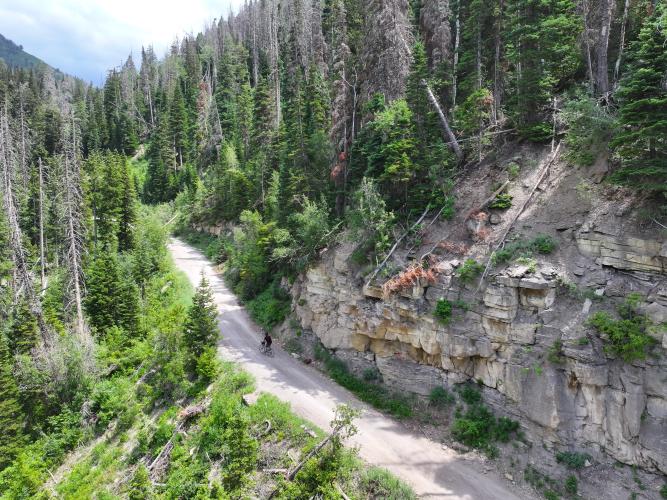
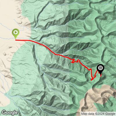
Pleasant Creek to Skyline climbs 9.2 miles and 4,064 feet at an average grade of 8.4%, running up Pleasant Creek Canyon out of Mount Pleasant, Utah to meet the famed Skyline Drive along the crest of the Wasatch Plateau. The route follows Forest Route 037, starting at 6,488 feet and topping out above 10,500 feet - a serious elevation gain packed into a short distance, on a road that spends real time above 10% grade.
This is Manti-La Sal National Forest terrain: dense stands of aspen and conifer lower down giving way to open, exposed ridgeline as the road nears Skyline Drive, with wide views over the Sanpete Valley on a clear day. Because the whole upper route sits above 10,000 feet, it's only reliably open from July through September - snow closes it the rest of the year.
Two PJAMM contributors who've ridden it firsthand back up what the numbers suggest: Geerlof De Mooij rode it in November and found the road mostly snow-covered, rating the exposed surface a 3 out of 5. Ron Richmond, who's ridden it more, describes the surface as roughly 3/5 up to the national forest boundary and 4 to 4.5/5 above it - rockier and rougher the higher you climb - noting the Forest Service grades it only once every 10-15 years, so conditions vary a lot by year.
PLAN YOUR ROUTE
 We've partnered with Sherpa-Map.com to bring you the best route planning tool. With a PRO Membership you can use this climb as a reference when creating your route.
 At an 8.4% average over 9.2 miles, Pleasant Creek to Skyline is a genuinely hard, sustained climb - and the segment data shows it holds that difficulty rather than front- or back-loading it. The steepest half-mile and steepest quarter-mile both average close to 13%, and even the steepest full mile still holds right around 12%.
That difficulty doesn't fade with distance either: the steepest 2.5 miles average 10.7%, and the steepest 5-mile stretch - more than half the total climb - still averages 10.4%. There's essentially no easy section to recover on; this is a road that asks for consistent effort from bottom to top.
Riders should plan gearing around the double-digit grades being the rule for large stretches of this climb, not the exception, especially in the upper miles where the surface also gets rockier as the road approaches Skyline Drive.
Roadway: Forest Route 037 is unpaved for essentially its entire length. Surface quality varies by year since the Forest Service only grades it roughly every 10-15 years - contributors rate it about 3/5 up to the forest boundary and rougher, 4 to 4.5/5, in the final push to Skyline Drive. A gravel bike can handle it in good conditions, but expect a rockier, looser ride the higher you go.
Traffic: Light. This is a Forest Service road serving a mix of recreational traffic - OHV riders on the connected Arapeen trail system, hunters and hikers in season - rather than a through route, so car and truck volume stays low outside of peak fall use.
Parking: There's no dedicated trailhead - riders start from the mouth of Pleasant Creek Canyon at the eastern edge of Mount Pleasant and park informally along the road near the canyon entrance.
A gravel bike with wide, durable tires is the right tool here - the road is unpaved throughout and gets rockier in the upper miles, and with the Forest Service grading it only once a decade or so, conditions can range from smooth to genuinely rough depending on the year. Low gearing matters given how much of the climb sits at 10%+ grade.
The finish sits above 10,500 feet, so altitude will affect effort even for fit riders unused to it. Carry more water than the short distance suggests, since there's nothing along the route once you leave Mount Pleasant. A packable jacket is worth bringing too - the exposed ridge near Skyline Drive is noticeably colder and windier than the canyon below.
Before heading out on any cycling adventure check out our Things to Bring on a Cycling Trip and use our interactive check list to ensure you don't forget anything.
Mount Pleasant is a small Sanpete County town with basic services - gas, food, and lodging - making it an easy, low-key base for this climb. The route is only reliably rideable from July through September; the upper elevations near Skyline Drive sit above 10,000 feet and hold snow well outside that window, as one PJAMM contributor found out riding it in November.
If you're making a trip of it, Skyline Drive itself continues for miles along the crest of the Wasatch Plateau in both directions, so this climb doubles as an entry point to a much longer scenic ridge ride for anyone with the legs and the daylight for it.
ROUTE MAP
MEMBER RATING
CURRENT WEATHER
PJAMM TRIPS ADVENTURE STARTER BUNDLES
Check out PJAMM Adventure's prepackaged (self-guided) cycling trips. They will help you plan, document and conquer your next adventure.
NEARBY CLIMBS (0) RADIAL PROXIMITY
FROM No Climbs Found
MEMBER REVIEWS & COMMENTS
Let us know what you thought of this climb. Signup for our FREE membership to write a review or post a comment.
Already have an account?
LOG IN HERE
