
24.8
PDI
6.9 mi
DISTANCE
3,092 ft
GAINED
8 %
AVG. GRADE
FULL CLIMB STATS
Page Contributor(s): Daniel Clayton; Joe Dirt, St. George, UT; Jace Heger, St. George, UT
INTRO
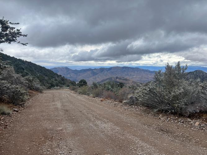
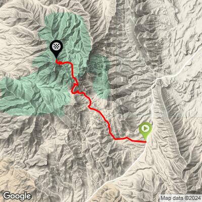
West Mountain Peak is a 6.85-mile gravel climb to 7,499 ft in the Beaver Dam Mountains, the range that forms the far southwest corner of Utah near Dammeron Valley and St. George. The road leaves Highway 8 through Shivwits, climbs a good gravel road toward Hell Hole Pass, then finishes with an engineering marvel: a stack of steep switchbacks cut into the final hillside to reach the summit's communication towers at 7,680 ft.
Joe Dirt: "This climb is rideable on a gravel bike but you need decently low gearing, like 1:1 at least. And I'd recommend 40c or wider for that climb. But other than that, gravel bikes are fine. It's a beast of a climb btw!"
Jace Heger: "I've done this route on both an xc bike and a gravel bike. Towards the top it's a hike-a-bike. It gets really steep and loose. I'd have to say that I prefer the mtb on this particular route though."
John Johnson (PJAMM Cycling): "As of October, 2024, the first half of the road is fairly smooth. The second half of the climb is incredibly difficult, 18-20% grades in spots and a very rough road, but rideable on a gravel bike. I recommend very low gearing, 45-50mm tires and a front fork shock (I used a Canyon Grizl that comes with a RockShox on the front fork)."
Joe Dirt: "This climb is rideable on a gravel bike but you need decently low gearing, like 1:1 at least. And I'd recommend 40c or wider for that climb. But other than that, gravel bikes are fine. It's a beast of a climb btw!"
PLAN YOUR ROUTE
 We've partnered with Sherpa-Map.com to bring you the best route planning tool. With a PRO Membership you can use this climb as a reference when creating your route.
 West Mountain Peak averages 7.96% over 6.85 miles, but that average hides a brutal back half. GPS data shows 20.2% over the steepest 100 yards, 19.1% over the steepest quarter-mile, 17.4% over the steepest half-mile, and 14.1% over the steepest full mile - all concentrated in the final switchback push to the communication towers on the summit, where riders report sustained 18-20% grades on loose, rough road. The first half, by contrast, is a comparatively smooth, moderate gravel road. Preview every pitch, kilometer by kilometer, with our Profile tool so the steep second half doesn't catch you out.
Roadway: Good, well-graded gravel for roughly the first half, climbing toward Hell Hole Pass. The second half gets progressively rougher and looser, finishing with a stack of tight switchbacks engineered into the final hillside - loose surface, 18-20% pitches, and, per one PJAMM rider's October 2024 report, rough enough that a front-fork shock is worth having. Expect a hike-a-bike section for some riders near the very top.
Traffic: Very light - this is a remote, high-clearance 4WD access road to a communication site, not a through road. Expect the occasional utility vehicle servicing the towers and little else.
Parking: No formal trailhead - riders typically park along the gravel road well below the switchbacks (a high-clearance vehicle is recommended even to get that far) or at a pullout near Hell Hole Pass, then ride from there. There are no pullouts on the switchback section itself.
No services anywhere on or near the route - fuel up and carry all your water from St. George before heading out on Highway 8. Multiple riders who've done this climb recommend very low gearing (1:1 or lower) and wide tires (40-50mm) for the loose, steep second half; one rider specifically recommends a gravel bike with front suspension (he used a Canyon Grizl with a RockShox fork) for the roughest sections near the summit.
Before heading out on any cycling adventure check out our Things to Bring on a Cycling Trip and use our interactive check list to ensure you don't forget anything.
St. George is the nearest base with full services, about 30 minutes from the Highway 8 turnoff through Shivwits; Dammeron Valley is the closest small community. This is a remote, exposed climb with no shade and no cell coverage for most of the way up, so tell someone your plan and check the weather before you go - summer afternoon heat and thunderstorms are both real concerns in the Beaver Dam Mountains. Use our Profile tool to study the steep second-half switchbacks before you commit to a gear setup.
ROUTE MAP
MEMBER RATING
CURRENT WEATHER
PJAMM TRIPS ADVENTURE STARTER BUNDLES
Check out PJAMM Adventure's prepackaged (self-guided) cycling trips. They will help you plan, document and conquer your next adventure.
NEARBY CLIMBS (0) RADIAL PROXIMITY
FROM No Climbs Found
MEMBER REVIEWS & COMMENTS
Let us know what you thought of this climb. Signup for our FREE membership to write a review or post a comment.
Already have an account?
LOG IN HERE
