20.7
PDI
20.4 mi
DISTANCE
4,198 ft
GAINED
3.5 %
AVG. GRADE
FULL CLIMB STATS
INTRO
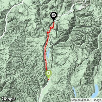
This 20.4 mile bike climb is located in CO, USA. The average gradient is 3.5% and there is a total elevation gain of 4,198 ft, finishing at 10,628 ft.
Use the profile tool, route map, and weather forecast to conquer this cycling climb.
Use the profile tool, route map, and weather forecast to conquer this cycling climb.
PLAN YOUR ROUTE
See more details and tools regarding this climb's grade via our interactive Profile Tool.
Information Not Available
If you have any information regarding this climb, we'd like to hear from you. Click the CONTRIBUTE button to share your thoughts with us.
Information Not Available
If you have any information regarding this climb, we'd like to hear from you. Click the CONTRIBUTE button to share your thoughts with us.
Before heading out on any cycling adventure check out our Things to Bring on a Cycling Trip and use our interactive check list to ensure you don't forget anything.
Information Not Available
If you have any information regarding this climb, we'd like to hear from you. Click the CONTRIBUTE button to share your thoughts with us.
ROUTE MAP
MEMBER RATING
CURRENT WEATHER
PJAMM TRIPS ADVENTURE STARTER BUNDLES
Check out PJAMM Adventure's prepackaged (self-guided) cycling trips. They will help you plan, document and conquer your next adventure.
NEARBY CLIMBS (0) RADIAL PROXIMITY
FROM No Climbs Found
MEMBER REVIEWS & COMMENTS
Let us know what you thought of this climb. Signup for our FREE membership to write a review or post a comment.
Already have an account?
LOG IN HERE
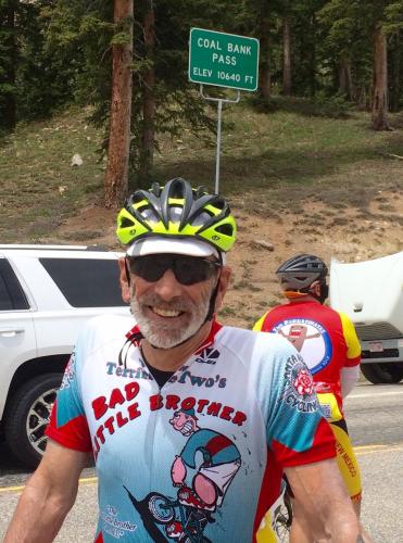
farmano
This is a fabulous climb. The grades are reasonable, but the climbs long. I started at the Trimble Crossings Plaza at 6,600 feet. In 17 miles climbed about 2400 feet to the Purgatory ski resort. The distant views were spectacular. But now, for the next 7.5 miles I had to climb 1800 feet. Here the road is reduced to 2 lanes. Quite often you are riding along a road edge that drops off 100s of feet. There are no views or spectacular scenery, but the pavement that I was concentrating on was quite good. As I thought I was getting close to the top, I reached a sign that read: Coal Bank Pass - 4 miles. But eventually, I was at the top. My lowest gear was a 36/28, which I stayed in for the last 5 miles. With good weather this is a nice climb that a cyclist in good condition can do. Make sure that your brakes are in good condition for a fast descent with lots of switch backs.