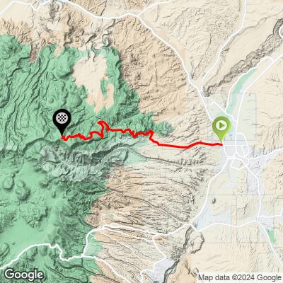
28.8
PDI
27.8 mi
DISTANCE
5,756 ft
GAINED
3.6 %
AVG. GRADE
FULL CLIMB STATS
Page Contributor(s): John Kaplin, North Kingstown, RI; Georges Mally, Moab, UT
INTRO
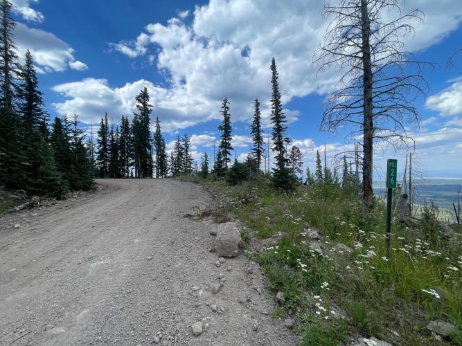
John Kaplin - From Espanola to top of ridge on gravel bike is very doable. Basically fire road and forest service roads that can be driven mostly by car or 4WD.
Georges Mally - FR144 or the so called 31 Mile road climbing out of Española is a wide gravel then dirt road on the top. It takes 31 miles to get from the paved road, 285/84 in Española at 5,700 ft to below Chicoma Peak at 10,900 ft. It takes exactly another 31 miles to get from the top to Youngsville on 96. You can drop down to Abiquiú taking the Polvadera Rd.
Wilson Lytefoot - Is this climb rideable on a gravel bike? I tend to judge that question on tire size versus bike type. For instance, if you ride this on a bike with 35 mm tires, you’ll have a terrible day. If you have a drop bar bike with really wide mtb tires, that’ll be a very a very different experience while still being on what we call a “gravel bike”. But to answer your question, I remember this climb being a mix of everything. Some smooth, some chunk. It’s a very long and sustained descent which might rattle you pretty hard on anything less than a 45mm tire. Great views, very little traffic, exposed and hot down low. Not much water. Have fun out there!
PLAN YOUR ROUTE
See more details and tools regarding this climb's grade via our interactive Profile Tool.
Information Not Available
If you have any information regarding this climb, we'd like to hear from you. Click the CONTRIBUTE button to share your thoughts with us.
Information Not Available
If you have any information regarding this climb, we'd like to hear from you. Click the CONTRIBUTE button to share your thoughts with us.
Before heading out on any cycling adventure check out our Things to Bring on a Cycling Trip and use our interactive check list to ensure you don't forget anything.
Information Not Available
If you have any information regarding this climb, we'd like to hear from you. Click the CONTRIBUTE button to share your thoughts with us.
ROUTE MAP
MEMBER RATING
CURRENT WEATHER
PJAMM TRIPS ADVENTURE STARTER BUNDLES
Check out PJAMM Adventure's prepackaged (self-guided) cycling trips. They will help you plan, document and conquer your next adventure.
NEARBY CLIMBS (0) RADIAL PROXIMITY
FROM No Climbs Found
MEMBER REVIEWS & COMMENTS
Let us know what you thought of this climb. Signup for our FREE membership to write a review or post a comment.
Already have an account?
LOG IN HERE