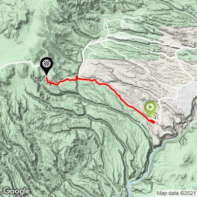
14.4
PDI
11.4 mi
DISTANCE
2,728 ft
GAINED
4.4 %
AVG. GRADE
FULL CLIMB STATS
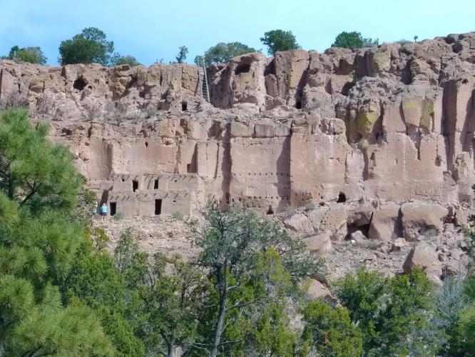
Page Contributor(s): (Cover photo) Antonne Perry, Google
INTRO
"4 East is a long and somewhat shallow climb south of Los Alamos that does reach high altitude towards its end. From its start at the bottom of a descent within a canyon, continue west and soon find increased grade through a giant S curve in impressive surroundings. At the top of the S curve the grade gets a bit more shallow as you ride on top of a plateau through scrub and small trees. Very quickly the entrance to Bandelier National Monument appears on the left but keep straight on Route 4 to continue west toward the big mountains. This section is along a straight road and fairly shallow grade. Near the junction with Route 501...the grade eases and then quickly steepens beyond the junction..." (This quote is presented with the approval of John Summerson, from his book, The Complete Guide to Climbing (by Bike), 2nd Edition, pg. 200.)
PLAN YOUR ROUTE
See more details and tools regarding this climb's grade via our interactive Profile Tool.
Information Not Available
If you have any information regarding this climb, we'd like to hear from you. Click the CONTRIBUTE button to share your thoughts with us.
Information Not Available
If you have any information regarding this climb, we'd like to hear from you. Click the CONTRIBUTE button to share your thoughts with us.
Before heading out on any cycling adventure check out our Things to Bring on a Cycling Trip and use our interactive check list to ensure you don't forget anything.
Information Not Available
If you have any information regarding this climb, we'd like to hear from you. Click the CONTRIBUTE button to share your thoughts with us.
ROUTE MAP
MEMBER RATING
CURRENT WEATHER
PJAMM TRIPS ADVENTURE STARTER BUNDLES
Check out PJAMM Adventure's prepackaged (self-guided) cycling trips. They will help you plan, document and conquer your next adventure.
NEARBY CLIMBS (0) RADIAL PROXIMITY
FROM No Climbs Found
MEMBER REVIEWS & COMMENTS
Let us know what you thought of this climb. Signup for our FREE membership to write a review or post a comment.
Already have an account?
LOG IN HERE