No Name Pass Bike Climb - PJAMM Cycling

12.5
PDI
8.8 mi
DISTANCE
2,163 ft
GAINED
4.7 %
AVG. GRADE

FULL CLIMB STATS

Page Contributor(s): Dan Razum, San Jose, CA

INTRO

This 8.8 mile bike climb is located in NM, USA. The average gradient is 4.7% and there is a total elevation gain of 2,163 ft, finishing at 10,488 ft.

Use the profile tool, route map, and weather forecast to conquer this cycling climb.

See more details and tools regarding this climb's grade via our interactive Profile Tool.
Information Not Available

If you have any information regarding this climb, we'd like to hear from you. Click the CONTRIBUTE button to share your thoughts with us.

Information Not Available

If you have any information regarding this climb, we'd like to hear from you. Click the CONTRIBUTE button to share your thoughts with us.

Before heading out on any cycling adventure check out our Things to Bring on a Cycling Trip and use our interactive check list to ensure you don't forget anything.
Information Not Available

If you have any information regarding this climb, we'd like to hear from you. Click the CONTRIBUTE button to share your thoughts with us.

ROUTE MAP

MEMBER RATING

Difficulty: Strenuous
4
Road
4
Traffic
4
Scenery

CURRENT WEATHER

PJAMM TRIPS ADVENTURE STARTER BUNDLES

Check out PJAMM Adventure's prepackaged (self-guided) cycling trips. They will help you plan, document and conquer your next adventure.
ALL TRIPS
Browse all of our prepackaged trips and find your next adventure!
The American Southwest
United States (AZ,NM,UT)
18 ROUTES
27 POIs
ROUTE STATS (TOTAL)
215.4
mi
DISTANCE
34,866
ft
ELEV. GAIN

NEARBY CLIMBS (0) RADIAL PROXIMITY

FROM
No Climbs Found

MEMBER REVIEWS & COMMENTS

Let us know what you thought of this climb. Signup for our FREE membership to write a review or post a comment.
Already have an account?

Jun 4, 2021
difficulty: Strenuous
scenery: 4
traffic: 4
road: 4
Jun 4, 2021
scenery: 4
traffic: 4
road: 4
I've done this ride as part of a race in 2004. TP to TA it was called. If your not used to riding , living at altitude then it'll have you breathing hard. Beautiful views not many people have seen, but that's the whole state of New Mexico. It's all out in the open, no shade. Low traffic.
ROUTE MAP
PROFILE TOOL
Route Data
S.G. (%)
hide
Segment Data
hide
CLIMB SUMMARY

Cycling No Name Pass

Ride 8.8 miles gaining 2,163’ at 4.7% average grade.

Climb summary by PJAMM ambassador Dan Razum, San Jose, California.

Perhaps there is a name for this pass but we weren't able to track it down.  It is close to the Brazos Cliffs, but apparently that isn't the name of the pass itself.  At a little over 10,500 feet, it is the highest paved pass in New Mexico.  (Sandia Crest isn't a pass).

There is a long straight section of road leading up to the beginning of the climb.  The climb begins as the road starts curving.  The gradient is never too steep but the elevation will make it a little more difficult if you are not acclimated to altitude.  There is a nice shoulder to ride on but traffic is very light so the cars really aren't a concern.  The curves are also

gentle on this one, with good sight lines, making for a good descent, if you ride down.

The landscape is green, with lots of trees and shrubs especially Ponderosa Pine as we climb higher. But the trees aren't close to the road so there isn't much shade, it is exposed.  The elevation keeps it cool in the summer, and it can get cold during other months.

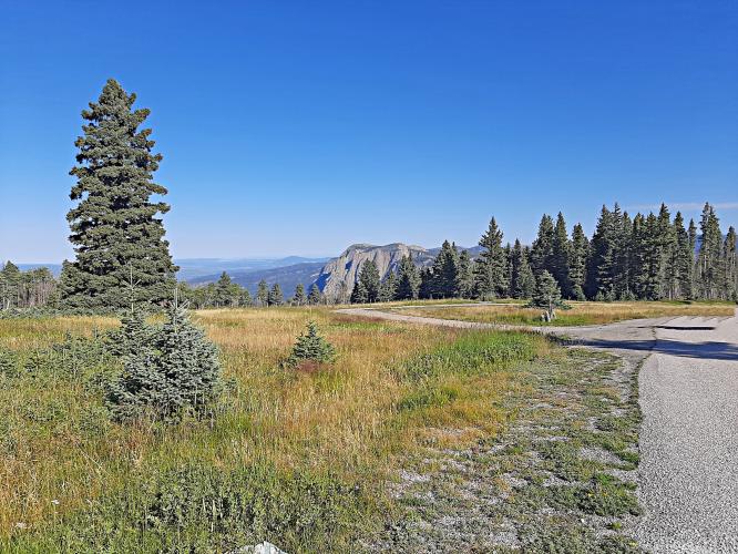
About a mile after the top there is a pullout where the Brazos Cliffs are visible. Since the gradient isn't too steep to come back, it is worth riding the extra mile for the view.

Brazos Peak is part of the Tusas Mountains of the San Juan Mountain Range.

View of the Tierra Amarilla Valley from the scenic pullout along the climb.