8.9
PDI
2.8 mi
DISTANCE
1,223 ft
GAINED
8.4 %
AVG. GRADE
FULL CLIMB STATS
Page Contributor(s): Andy VanPutte, Greenville, SC
INTRO
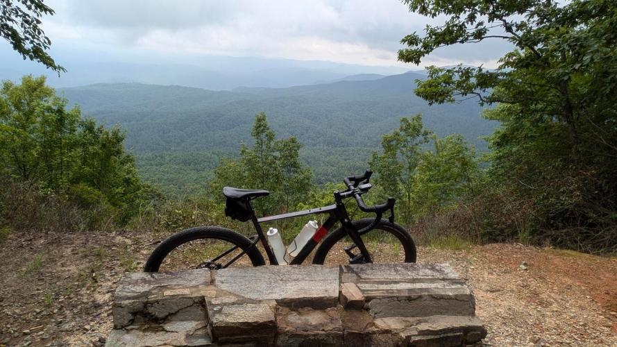
Laurel Fork Mountain via Shooting Tree Ridge, Cane Creek, and Horse Pasture Roads is a challenging and scenic bike climb near the South and North Carolina Borders in Pickens County. Spanning 2.8 miles with an average grade of 8.4%, this route ascends 1,223 feet to reach an elevation of 2,173 feet. The climb begins at the intersection of Shooting Tree Ridge Road and Cleo Chapman Highway, with alternative access points via Cane Creek Road and Mill Creek Road. Along the way, riders can take a short detour to "Jumping Off Rock" for breathtaking views of Lake Jocassee before continuing to the summit.
PLAN YOUR ROUTE
See more details and tools regarding this climb's grade via our interactive Profile Tool.
Information Not Available
If you have any information regarding this climb, we'd like to hear from you. Click the CONTRIBUTE button to share your thoughts with us.
Information Not Available
If you have any information regarding this climb, we'd like to hear from you. Click the CONTRIBUTE button to share your thoughts with us.
Before heading out on any cycling adventure check out our Things to Bring on a Cycling Trip and use our interactive check list to ensure you don't forget anything.
Information Not Available
If you have any information regarding this climb, we'd like to hear from you. Click the CONTRIBUTE button to share your thoughts with us.
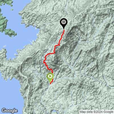
ROUTE MAP
MEMBER RATING
CURRENT WEATHER
PJAMM TRIPS ADVENTURE STARTER BUNDLES
Check out PJAMM Adventure's prepackaged (self-guided) cycling trips. They will help you plan, document and conquer your next adventure.
NEARBY CLIMBS (0) RADIAL PROXIMITY
FROM No Climbs Found
MEMBER REVIEWS & COMMENTS
Let us know what you thought of this climb. Signup for our FREE membership to write a review or post a comment.
Already have an account?
LOG IN HERE