![]()
Cycling to the McDonald Observatory
Ride 5.7 miles gaining 1,561’ at 4.9% average grade (6% climb only)
Climb report by PJAMM ambassador Dan Razum, Campbell, CA.
We start the climb a few miles after Davis Mountains State Park. It is possible to ride from the State Park but there is also a parking area close to the beginning of the climb, if you want to start closer.
![]()
The observatory is visible from the start of the climb. We actually climb up the backside of the mountain, the entrance to the observatory is on the opposite side of the mountain from where we start. We ride on Route 118 for about four and a half miles before reaching the cutoff to the observatory. Route 118 isn't too hard, it is mostly a gentle gradient with several sections that are almost flat. The road is in good condition, with a wide shoulder and traffic is light.
![]()
As we approach the Observatory, there is a cutoff to the right that leads to the Observatory.
![]()
![]()
However, there is also a second entrance about a quarter mile further on. The day we rode the first entrance was closed due to construction so we used the second entrance. Both work equally well.
![]()
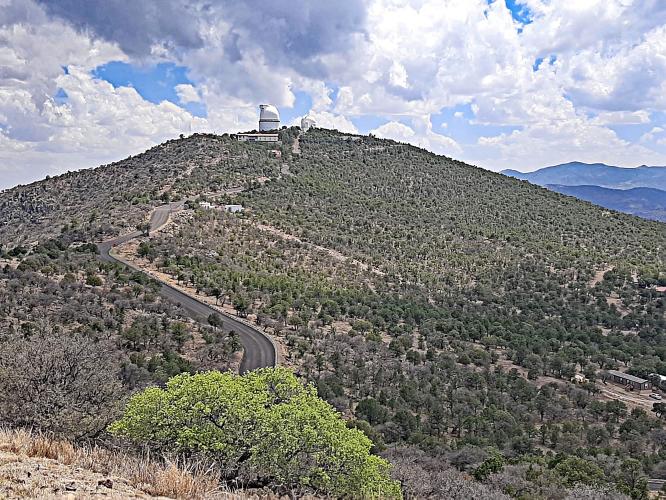
After we exit Route 118 and start approaching the Observatory, the road kicks up a bit but we only have about a mile to go, so it isn't too bad. There are actually two observatories on two different peaks. The observatory on the right peak is the main observatory and it is slightly higher than the observatory on the left.
![]()
You can ride to both of them, there is a junction partway up where you can go left or right. To the right is a little steeper and longer than to the left. There are also nice views if you climb the peak to the right. The left peak doesn't have much of a view, except that it does have a nice view of the right peak and the entrance from Route 118.
![]()
This is a nice climb and it is worthwhile to take some time to visit the observatory and take in the views on the right peak. On the left peak there is also a small visitor center worth checking out.
![]()
Thank you Dan!!

 We've partnered with Sherpa-Map.com to bring you the best route planning tool. With a PRO Membership you can use this climb as a reference when creating your route.

