
47.1
PDI
34.6 mi
DISTANCE
7,874 ft
GAINED
3.9 %
AVG. GRADE
FULL CLIMB STATS
Page Contributor(s): Kevin Pedersen, Eagle River, AK
INTRO
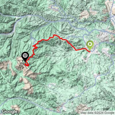
This is the longest way to the top of Mt. Blue Sky (Mt. Evans), the highest paved road in North America. From Evergreen, the route covers 34.6 miles and 7,874 feet of gain at a gentle-by-comparison 3.9% average grade, starting at 7,077 feet and finishing at 14,151 feet.
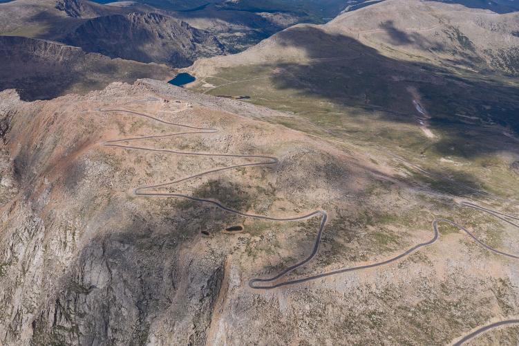
The route climbs CO-103 over Mestaa'Ehehe Pass (the recently renamed road formerly called Squaw Pass), then continues on to Echo Lake, where it joins the main Mt. Evans Road (CO-5) for the final push to the summit - the same finish shared by the shorter, steeper standard route from Idaho Springs. This version trades steepness for distance and altitude exposure, making for a very long day above 10,000 feet.
Worth knowing before you go: the summit road was closed for construction through the 2024 and 2025 seasons and reopened on May 22, 2026. It's a seasonal road, so confirm current status before planning a trip. Cyclists ride free - the $20 vehicle reservation required through recreation.gov doesn't apply to bikes.
PLAN YOUR ROUTE
 We've partnered with Sherpa-Map.com to bring you the best route planning tool. With a PRO Membership you can use this climb as a reference when creating your route.
 See more details and tools regarding this climb's grade via our interactive Profile Tool.
Roadway: Paved the entire way - CO-103 over Mestaa'Ehehe Pass, then CO-5 to the summit. The upper section above Echo Lake was repaved as part of the 2024-2025 construction closure, so it's in excellent shape for the 2026 season.
Traffic: CO-103 carries moderate mountain-highway traffic between Evergreen and Echo Lake. Above Echo Lake, vehicle traffic is metered by a timed-entry reservation system, which keeps it from getting as congested as it once did, though summer weekends still bring steady tourist traffic - the reservation requirement doesn't apply to cyclists.
Parking: No dedicated lot at the start; riders typically park in town in Evergreen near the CO-103 junction.
This is a high-altitude ride to over 14,000 feet, so pack real layers and a windbreaker regardless of how warm it is at the start in Evergreen - temperatures at the summit can be 30-40 degrees colder, with wind on top of that. Water and food are available in Evergreen at the base; there's little to nothing reliable again until the seasonal summit visitor facilities.
Before heading out on any cycling adventure check out our Things to Bring on a Cycling Trip and use our interactive check list to ensure you don't forget anything.
Base yourself in Evergreen or elsewhere in the Denver foothills. This is a seasonal road - it typically opens in late May and closes by early September, and it was fully closed for construction through the 2024 and 2025 seasons, so check current conditions before planning around it. Cyclists don't need the vehicle reservation required for cars, but everyone using the road should be prepared for fast-changing high-altitude weather, including afternoon thunderstorms.
ROUTE MAP
MEMBER RATING
CURRENT WEATHER
PJAMM TRIPS ADVENTURE STARTER BUNDLES
Check out PJAMM Adventure's prepackaged (self-guided) cycling trips. They will help you plan, document and conquer your next adventure.
NEARBY CLIMBS (0) RADIAL PROXIMITY
FROM No Climbs Found
MEMBER REVIEWS & COMMENTS
Let us know what you thought of this climb. Signup for our FREE membership to write a review or post a comment.
Already have an account?
LOG IN HERE
ReneF
None of this is gravel - 100% paved. I’m also curious when a “climb” ends and when a “route” begins? This seems more like a route given the miles of descent in between the two climbs.
