![]()
Oat Mountain
Ride 6.2 miles at 7.8%, climbing 2,694 ft and finishing at 3,673 ft.
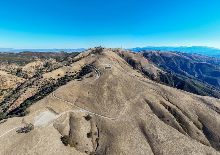
At 3,733 ft, Oat Mountain is the highest peak in the Santa Susana Mountains between the Los Angeles suburbs of Chatsworth and Santa Clarita. This climb finishes at the radio tower campus on the very top, giving 360 degree summit views.
![]()
![]()
It’s not every day we come across a significant road climb in the US that’s not already on our site, but Charles Fann (Los Angeles, CA) sent us a route that broke into the top 200 US’ hardest climbs (#186/1665). Being in the neighborhood, it was only fitting that he gave us a personal tour of the climb himself!
![]()
Temperatures were cold when we clipped in on a late November morning. During the summer, these canyons can get very hot, and only the first part of the ride has shade.
Immediately, we’re greeted with 12-15% grades, but only for the first quarter mile. The next 2.5 miles are mellow, but the final 3.5 miles average almost 12%, and frequently reach into the 16-22% range.
![]()
The ride begins to get steep when you enter the “Michael D. Antonovich Regional Park at Joughin Ranch”, or easier to remember, whenever you pass the fancy brick gate.
![]()
Views looking back into the valley are exceptional for the entire climb. After you enter the park, you’re high enough to see the Pacific Ocean over the Santa Monica Mountains.
![]()
![]()
At mile 3.9, you reach the abandoned Nike Missile Site, exactly halfway to the top in terms of elevation. This is a super cool place to explore, and builds in a much needed rest!
![]()
![]()
![]()
![]()
![]()
Climbing above the missile site, you get above the treeline into beautiful rolling hills. In the spring these hills are lush green with wildflowers, but in the summer and fall they’re a beautiful golden brown.
![]()
![]()
![]()
This climb is ridiculously steep.
![]()
![]()
The surface is good enough to ride on 23mm road tires, but you’ll be a lot more comfortable (and happier on the descent) rolling wider tires. We chose to ride our gravel bikes for this climb for this reason, as well as so we could tack on some singletrack on the way down (lots of good trails in this area)
![]()
![]()
The radio towers at the end of the climb.
For more on the Oat Mountain bike climb, read Cica Valley’s blog!
![]()
![]()

 We've partnered with Sherpa-Map.com to bring you the best route planning tool. With a PRO Membership you can use this climb as a reference when creating your route.

