
24
PDI
9.7 mi
DISTANCE
3,383 ft
GAINED
6.6 %
AVG. GRADE
FULL CLIMB STATS
INTRO
Sawtell Peak is a 9.6-mile gravel climb in Idaho's Caribou-Targhee National Forest, gaining 3,383 feet from the shore of the Island Park area up to a 9,834-foot summit at an average grade of 6.64%.
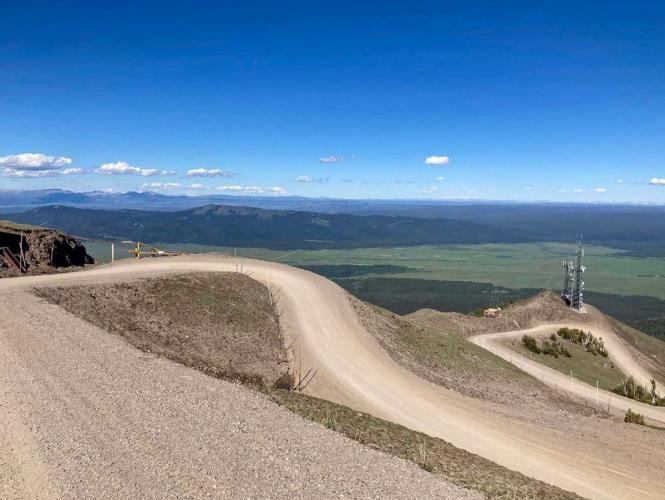
Peaking at almost 10,000 feet, this is a serious, sustained effort made harder by loose gravel and consistently exposed switchbacks with no real flat sections to recover on.
The road (Forest Road 024) was built to serve an FAA radar installation still operating at the top, and before that, a fire lookout named for Captain Jesse Sawtell, a 19th-century US Army officer stationed at Fort Yellowstone. That history is what makes the summit worth the effort: from the radar dome, riders get sweeping views over Henry's Lake, the Centennial Valley in Montana, the Madison Valley, and on clear days the Grand Tetons and Yellowstone's northern reaches.
The road is well-graded and passable to all vehicles in summer, but it's a genuine mountain gravel climb - expect washboard sections, loose surface on the steeper pitches, and enough vehicle and RV traffic in peak season that riders should stay alert on the tighter switchbacks. The Forest Service gates the road annually from November 1 to June 1 for snow and maintenance, so this is strictly a summer-and-fall climb.
PLAN YOUR ROUTE
 We've partnered with Sherpa-Map.com to bring you the best route planning tool. With a PRO Membership you can use this climb as a reference when creating your route.
 Sawtell Peak climbs 3,383 feet over 9.67 miles at an average grade of 6.64% - a steady, demanding gradient with very little relief from start to finish. The steepest 100 yards reaches 9.4%, and the opening quarter-mile averages 8.89%, so the climb starts hard and never really eases up.
The steepest half-mile (8.68%) and steepest mile (8.5%) are both close to the overall average, which is the real story here: unlike climbs with a brutal wall followed by easy recovery miles, Sawtell Peak just grinds at 7-9% nearly the whole way up its switchbacked gravel surface. The steepest 5 miles still average 7.57%, confirming there's no extended easy stretch anywhere on the route.
Roadway: The climb follows Forest Road 024, a well-graded gravel road maintained by the Caribou-Targhee National Forest and the FAA (which operates the radar facility at the summit). The surface holds up well through summer but expect washboard sections and loose gravel on the steeper switchbacks, especially after rain. The road is gated and closed annually from November 1 through June 1 for snow and maintenance - it's open only in summer and early fall.
Traffic: Traffic is moderate for a forest road - a mix of FAA maintenance vehicles, sightseers driving up for the summit view, and RVs, especially on weekends in July and August. The switchbacks are tight enough that riders should ride predictably and stay right on blind corners.
Parking: There's an informal pullout at the base where Forest Road 024 leaves US-20, a few miles west of Island Park. Riders based in Island Park or West Yellowstone can also drive to the base and park there before starting the climb.
This is a gravel climb, so tire choice matters more than usual - a gravel or all-road bike with at least 32-35mm tires handles the washboard and loose sections far better than a standard road setup. A lower gearing than you'd run on a comparable paved climb is worth it given the sustained 7-9% gradient on a loose surface.
Pack layers: the summit sits nearly 3,400 feet above the highway, and wind around the exposed radar installation can make it feel considerably colder than the trailhead, even in summer.
There's no water source on the climb itself, so carry everything you'll need for the full round trip.
Cell service is spotty once you're a few miles up the mountain, so a paper map or offline GPS track is worth having as backup.
Before heading out on any cycling adventure check out our Things to Bring on a Cycling Trip and use our interactive check list to ensure you don't forget anything.
Sawtell Peak Road is only open from June 1 to November 1 each year - the Forest Service gates it for the rest of the year, so confirm the gate is open before planning a trip in early June or late October, when opening/closing can shift a few days with snow conditions.
Island Park, a few miles east on US-20, is the closest base with lodging, food, and gas, and it sits roughly halfway between West Yellowstone and Yellowstone's western entrances - a natural add-on if you're already road-tripping the park.
Summer weekends bring meaningful sightseeing traffic up the mountain for the view, so a weekday or early-morning start makes for a quieter ride.
Riders building out a longer Idaho/Yellowstone-area cycling trip can check our Routes in the Area tool to see what else is worth combining with Sawtell Peak nearby.
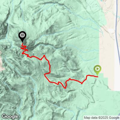
ROUTE MAP
MEMBER RATING
CURRENT WEATHER
PJAMM TRIPS ADVENTURE STARTER BUNDLES
Check out PJAMM Adventure's prepackaged (self-guided) cycling trips. They will help you plan, document and conquer your next adventure.
NEARBY CLIMBS (0) RADIAL PROXIMITY
FROM No Climbs Found
MEMBER REVIEWS & COMMENTS
Let us know what you thought of this climb. Signup for our FREE membership to write a review or post a comment.
Already have an account?
LOG IN HERE
