8.3
PDI
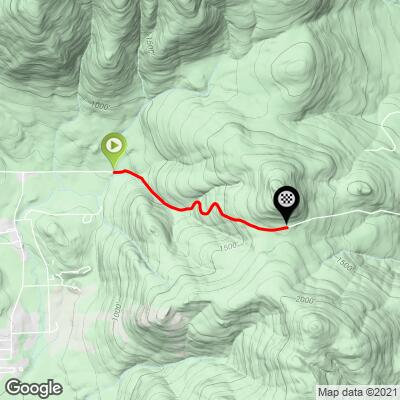
1.8 mi
DISTANCE
1,004 ft
GAINED
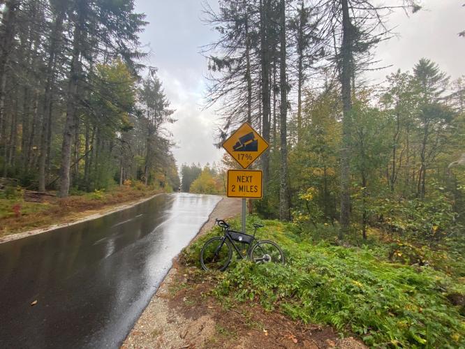
10.4 %
AVG. GRADE
FULL CLIMB STATS
Page Contributor(s): John Summerson, The Complete Guide to Climbing (by Bike) 2d Ed.
INTRO
"The west side of Hurricane Mountain Road near North Conway is an even steeper climb than its east side but just a bit shorter and also along a dark and narrow route. Although it has somewhat similar statistics this side seems to have a more ominous look and feel as you ride it. A variable grade will wear you down and the maximum grade is near the top just before a steep right hand turn. From this point the listed top is close and it is unmarked but obvious as the grade decreases dramatically. Due to its steep grade and narrow gauge it is also a difficult descent." (This quote is provided with the approval of John Summerson from his book, The Complete Guide to Climbing (By Bike) in the Northeast, pg. 95.)
PLAN YOUR ROUTE
See more details and tools regarding this climb's grade via our interactive Profile Tool.
Information Not Available
If you have any information regarding this climb, we'd like to hear from you. Click the CONTRIBUTE button to share your thoughts with us.
Information Not Available
If you have any information regarding this climb, we'd like to hear from you. Click the CONTRIBUTE button to share your thoughts with us.
Before heading out on any cycling adventure check out our Things to Bring on a Cycling Trip and use our interactive check list to ensure you don't forget anything.
Information Not Available
If you have any information regarding this climb, we'd like to hear from you. Click the CONTRIBUTE button to share your thoughts with us.
ROUTE MAP
MEMBER RATING
CURRENT WEATHER
PJAMM TRIPS ADVENTURE STARTER BUNDLES
Check out PJAMM Adventure's prepackaged (self-guided) cycling trips. They will help you plan, document and conquer your next adventure.
NEARBY CLIMBS (0) RADIAL PROXIMITY
FROM No Climbs Found
MEMBER REVIEWS & COMMENTS
Let us know what you thought of this climb. Signup for our FREE membership to write a review or post a comment.
Already have an account?
LOG IN HERE
jsummers
The first climb I ever did in New England, this one is short and sweet but over solid double digit grade. The narrow road gives it somewhat of an alpine feel. Descend its east side and turn around for some sobering hill repeats!


