34.3
PDI
17 mi
DISTANCE
5,464 ft
GAINED
6.1 %
AVG. GRADE
FULL CLIMB STATS
Page Contributor(s): Kestrel Blais, CA
INTRO
This 17 mile bike climb is located in CA, USA. The average gradient is 6.1% and there is a total elevation gain of 5,464 ft, finishing at 6,936 ft.
Use the profile tool, route map, and weather forecast to conquer this cycling climb.
Use the profile tool, route map, and weather forecast to conquer this cycling climb.
PLAN YOUR ROUTE
See more details and tools regarding this climb's grade via our interactive Profile Tool.
Information Not Available
If you have any information regarding this climb, we'd like to hear from you. Click the CONTRIBUTE button to share your thoughts with us.
Information Not Available
If you have any information regarding this climb, we'd like to hear from you. Click the CONTRIBUTE button to share your thoughts with us.
Before heading out on any cycling adventure check out our Things to Bring on a Cycling Trip and use our interactive check list to ensure you don't forget anything.
Information Not Available
If you have any information regarding this climb, we'd like to hear from you. Click the CONTRIBUTE button to share your thoughts with us.
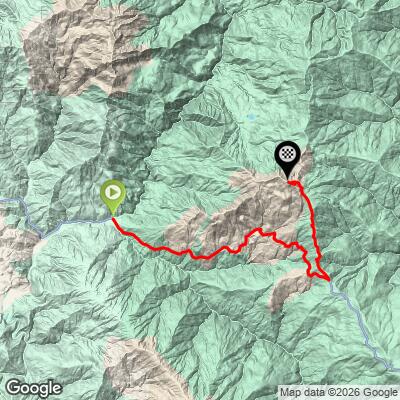
ROUTE MAP
MEMBER RATING
CURRENT WEATHER
PJAMM TRIPS ADVENTURE STARTER BUNDLES
Check out PJAMM Adventure's prepackaged (self-guided) cycling trips. They will help you plan, document and conquer your next adventure.
NEARBY CLIMBS (0) RADIAL PROXIMITY
FROM No Climbs Found
MEMBER REVIEWS & COMMENTS
Let us know what you thought of this climb. Signup for our FREE membership to write a review or post a comment.
Already have an account?
LOG IN HERE
kestrelblais
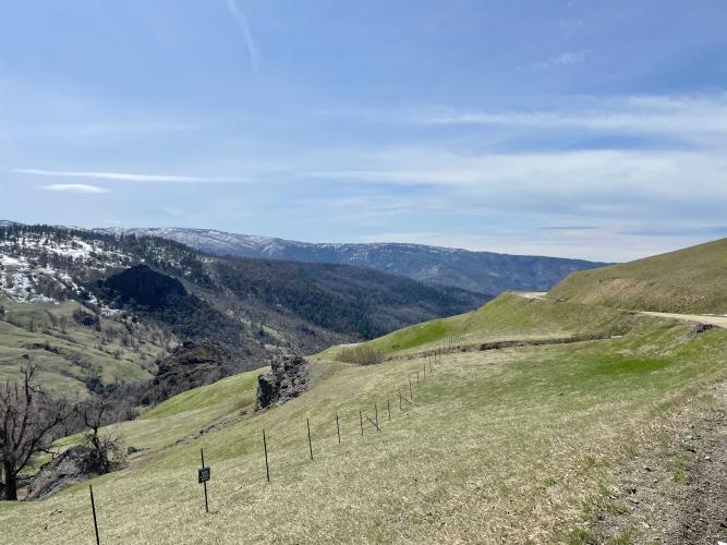
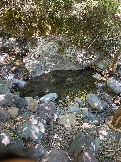
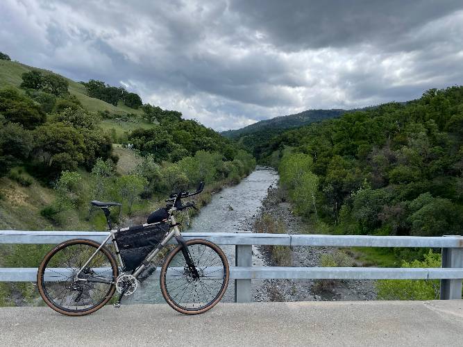
I loved the isolation, and cool down in the Eel river. So very remote, pack in everything you need, including a water filter. 50mm-60mm tires are best for the last 1/3. Could be done on 40mm. Peaceful, wind sounds in forest, and desolate in a zen kind of way.
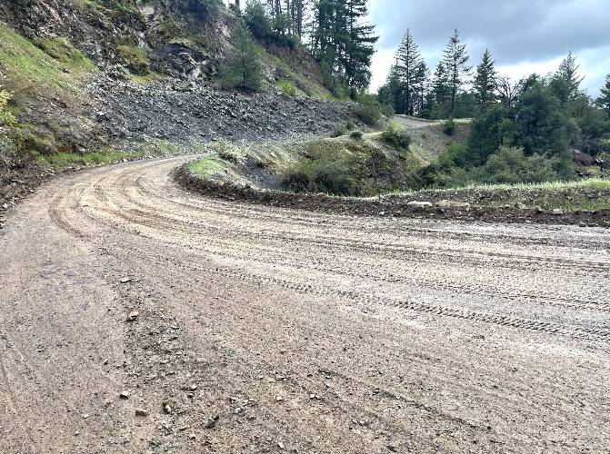
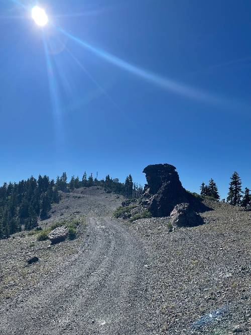
kestrelblais
There is a campsite at the base of the climb called Eel River Work Station. Great swimming there. The climb is well graded to Mendocino Pass, turns right onto M4 and gets rough then a bit chunky. Snow likely until May. Steady, fast climb with little car traffic if any. Some limited cell. Limited water from streams and a spring on the right by the big rock on private property, you can sneak in. The climb breaks down to 3 roughly equal sections, the first is hot and exposed, the mid point on the way up to Mendo Pass is forested, and there is a big creek with a dunk pool by the road. Second section is narrower with a bit of shade, then at the pass you veer hard left, it gets chunky and looser, with steep switchbacks and ruts up to the lookout. Super remote, I saw two people in 4 hours.